
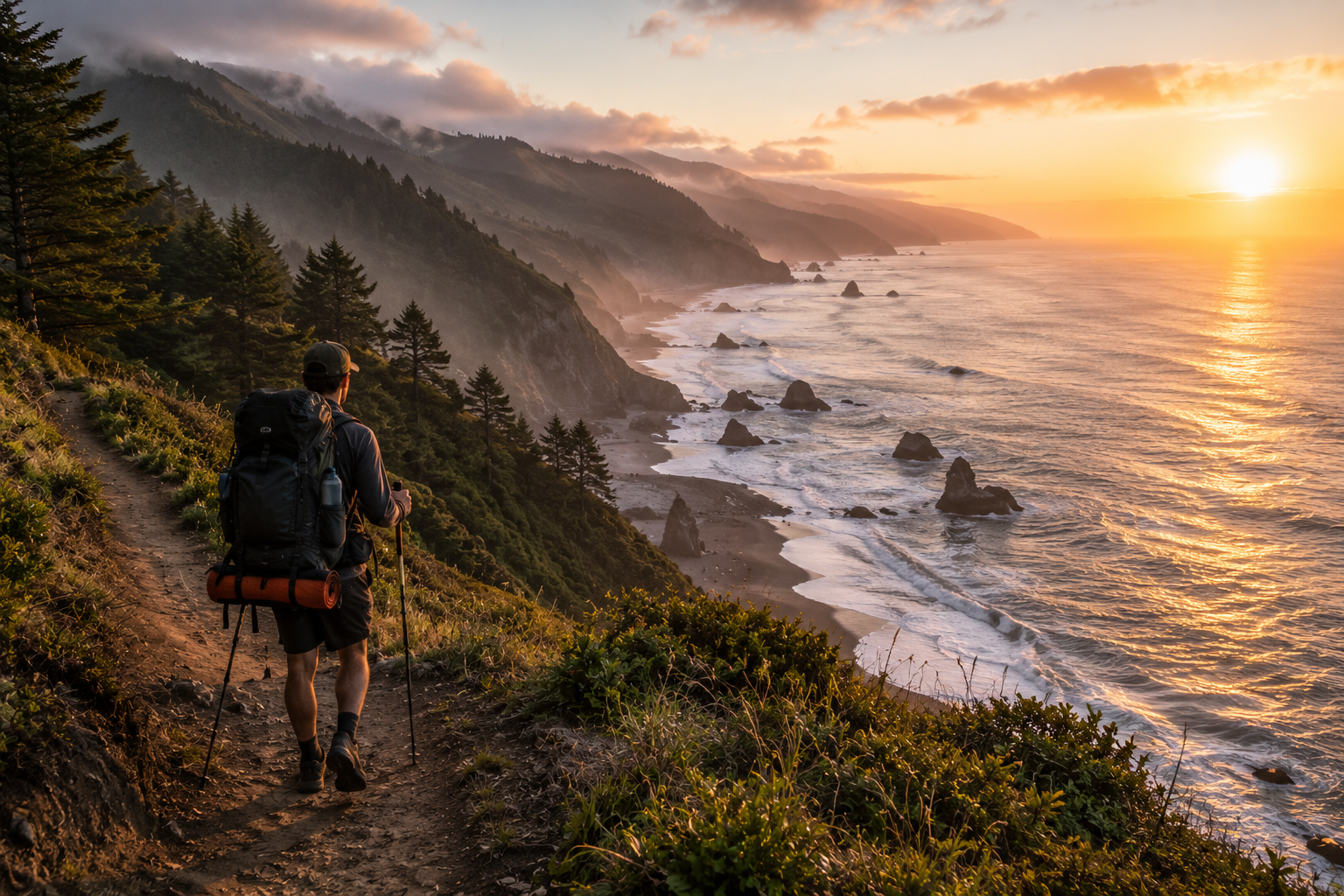
The Lost Coast earned its name honestly. When California was building its highway system in the 1930s, the coastal mountains of Humboldt County were too steep, too unstable, and too geologically complex to route a road through — so the state went around them instead. The result is the longest roadless stretch of California coastline remaining: a 25-mile section of Humboldt and Mendocino counties where the King Range drops directly into the Pacific, where black sand beaches extend for miles without a parking lot in sight, and where the combination of high tides, rattlesnakes, bears, sneaker waves, and rugged terrain keeps the kind of casual visitor who’d otherwise crowd it away.
The Lost Coast Trail is one of the most distinctive backpacking routes in California — not because of dramatic elevation or alpine scenery, but because it delivers something genuinely rare: coast wilderness where the mountains meet the ocean in their full, unmanaged intensity. Seven days on this trail will show you wildlife-strewn beaches, freshwater springs appearing directly from the cliffside, sea lions sunbathing on rocks within 50 feet of the trail, wildflower meadows in full spring bloom, and skies full of condors and turkey vultures working the cliff thermals.
This guide covers everything you need to plan a complete Lost Coast Trail trip — permits, tides, campsites, gear, wildlife, seasonal conditions, and the honest realities of what makes this trail both challenging and unforgettable.
For gear recommendations before any multi-day coastal route, our how to pack a backpack for hiking guide covers the packing system that handles multi-day coastal conditions, and our best personal water filter for hiking guide covers hydration solutions for a trail with abundant but untreated water sources.
Overview
Distance: Approximately 25 miles one-way from Black Sands Beach (Shelter Cove) to Mattole Beach trailhead, or reverse
Direction: The trail can be hiked north to south or south to north. Most permit-holders hike south to north — starting at Black Sands Beach in Shelter Cove and finishing at Mattole Beach near Petrolia — because this direction puts the most tide-sensitive sections early in the trip when hikers are fresher and more alert.
Duration: 3-7 days depending on pace and planned rest days. Five to seven days allows comfortable mileage averaging 4-6 miles per day, which is appropriate for the terrain. Attempting the route in 3-4 days is possible for experienced backpackers but leaves little margin for tide delays and significantly limits the experience.
Difficulty: Strenuous. The terrain is more demanding than the mileage suggests — boulder hopping, deep sand, and rocky headland sections slow pace significantly compared to maintained trail hiking. Expect to average 1-2 miles per hour through the most technical sections rather than the 2-3 miles per hour typical of established trails.
Best season: April through October. Spring offers wildflowers and reliable water in all creek crossings. Summer provides the most stable weather. Fall offers clearer skies and reduced crowds. Winter brings dangerous storm surf, flooded creek crossings, and significantly higher risk across all of the trail’s natural hazards.
Permits and Regulations
A permit is required for overnight camping on the Lost Coast Trail. The Bureau of Land Management issues permits through Recreation.gov, with a per-person per-night fee. During peak season — May through September — permits are competitive and should be reserved well in advance. Off-season permits are more readily available but trail conditions are significantly more variable.
Bear canister requirement: A bear canister is mandatory for all overnight camping on the Lost Coast Trail. This is a hard requirement, not a recommendation. Bears are active throughout the King Range and food storage in tents, stuff sacks, or hanging systems is not permitted. Size your pack for the bear canister before committing to a specific backpack — the large canister required for trips of 5+ days is wider than many standard backpacking packs can accommodate. Osprey, Gregory, and ULA Circuit-style packs are the most common choices among Lost Coast backpackers; verify canister compatibility with your specific pack before departure.
Campfire regulations: Campfires are permitted on established beaches below the high tide line using only driftwood — no cutting of living wood anywhere in the King Range. A California Campfire Permit is required. The same fire pits used for cooking function well for warmth on cool coastal evenings; collecting driftwood as you hike during the day and stashing it at your chosen camp is the most practical approach.
The Tide Factor — The Most Important Planning Variable
The Lost Coast Trail has sections that are completely impassable at high tide. This is not a minor inconvenience — it’s a fundamental planning variable that determines your daily schedule as much as distance or elevation does.
The two most significant tide-dependent sections are in the middle portion of the trail near Punta Gorda and near Big Flat. At high tide, the beach narrows to nothing against vertical cliff faces — there is literally no passable ground. At low tide, the same sections open to a wide, walkable beach. The difference between the two states can be as little as two to three hours, but attempting to pass a tide-sensitive section in the wrong tidal window risks being trapped against a cliff with rising water.
Before your trip: Download a tide chart for Shelter Cove or Punta Gorda for every day of your planned trip. Many Lost Coast-specific apps provide this automatically. Identify the tide-sensitive sections on your route map and plan your daily mileage so you’re passing those sections during low tide windows.
On the trail: Check your downloaded tide chart every morning and plan the day’s movement around the tidal schedule. Be willing to adjust planned mileage — hiking extra miles to clear a section before high tide, or stopping short and waiting for the tide to recede, is normal practice on this trail rather than a sign of poor planning.
Conservative margin: Plan to reach tide-sensitive sections at least 2 hours before the predicted low tide peak and be through them before the tide begins rising again. Tidal predictions are accurate to 15-30 minutes; weather and swell can push actual tidal height slightly above predictions.
Getting There
Black Sands Beach (South Trailhead): Located in Shelter Cove, accessible via Shelter Cove Road from Highway 101 near Garberville. The drive from Highway 101 takes approximately 45 minutes on a winding mountain road. Shelter Cove has limited services — a small store, restaurant, and lodging — but no major resupply options. Complete your food and gear preparation before arriving.
Mattole Beach (North Trailhead): Near Petrolia, accessible via Mattole Road. The drive from Highway 101 takes approximately 2 hours. The road winds through the agricultural Lost Coast interior and is entirely paved but narrow in sections.
Shuttle logistics: Most backpackers arrange a car shuttle between trailheads or use one of the shuttle services operating in the area. The drive between trailheads takes approximately 2.5-3 hours via Garberville and the inland highway route. Commercial shuttle services are available and recommended — arrange in advance as availability is limited during peak season.
From the Bay Area: Approximately 4-5 hours from San Francisco to Shelter Cove via Highway 101 and Shelter Cove Road.
Campsite Overview
The Lost Coast Trail has both designated campsites shown on BLM maps and dispersed camping options on established beaches. During peak season, designated sites can be crowded with limited privacy. Established but off-map sites on beach bluffs and meadows above the beach provide more solitude and are generally permitted as long as they’re below the high tide line or on established use areas.
Big Flat (approximately Mile 8-9): One of the most popular established camps on the trail — a wide, flat beach section with a freshwater creek and mountain views inland. Beautiful location but frequently occupied. Good surfable waves offshore in spring swell.
Spanish Flat area (approximately Mile 12-14): A series of bluff-top meadow camping options above the beach with wildflower displays in spring and good privacy relative to the beach campsites below. Wind can be significant on exposed bluff positions — stake tents thoroughly and use guy lines.
Randall Creek (approximately Mile 14-15): Two established campsites at the creek confluence. Limited privacy when both are occupied — the adjacent Spanish Flat meadow options provide an alternative with more solitude.
Big Creek area (approximately Mile 18-19): Beautiful camp with mountain views inland and ocean views seaward. A distinct change from the flat beach camps further south — the terrain here creates a more enclosed, mountain-feeling camp environment.
General camping principles: Camp below the high tide line on open beach wherever possible — this concentrates camping impact on the most resilient surfaces and minimizes vegetation damage. Never camp in creek drainages where bear activity is highest. Water is abundant at creek crossings throughout the trail; filter all water regardless of how clean it appears.
Trail Character — What to Actually Expect
Sandy Beach Sections
The majority of the Lost Coast Trail is simply walking on the beach — which sounds easier than it is. Deep sand provides no firm footfall and forces the foot to stabilize differently with every step. The cumulative fatigue in calves, ankles, and hip flexors from hours of sand walking significantly exceeds the fatigue from equivalent mileage on maintained trail. Ankle soreness is nearly universal after the first two days; it typically improves as your body adapts to the surface.
Pace slows dramatically in deep sand. Planning for 1.5 miles per hour on average sandy beach sections is more realistic than the 2+ mph most hikers default to when calculating daily mileage.
Some beach sections have a harder-packed zone at the surf line where the sand is wet and firm. This is significantly faster and less fatiguing than the dry sand above it — walk it when available, but watch for sneaker waves. Rogue wave sets on the Lost Coast reach significantly further up the beach than the preceding waves suggest, particularly in spring swell. Stay aware of ocean conditions and maintain a margin from the surf that accounts for unexpected large sets.
Boulder Hopping Sections
Several sections of the trail require boulder hopping over headland rock fields — the most technically demanding terrain on the route and the slowest progress per hour. Footing on wet or algae-covered rocks is treacherous. Trekking poles are strongly recommended for balance and reduced ankle stress. Take each boulder sequence at a deliberate pace rather than rushing — a twisted ankle miles from the trailhead with no cell service changes a great backpacking trip into a rescue scenario.
Meadow and Bluff Sections
The sections through inland meadows and along coastal bluffs above the beach are the fastest and most visually rewarding terrain on the trail. Spring wildflowers — California poppies, lupine, various coastal species — cover the meadow sections in a continuous color display from April through June. These sections provide relief from both the sand fatigue and the technical boulder hopping and represent the trail at its most accessible and beautiful.
Wildlife
Bears: Black bears are active throughout the King Range and regularly travel the beach. Fresh tracks and scat on the beach are common — evidence of overnight bear activity in areas where hikers camped the previous evening. Bears are the reason the bear canister requirement exists; they’re experienced and persistent in accessing improperly stored food. Store all food, scented items, and cooking gear in the canister at night. Bears that have been conditioned to human food are the bears that eventually require management removal — responsible food storage protects both you and the bear.
Rattlesnakes: Present throughout the trail, particularly in rocky sections, brush edges, and sunny rest spots on warm days. Watch where you place your hands and feet when scrambling over rocks. The rattlesnake encountered on a sunny boulder section mid-trail is a normal part of the Lost Coast experience — give it time to move and proceed.
Sea lions and harbor seals: Abundant and frequently visible on offshore rocks and hauled out on accessible beach sections. Sea Lion Steve sunbathing on a rock while backpackers file past 30 feet away is a genuinely memorable wildlife moment. Maintain viewing distance and don’t approach resting animals.
Turkey vultures and condors: The King Range thermals support significant raptor populations. Turkey vultures are abundant and serve as indicators of large wildlife carcasses on the beach — whale, sea lion, and large fish die-offs provide feeding opportunities that concentrate these birds in numbers. California condors are also present in the King Range area; identifiable by their massive 9-foot wingspan and the white wing triangles visible in flight.
Deer: Common throughout, particularly in meadow sections at dawn and dusk. Habituated to human presence and often unconcerned by hikers passing within short distances.
Coastal birds: Diverse seabird populations including pelicans, cormorants, surf scoters, and various shorebirds throughout the beach sections. The freshwater creek confluences with the ocean attract additional species not found on the open beach.
Water
The Lost Coast Trail has abundant water in spring and early summer — freshwater creeks and springs cross the route consistently enough that carrying more than 2-3 liters at a time is rarely necessary. By late summer and fall, some smaller seasonal springs dry up; verify current water conditions through recent trip reports before departure.
Freshwater springs emerge directly from the hillside at multiple points along the trail — look for green vegetation on otherwise dry cliff faces and listen for trickling water. These spring sources are typically the clearest water on the route but still require filtration. Giardia and other waterborne pathogens are present in backcountry water sources regardless of appearance.
The Katadyn BeFree is the most commonly used filter on this trail given its fast flow rate and minimal pack volume — the ability to drink directly from a scoop without stopping is practical on a route with frequent water sources. The Sawyer Squeeze is the backup favorite. Both are covered in our best personal water filter for hiking guide.
Salt water is not filterable with standard hollow fiber filters and is not a backup water source. Never drink ocean water under any circumstances regardless of how desperate water supplies become — dehydration from salt water consumption accelerates rather than relieves dehydration.
Gear Considerations
Bear canister: Mandatory. Size matters — 7 days of food for one person typically requires the largest standard canister. Pack your bear canister, fill it with your food, and then choose your backpack around it rather than hoping your existing pack accommodates it.
Tent: The Lost Coast is notoriously windy — coastal winds shift direction throughout the day and night, picking up dramatically at dusk and through the night. A freestanding tent with robust guy line points and staking capability handles the conditions better than ultralight non-freestanding designs that struggle in sustained wind. Stake out all guy lines every night regardless of initial conditions — wind that’s calm at sunset may be 25 mph by midnight.
Rain fly: Keep the rain fly on your tent every night regardless of forecast. Coastal fog deposits significant moisture on any surface exposed to it overnight — a tent without a rain fly will have a soaked interior from condensation by morning even without any rain falling.
Trekking poles: More useful on the Lost Coast than on most trails given the boulder hopping sections and the fatigue from sustained sand walking. Two poles significantly improve stability and reduce knee stress over the course of a multi-day route on this terrain.
Footwear: Trail runners with ankle support handle the terrain well and dry faster than waterboots after creek crossings. Dedicated waterproof boots keep feet dry through small tidal edge crossings but become heavy, blistered-inducing weights after full immersion in deeper crossings. Most experienced Lost Coast backpackers use trail runners and accept wet feet at creek crossings as preferable to the weight and blister risk of waterproof boots. For the best trail shoe options, check our best hiking shoes for men and best hiking shoes for women guides.
Gaiters: Low trail gaiters keep sand out of shoes during the long sandy sections significantly better than standard trail shoes alone. The difference in shoe cleanliness and blister prevention after 6 miles of sand hiking is meaningful. Check our best trail gaiters for hiking guide for the most packable options.
Sun protection: The coastal fog provides misleading UV protection — overcast sky conditions on the Lost Coast allow significant UV penetration and sunburn happens faster than the grey sky suggests. Apply SPF 30+ every morning regardless of visible sun.
Suggested Itinerary — 7 Days South to North
Day 1 (4 miles): Black Sands Beach trailhead to first suitable camp. The first miles from the trailhead are the most accessible and beautiful for introduction to the trail character — stunning black sand beaches immediately visible from the trailhead, with the King Range rising steeply behind. A shorter first day accounts for the late afternoon start that logistics typically require.
Day 2 (5-6 miles): Camp to Big Flat. The trail through this section alternates between sandy beach and boulder sections. Monitor tides for the sections that narrow against headlands. Big Flat provides a reliable campsite with creek water and good tent sites.
Day 3 (6-9 miles): Big Flat to Spanish Flat or Randall Creek area. The middle section of the trail passes through some of the most varied terrain — meadow sections, wildflower displays, creek crossings. If Randall Creek is crowded, the Spanish Flat meadow bluffs provide better privacy.
Day 4 (Rest day or day hike): Base camp day from Spanish Flat or Randall Creek area. Day hiking north to explore beyond your furthest point without the full pack, or a beach day recovery. This is the inflection point where pace slows and the body benefits from a reduced effort day before the return.
Day 5 (6 miles): Begin return south. The same terrain looks and feels different in the opposite direction — different light, different tide windows, features you missed on the northbound pass. Big Creek camp for the night.
Day 6 (8-11 miles): Big Creek to final camp near Black Sands Beach. A longer day to position for the trailhead exit. Watch the tide-sensitive sections carefully on the return — they require the same attention as on the northbound pass.
Day 7 (1.5-2 miles): Final camp to Black Sands Beach trailhead. A short exit morning that allows for a full breakfast, breaking camp at a leisurely pace, and arriving at the trailhead mid-morning.
What to Expect Realistically
The Lost Coast consistently exceeds expectations in both directions simultaneously — the scenery and wildlife are more extraordinary than most California trail descriptions prepare you for, and the terrain is more demanding than the 25-mile distance and minimal elevation change suggest.
Mileage that would take 4 days on a maintained trail takes 6-7 days here. The sand, boulder hopping, and tide management add time that raw distance doesn’t capture. Hikers who plan this trip expecting typical trail pacing arrive at the first tide-sensitive section already behind schedule and never catch up.
The wind is significant and persistent — particularly in spring and early summer when coastal winds are strongest. Tent nights where gusts require getting up to re-stake and re-guy are normal rather than exceptional. The spray off wave crests in offshore wind at dusk is spectacular — the same conditions that make the evening miserable to be outside in make it one of the most dramatic coastal camping scenes in California.
The solitude varies dramatically by section and season. The middle sections are popular and you’ll see other backpacking groups regularly. The more distant sections — particularly north of Randall Creek toward the Mattole end — become progressively quieter. Planning campsites away from the designated spots shown on maps provides the most reliable privacy.
The experience is genuinely worth every difficult mile. The diversity of terrain — rugged mountains, wildflower meadows, freshwater springs, sea lion beaches, and the persistent Pacific — delivers something that no other California trail replicates.
Final Thoughts
The Lost Coast Trail earns its reputation as one of California’s finest backpacking routes through sheer diversity of experience rather than any single dramatic feature. Seven days on this trail produces the kind of trip story that doesn’t fit neatly into any single category — it’s not a mountain trip, not a beach trip, not a wildlife trip, not a wildflower trip, but genuinely all of them simultaneously.
Plan your tides. Bring the bear canister. Accept that the terrain will slow you below your normal trail pace. And give yourself enough days to stop when something beautiful demands stopping — because on the Lost Coast, something beautiful demands stopping constantly.
For more California trail guides, check out our Redwood National Park hiking guide, Point Lobos State Natural Reserve hiking guide, and Sequoia National Park hiking guide for more of California’s finest outdoor destinations.