
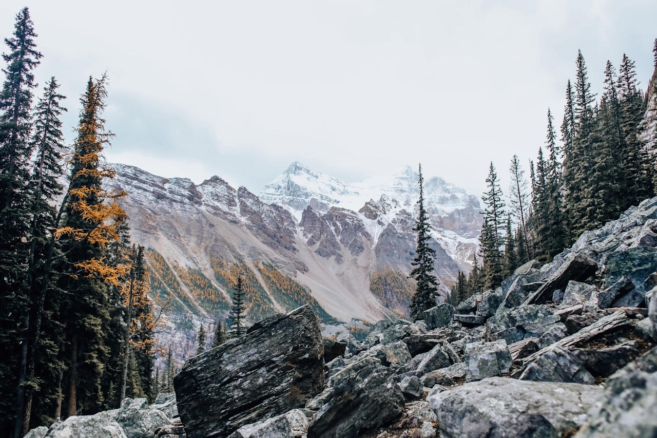
Rocky Mountain National Park sits about 90 minutes northwest of Denver and spans the Continental Divide across more than 415 square miles of alpine terrain. Within that geography you’ll find everything from flat lakeside walks accessible to almost anyone to serious 14,000-foot summit routes that demand full-day commitment and alpine experience. The challenge for first-time visitors isn’t finding good hikes — it’s understanding the permit system, the trailhead logistics, and which trails deliver the experiences that match what you’re actually looking for.
This guide covers the 10 best hikes in Rocky Mountain National Park — from easy family trails to major summit routes — organized by difficulty and use case. Every trail on this list has been done multiple times by people who know the park well, and the information here reflects real trail conditions rather than official park descriptions alone.
Before You Go: The 2026 Timed Entry Reservation System
The single most important planning step for any Rocky Mountain National Park visit from late May through mid-October is securing a timed entry reservation before you arrive. The park implemented this system during peak season to manage the visitor volume that was degrading the trail experience at the most popular trailheads.
From May 22 through mid-October 2026, a timed entry reservation is required to enter Rocky Mountain National Park during certain hours of the day. There are two options: Timed Entry Reservations and Timed Entry+ Bear Lake Road Reservations.
Here’s what the distinction means practically:
Timed Entry Reservations provide access to all areas in Rocky Mountain National Park excluding the Bear Lake Road Corridor. These are best for visitors planning to drive Trail Ridge Road, visit the Alpine Visitor Center, explore the west side of the park, hike at Wild Basin or Lily Lake, or visit any area outside the Bear Lake Road Corridor. These reservations are needed between 9 a.m. and 2 p.m. daily.
Timed Entry+ Bear Lake Road Reservations are needed to enter the Bear Lake Road Corridor between 5 a.m. and 6 p.m. daily from May 22 through October 18, 2026. This covers the park’s most popular trailheads including Bear Lake, Glacier Gorge, Bierstadt Lake, Sprague Lake, and Hollowell Park.
For most hikers doing the trails on this list, the Bear Lake Road reservation is the one you need — it covers the majority of the best hiking in the park. The reservation costs $2 per vehicle in addition to the park entrance fee. Timed entry tickets become available on Recreation.gov about one month in advance — May 1 releases permits for May 22 through June 30, June 1 releases July, and so on.
You can enter the park before 9 a.m. or anytime after 2 p.m. without a timed entry reservation. Early morning arrivals — before 5am for Bear Lake Road — avoid the reservation requirement entirely and provide the best parking, quietest trails, and best morning light. This is the preferred approach for serious hikers who want maximum flexibility.
Entry fees: A 7-day vehicle pass costs $30. The $80 America the Beautiful annual pass pays for itself in three visits.
Altitude and Safety
Rocky Mountain National Park sits high. The Bear Lake trailhead — starting point for several trails on this list — sits at 9,475 feet. Longs Peak trailhead is at 9,400 feet. The trails climb significantly from there.
For visitors arriving from sea level, altitude affects performance significantly — reduced oxygen availability slows pace, increases fatigue, and can cause headaches and nausea. Spending a night at elevation in Estes Park (7,522 feet) before attempting any serious hiking day significantly reduces altitude-related difficulty. You can check out some of the best oxygen boosters to help you supplement your oxygen needs in high altitudes from Tent Camping Pro.
Drink more water than usual at altitude. Afternoon thunderstorms develop rapidly above treeline in summer — plan to be below treeline by noon on any exposed summit or ridge route. Lightning above treeline is a genuine danger that requires taking seriously.
For winter hiking, microspikes or crampons are essential on icy trail sections. Download offline trail maps before entering areas with limited cell service. Tell someone your planned route and expected return time.
For full gear recommendations, our day hiking essentials checklist covers everything worth bringing. For footwear appropriate to Rocky Mountain terrain, our best hiking boots for men and best hiking boots for women guides cover options for the rocky, variable terrain you’ll encounter.
Easy Hikes — Great for Families and First-Time Visitors
Alberta Falls and Mills Lake — Best Family Hike in the Park
5.4 miles round trip | 856 feet elevation | 2-3 hours | Easy to Moderate | Glacier Gorge Trailhead | Bear Lake Road Permit Required
Alberta Falls is the park’s most accessible quality waterfall — a 40-foot cascade on Glacier Creek reached after less than a mile of easy walking from the Glacier Gorge trailhead. For families with young children or hikers who want a short, rewarding trail, the falls alone justify the trip. The water volume is highest in late spring and early summer when snowmelt is at peak — plan for May through July for the most impressive flow.
Continuing past Alberta Falls to Mills Lake adds significant distance and elevation but delivers one of the park’s finest alpine lake views — a large, clear lake directly below Longs Peak with the Continental Divide visible along the ridgeline above. The additional 3.8 miles round trip from the falls to Mills Lake and back is moderate and appropriate for fit hikers and older children. The lake is a popular lunch destination with picnic-appropriate flat rocks along the shoreline.
Practical tip: The Glacier Gorge trailhead parking lot fills before 7am on summer weekends. Use the Bear Lake Road shuttle from the Park and Ride lot rather than driving to the trailhead directly — it eliminates the parking uncertainty and provides a more relaxed start to the day.
Nymph Lake, Dream Lake, and Emerald Lake — Most Popular Easy Trail
3.2 miles round trip | 698 feet elevation | 1.5-2 hours | Easy | Bear Lake Trailhead | Bear Lake Road Permit Required
The lakes loop from Bear Lake is the trail that most first-time Rocky Mountain visitors do — and for good reason. Three distinct alpine lakes in 3.2 miles, each more impressive than the last, with the distinctive dagger peak reflection in Dream Lake making it one of the most photographed spots in Colorado.
Nymph Lake, less than half a mile from the Bear Lake trailhead, is covered in lily pads in summer and freezes into a smooth skating surface in winter — distinctively beautiful in both conditions. Dream Lake, another half mile beyond, has the most recognizable view in the park — the jagged peak of Hallett reflected in the still water with surrounding peaks framing the scene. Emerald Lake at the end of the trail sits beneath towering rock walls that make the mountains feel dramatically close and vertical.
The trail is genuinely crowded in summer — this is the most heavily trafficked route in the park. Arriving at the Bear Lake trailhead before 7am provides a meaningfully different experience from the midday visit. The shuttle from the Park and Ride lot is the practical solution to the parking situation.
Practical tip: If you do this trail and want to immediately improve it, take the left fork toward Lake Haiyaha rather than following the main trail — a choice that takes you to one of the park’s least-visited and most beautiful lakes.
Lake Haiyaha — Best Hidden Gem in the Park
3.6 miles round trip | 846 feet elevation | 2 hours | Easy to Moderate | Bear Lake Trailhead | Bear Lake Road Permit Required
Lake Haiyaha is the park’s best-kept secret and the trail that separates visitors who’ve done real research from everyone else. Located just left of the Dream Lake and Emerald Lake trail junction, it adds less than half a mile to the Dream Lake hike but takes you to a completely uncrowded lake that most visitors to the neighboring trails never find.
The lake sits in a rocky, boulder-strewn basin with water that reads a deeper, more saturated blue than any other lake in the park — a color that photographs unusually well and that surprises most visitors expecting the turquoise tones more common to alpine lakes. The boulders at the lake’s edge provide good scrambling for children and photography positions for adults.
On days when Dream Lake is crowded with hundreds of hikers, Lake Haiyaha will have a handful. The trail quality is equal; the solitude differential is enormous. If you’re doing the Bear Lake trailhead area and want one lake instead of three, this is the one to choose.
Moderate Hikes — More Challenge, More Reward
Twin Sisters Peak — Best Moderate Summit in the Park
7.5 miles round trip | 2,516 feet elevation | 4-5 hours | Moderate to Strenuous | Lily Lake Trailhead | No Bear Lake Road Permit Required
Twin Sisters Peak sits across the valley from Longs Peak and provides the finest views of Colorado’s most iconic 14er from any trail in the park — a full-face perspective on the East Face and the Diamond climbing wall that the Longs Peak summit itself doesn’t provide. The trail climbs steadily through subalpine forest before emerging above treeline into a rocky approach to the twin summits at 11,413 feet.
The trail is an excellent progression hike for visitors who want a genuine summit experience without the technical demands of Longs Peak — it goes above treeline, requires navigating loose rocky terrain near the summit, and demands enough elevation gain to provide a real physical challenge. Experienced hikers will find it comfortable; less experienced hikers will find it prepares them for bigger objectives.
Trailhead parking is available at Lily Lake, which sits just across the highway — the most convenient parking situation of any trailhead on this list. The trail doesn’t require the Bear Lake Road permit, making it a practical option for hikers who couldn’t secure that reservation.
Practical tip: Start before 8am to reach the exposed summit section before afternoon thunderstorms develop. The above-treeline section of this trail has no shelter.
Sky Pond, Lake of Glass, and The Loch — Best Dramatic Alpine Scenery
9.4 miles round trip | 1,758 feet elevation | 5-6 hours | Moderate | Glacier Gorge Trailhead | Bear Lake Road Permit Required
Sky Pond is the trail that consistently produces the strongest reaction from hikers who’ve done it — the combination of Timberline Falls, Lake of Glass, and the final destination beneath the Shark’s Tooth creates a progression of increasingly dramatic alpine scenery that peaks at one of the finest mountain lake settings in the entire Rocky Mountain range.
The Shark’s Tooth is the defining feature of Sky Pond’s visual identity — a series of jagged granite spires rising directly above the lake’s surface that look exactly as named: multiple shark teeth emerging from the rock above clear water. The geological drama of this setting is unique in the park and makes Sky Pond distinctly photogenic compared to the more conventionally beautiful alpine lakes elsewhere.
Timberline Falls, encountered just below Lake of Glass on the ascent, requires a short scramble up the rock beside the falls to gain the upper basin — the only technical move on the trail, appropriate for most hikers but worth knowing about before committing to the route. Lake of Glass sits just above the falls and is worth pausing at before continuing to Sky Pond.
This is a long day at altitude with significant elevation gain. An early start, 3 liters of water, and food for a full day are the practical requirements. The trail shares the Glacier Gorge trailhead with Alberta Falls and Mills Lake — arrive before the lot fills. Our best backpacking sleeping pads guide covers overnight options for hikers who want to camp in the basin rather than doing this as a day hike.
Chasm Lake and Peacock Pool — Best Approach to Longs Peak Without the Summit
8.8 miles round trip | 2,542 feet elevation | 5-6 hours | Strenuous | Longs Peak Trailhead | No Bear Lake Road Permit Required
Chasm Lake sits directly below the East Face of Longs Peak — the 1,600-foot vertical granite wall known as the Diamond that’s one of the most imposing rock faces in Colorado. Reaching the lake without attempting the summit provides access to the visual drama of the Diamond and the Boulder Field without the technical demands and route-finding complexity of the Keyhole Route.
Peacock Pool, passed on the ascent, sits beneath Mount Meeker and provides a preview of the alpine lake scenery before the steeper climbing begins. The elevation gain for Chasm Lake significantly exceeds anything in the easy or moderate categories — 2,542 feet over 4.4 miles of ascent is a demanding physical effort that separates this from casual hiking.
The lake is positioned to catch alpenglow on the Diamond at sunrise — making this one of the finest sunrise hikes in the park for photographers willing to start in darkness to be at the lake before first light. The trail doesn’t require the Bear Lake Road permit, making it accessible regardless of reservation type.
Practical tip: Longs Peak trailhead parking fills completely before sunrise on summer weekends. Arrive before 4am for sunrise hikes or accept walking from overflow parking on the access road.
Andrews Glacier — Best Hike for a True Glacier Experience
8.4 miles round trip | 2,260 feet elevation | 4-5 hours | Moderate to Strenuous | Glacier Gorge Trailhead | Bear Lake Road Permit Required
Andrews Glacier is one of the most accessible true glaciers in Rocky Mountain National Park — a persistent ice and snowfield visible from the trail with distinctive blue-tinged meltwater pooling at its base. The route follows the Sky Pond trail before veering right toward Andrews Tarn rather than continuing left to Lake of Glass, placing it on the same access path as that trail.
The upper section of the Andrews Glacier approach crosses boulder fields and requires navigation of class 2 terrain — hands-on scrambling in sections where the trail becomes less defined. Download the AllTrails map before departure and be prepared for the route to require more route-finding attention than marked trails lower in the park.
The glacier is most impressive in early summer before seasonal melting reduces the ice extent. By late August, the snowfield has often retreated significantly. May through July provides the most dramatic glacier experience alongside the clearest views of the surrounding rock walls.
Not recommended as a winter objective — the route becomes serious avalanche terrain and technical snow travel in snow conditions.
Strenuous Hikes — For Experienced and Fit Hikers
Black Lake, Green Lake, and Frozen Lake — Best Deep Alpine Hike
11 miles round trip | 2,529 feet elevation | 6-7 hours | Strenuous | Glacier Gorge Trailhead | Bear Lake Road Permit Required
Black Lake sits deeper into the Glacier Gorge than most day hikers go — past Alberta Falls, past Mills Lake, past Loch Vale, into a high alpine basin surrounded by some of the park’s most impressive peak faces. The approach passes beneath Glacier Knobs, Thatchtop, Powell Peak, McHenrys Peak, Chief Heads Peak, and the Arrowhead — a continuous panorama of jagged alpine terrain that few road-accessible viewpoints in the park can match.
Green Lake and Frozen Lake sit above Black Lake and add additional distance and scrambling for hikers who want to push further into the basin. The combination of all three makes for a very full day that requires an early start and careful time management to complete safely before afternoon weather develops.
Black Lake itself is exceptional — a large, deep alpine lake at the base of dramatic cliff walls that shows the park’s geology at its most imposing scale. The effort required to reach it provides proportional reward in the quiet and remoteness of the upper basin.
Practical tip: This hike is significantly more demanding in snow conditions. Plan for summer or early fall when the trail is clear of snow and the boulder field sections are navigable without crampons.
Chasm View — Best Off-Trail Experience for Serious Hikers
~12.9 miles round trip | ~4,000 feet elevation | Full day | Class 3 terrain | Longs Peak Trailhead
Chasm View is not on AllTrails and not marked on standard park maps — it’s a destination for hikers who research deeply and want an experience beyond the marked trail system. Located at the base of the Diamond — Longs Peak’s famous 1,600-foot East Face climbing wall — it provides what may be the most dramatic perspective of any natural feature in Rocky Mountain National Park: an eye-level view of a granite wall on the scale of El Capitan, with climbers visible as small figures on the rock above.
The route follows the Longs Peak trail toward the Boulder Field before a left departure onto class 3 terrain at the base of the cables route. Navigation requires offline maps downloaded in advance and experience reading alpine terrain without trail markers. The terrain is serious — not appropriate for hikers without previous experience on exposed rocky routes.
The payoff for those with the experience and preparation to reach it is extraordinary — an unobstructed view of the Diamond that climbers spend years working toward accessing, available to hikers willing to do the research and accept the terrain demands.
Practical tip: This is not a hike to attempt without previous experience on class 3 rocky terrain. Know what you’re getting into before committing to the off-trail section.
Longs Peak via the Keyhole Route — Best Summit Hike in Colorado
14.8 miles round trip | 5,039 feet elevation | 10-15 hours | Strenuous Class 3 | Longs Peak Trailhead
Longs Peak is the only 14,000-foot mountain in Rocky Mountain National Park and one of Colorado’s most iconic peaks — the mountain visible from the eastern plains for 100 miles and the objective that defines serious hiking ambitions across the entire Denver Front Range. The Keyhole Route is the standard non-technical ascent route, though “non-technical” requires qualification: the route crosses the Trough, the Narrows, and the Homestretch — sections of exposed class 3 terrain that require hands-on scrambling and comfort with significant exposure.
The 14.8-mile round trip with 5,039 feet of elevation gain represents the most demanding day hike in this guide. Most parties start between 2am and 4am to summit before afternoon thunderstorms — lightning on the exposed summit ridge is the primary objective hazard that ends more summit attempts than physical difficulty. Being below the Keyhole by noon is the practical safety standard most experienced Longs Peak climbers follow.
This is not a hike for first-time visitors to the park, hikers without previous high-altitude experience, or anyone not comfortable with extended exposure on rocky terrain. For visitors who want to experience the Longs Peak environment without the summit commitment, the Chasm Lake trail described above reaches the base of the Diamond and provides the high-altitude alpine experience at a more manageable scale.
A backcountry camping permit allows overnight stay at the boulder field camp — splitting the route into two days with a high camp and dramatically reducing the physical demand of the summit day. Apply through the park’s backcountry reservation system well in advance for summer dates.
Building Your Rocky Mountain National Park Itinerary
One day: Nymph, Dream, and Emerald Lakes from Bear Lake, then Lake Haiyaha as the extension if energy allows. Secure the Bear Lake Road reservation and arrive before 6am. This combination covers the park’s most famous scenery with manageable logistics.
Two days: Day one covers the Bear Lake corridor — Lakes loop plus Lake Haiyaha. Day two goes to the Glacier Gorge trails — Alberta Falls to Mills Lake, or Sky Pond for stronger hikers. Two days allows the park’s two primary hiking zones without schedule pressure.
Three days: Add Twin Sisters Peak on day three for a genuine summit experience with the finest Longs Peak views in the park. Three days provides a complete experience from easy family trails to above-treeline summit hiking.
Extended visit: Add Chasm Lake for the Diamond view, Black Lake for the deep alpine basin, and for experienced and fit hikers, the Longs Peak summit as the culminating objective. Budget five or more days for this full range.
Seasonal Notes
Summer (June through August): Peak season with all trails accessible and wildflowers in bloom above treeline in July. Timed entry reservations required. Afternoon thunderstorms predictable — plan summit routes for early starts.
Fall (September through October): Elk rut produces dramatic bugling and large herd activity in the meadows throughout September. Reduced crowds, clear skies, and golden aspen color in the lower elevations make this many experienced visitors’ preferred season.
Winter (November through April): Trail Ridge Road closes, reducing park access. Longs Peak trailhead and the Bear Lake corridor remain accessible for snowshoeing and ski touring. Microspikes or crampons essential on icy trail sections.
For a complete packing list for any season in Rocky Mountain National Park, our what to wear hiking in summer guide covers the layering approach that works for the variable mountain conditions you’ll encounter — warm at the trailhead, cold above treeline, and wet in afternoon storms regardless of the morning forecast.
Final Thoughts
Rocky Mountain National Park rewards visitors who plan ahead — securing timed entry reservations, arriving at trailheads before the crowds, and matching trail ambition to the altitude reality of hiking above 9,000 feet. The logistics are straightforward once understood; the trails themselves deliver on every expectation.
For easy family hiking, the Bear Lake corridor covers everything within reach of most visitors. For serious hikers, the Glacier Gorge trails and the Longs Peak objective provide full-day challenges that justify the park’s reputation among Colorado’s outdoor community. And for hikers somewhere between those extremes, Twin Sisters Peak delivers the above-treeline summit experience that defines Colorado hiking without the technical demands of the 14er.