
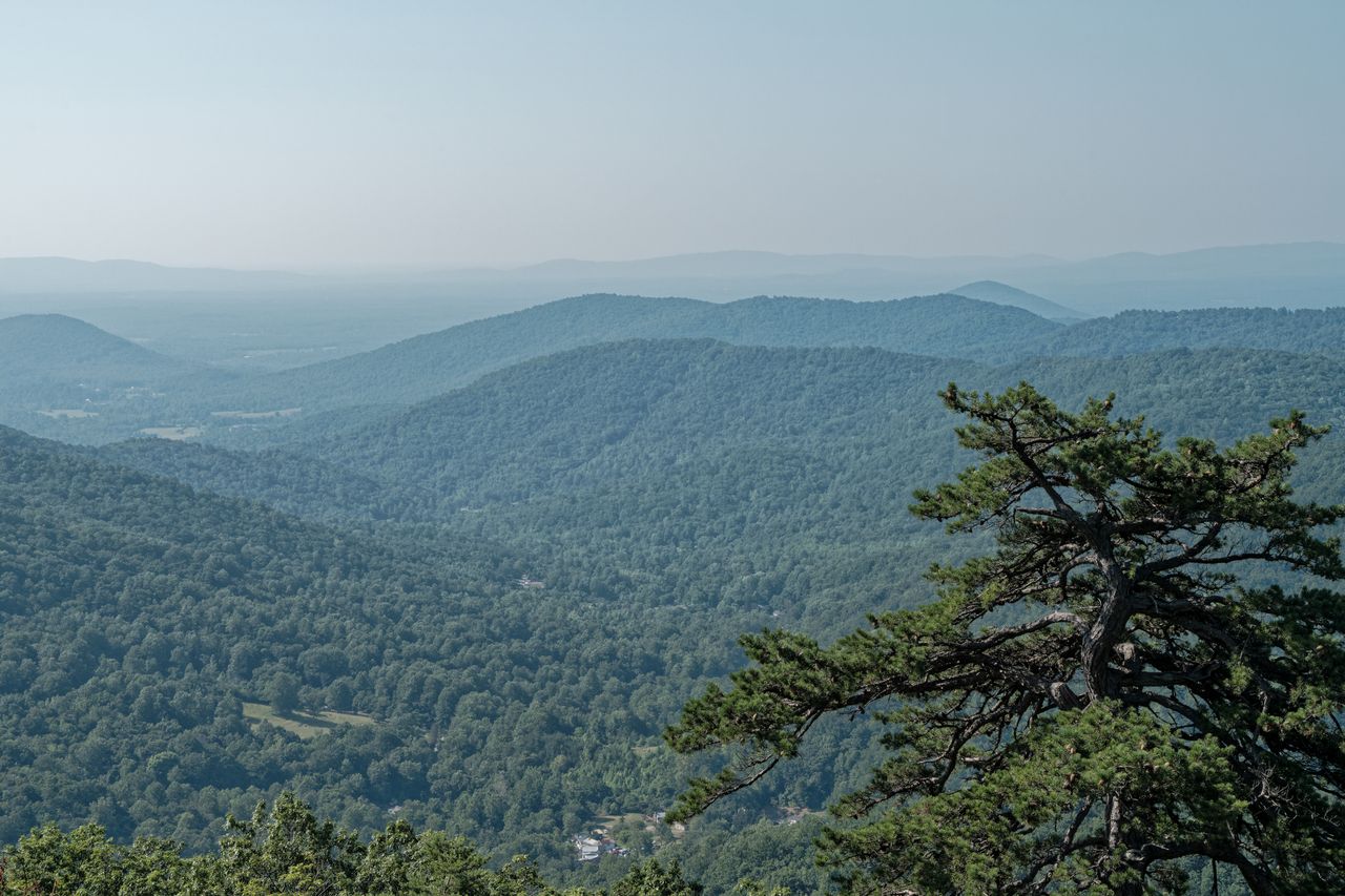
Just 75 miles west of Washington DC, Shenandoah National Park stretches along the Blue Ridge Mountains in north-central Virginia, and it punches well above its weight for scenery relative to how accessible it is. With peaks topping 4,000 feet, dramatic granite scrambles, cascading multi-tier waterfalls, and Skyline Drive running the full 105-mile length of the park with a trailhead practically every few miles, Shenandoah is genuinely one of the most convenient wilderness escapes available to tens of millions of East Coasters — you don’t need to hike for hours to reach a spectacular view, and you don’t need to drive for hours to reach the trailhead either.
This guide covers the best hikes in Shenandoah, from short, spectacular-view trails accessible to nearly anyone through the park’s most demanding scrambles — with current 2026 permit information, dog-friendly trail notes, and the practical details that make the difference between a smooth visit and a frustrating one.
For gear appropriate to Shenandoah’s mix of rock scrambling and forested trail, our best hiking boots for men and best hiking boots for women guides cover footwear with the grip this terrain rewards, and our best hiking poles guide covers options for the steep, sustained climbs several trails on this list demand.
Before You Go — Essential 2026 Planning Information
Entrance fees. A 7-day vehicle pass costs $30. The America the Beautiful Annual Pass at $80 covers entry to all national parks for 12 months and pays for itself quickly if you’re visiting multiple parks in a year.
Old Rag requires a separate day-use ticket. A $2 per-person day-use ticket is mandatory to hike Old Rag from March 1 through November 30, purchased in advance through Recreation.gov. This is genuinely required — reserve your ticket well ahead of your planned date, since Old Rag’s popularity means tickets for peak weekends and fall foliage season can sell out.
Dogs are permitted on some trails, but not most of the popular ones. Per the National Park Service, dogs are not allowed on Fox Hollow, Stony Man, Limberlost, the Old Rag ridge and saddle trails, Dark Hollow Falls, Story of the Forest, Bearfence Mountain, or Frazier Discovery, among others. Good dog-friendly options include Blackrock Summit and the Rose River Loop. Check the current NPS trail list before planning a hike specifically around bringing a dog.
Skyline Drive is the main artery through the park, and every trailhead on this list is accessed from it. The road runs 105 miles from Front Royal in the north to Rockfish Gap near Waynesboro in the south, with mile markers used throughout the park (and throughout this guide) as the standard way to locate trailheads. The road can close temporarily during winter snow and ice events — check current status before a cold-weather visit.
Cell service is genuinely unreliable throughout most of the park. Download offline maps before you arrive, and don’t count on being able to look up trail information or call for help once you’re on trail.
Fall foliage season brings the heaviest crowds of the year by a wide margin. For a quieter experience on the park’s most popular trails — Old Rag, Stony Man, Hawksbill, Dark Hollow Falls — arrive before 8am, visit on a weekday rather than a weekend, or aim for the shoulder seasons of late April through early June or September before the foliage rush begins in earnest.
Easy to Moderate Hikes — Big Views for Modest Effort
Mary’s Rock — Best Easy Summit View
Distance: 3.6 miles round trip | Elevation gain: Roughly 1,200 feet | Difficulty: Moderate
Mary’s Rock is one of the more accessible peaks in the park, delivering sweeping views over the Shenandoah Valley and Massanutten Mountain for a genuinely reasonable amount of climbing. Start at the upper Panorama parking area in Thornton Gap, at Skyline Drive milepost 31.6. A short connector trail from the lot leads to the Appalachian Trail, where you’ll turn left and head south, climbing steadily and steeply from there.
At 1.8 miles, watch for a side trail on the right leading to Mary’s Rock itself. Multiple legends surround how the rock got its name — worth looking up before or after the hike for a bit of local color. The summit rewards the climb with genuinely expansive valley views in a package that’s accessible to most reasonably fit hikers without requiring technical scrambling.
Little Stony Man — Best Cliff-Edge Thrill Without the Crowds
Distance: 0.9 miles round trip | Elevation gain: Roughly 300 feet | Difficulty: Easy to Moderate
Walking the steep, jagged cliff edges along Little Stony Man is a genuinely thrilling, heart-pounding short hike, and it’s a strong alternative to the more famous (and more crowded) Stony Man Summit nearby. Access the trailhead from the Little Stony Man parking area along Skyline Drive at milepost 39.1, take the short connector trail to the Appalachian Trail, and turn left heading south.
At under half a mile with about 300 feet of elevation gain over a series of switchbacks, this is one of the shortest hikes on this list relative to its payoff. The views rival Stony Man’s directly — you can actually see Stony Man from Little Stony Man’s overlook — and this trail consistently sees meaningfully lighter crowds. For hikers with extra energy, the two peaks connect into a single loop covering both viewpoints.
Bearfence Mountain — Best Rock Scramble for a 360-Degree View
Distance: Under 1 mile for the Blue Blaze Trail scramble, roughly 1 mile for the full loop to the summit | Elevation gain: Modest, but genuinely steep in sections | Difficulty: Moderate (scrambling required)
This is one of the most genuinely fun short hikes in the park — a somewhat challenging rock scramble along the Blue Blaze Trail that requires using both hands to pull yourself up in sections, though most physically able hikers can manage it without technical climbing skill. The trailhead is at the Skyline Drive parking area near milepost 56.4.
The reward is a full 360-degree view of the Virginia Piedmont and Shenandoah Valley from the rocky outcroppings at the top — but be prepared to share it, since this is genuinely one of the most popular short hikes in the entire park. Arrive early to claim a spot on the rocks with some breathing room. For a longer day, continue along the Blue Blaze Trail to the actual summit of Bearfence Mountain and return via the Appalachian Trail for a roughly mile-long complete loop. Dogs are not permitted on this trail.
Fraser Discovery Trail — Best Overlooked Hidden Gem
Distance: 1.3 miles (loop) | Elevation gain: Roughly 400 feet | Difficulty: Easy to Moderate
Originally known as the Deadening Nature Trail, this genuinely underappreciated loop is easily accessible from the Loft Mountain wayside, with ample parking available right at the trailhead. Cross Skyline Drive from the wayside parking and begin climbing Loft Mountain, passing several beautiful vistas along the way.
The real appeal here is solitude — this trail delivers scenery genuinely comparable to the park’s more famous short hikes, but without anywhere near the crowds. If you’re specifically looking to get away from the congestion at Old Rag, Stony Man, or Bearfence, this is a strong, quiet alternative.
Blackrock Summit — Best Family-Friendly Talus Slope Views
Distance: 1 mile round trip | Elevation gain: Minimal | Difficulty: Easy
A short, easy, genuinely family-friendly walk from the trailhead parking lot along Skyline Drive at milepost 84.4, leading to a wonderful viewpoint atop a rocky talus slope. Take the Appalachian Trail south for a little more than half a mile to reach the top, where you’ll find incredible views of the Shenandoah Valley, Massanutten Mountain, and beyond.
A genuine safety note: the large pile of rocks at the summit might look inviting to scramble up further, but exercise real caution — rattlesnakes are known to use this rocky terrain, and this is one of the more commonly reported snake encounter spots in the park. This trail is also one of the good dog-friendly options in the park.
Dark Hollow Falls — Best Waterfall for the Distance
Distance: 1.4 miles round trip | Elevation gain: Roughly 440 feet | Difficulty: Moderate
Don’t let the short length fool you — this trail requires descending to the falls first and then climbing back up to the parking lot on the return, which means the “easy” half-mile figure understates the real effort involved. It’s genuinely one of the most popular day hikes in the entire park, so expect real crowds, particularly on weekends and during fall foliage season.
The falls themselves have reportedly impressed visitors as notable as Thomas Jefferson, and the trail passes plenty of wildflowers along with comfortable rest spots on the climb back up. Dogs are not permitted on this trail.
Strenuous Hikes
Hawksbill Summit — Best Views From the Park’s Highest Point
Distance: 1.7 to 2.9 miles round trip depending on route | Elevation gain: 520 to 860 feet depending on route | Difficulty: Moderate to Strenuous
Hawksbill is Shenandoah’s tallest peak at 4,050 feet, and it’s consistently cited as the single best all-around hike in the park for hikers who want one trail that captures everything Shenandoah does well. Two main route options exist: the Lower Hawksbill Trail is shorter and steeper at 1.7 miles round trip with 690 feet of gain, while the loop via the Appalachian Trail runs 2.9 miles with 860 feet of gain but is considered more scenic along the way.
The summit delivers outstanding, sweeping views in every direction — genuinely among the best in the entire park given the elevation advantage. For a longer day, the Skyland-Big Meadows loop combining the AT and Hawksbill Summit runs roughly 9.7 miles and passes a historic homesite and waterfall along the way.
Whiteoak Canyon — Best Multi-Waterfall Hike
Distance: Roughly 4.6 miles round trip to the upper falls, up to 9 miles for the full Cedar Run/White Oak Canyon loop passing all the falls | Elevation gain: Roughly 1,555 to 2,495 feet depending on route | Difficulty: Strenuous
Whiteoak Canyon delivers up to six or more waterfalls on the climb, depending on how far into the canyon you go, making it the clear choice for hikers who want a genuine multi-waterfall experience rather than a single falls destination. From the Hawksbill Gap parking lot on Skyline Drive at milepost 45.6, the trail makes a substantial descent down to the falls before a steep, genuinely strenuous climb back up — budget 6 to 8 hours for the full experience.
Several stream crossings occur throughout the hike; check with park rangers for current water conditions before you go, and use available footbridges rather than fording if water levels are high. Combining this with the adjacent Cedar Run Trail into a full loop extends the trip to roughly 9 miles with over 2,000 feet of cumulative elevation change, taking in the full run of cascades and pools the canyon offers. This canyon is also popular for swimming in its numerous “blue holes” during hot summer months.
Old Rag — The Signature Hike of Shenandoah National Park
Distance: 9.4 miles round trip (full loop with rock scramble); 5.4 miles via the Berry Hollow alternate route | Elevation gain: Roughly 2,415 feet | Difficulty: Strenuous, technical
Old Rag is the hike that put Shenandoah on the map for many hikers, and it earns that reputation through a genuinely distinctive rock scramble — Old Rag stands alone as a separate peak rather than part of the continuous Blue Ridge chain, which is part of why its granite scramble feels so different from anything else in the park. The full loop is 9.4 miles with a mile-long technical rock scramble section requiring genuine hand-over-hand climbing through boulder fields, followed by a fire road descent.
This is also, by a meaningful margin, Shenandoah’s most dangerous hike, reflected in the number of search-and-rescue missions conducted here annually — take the scramble seriously, wear real hiking footwear with good grip, and don’t attempt it in wet or icy conditions. For hikers who want the summit views without the technical scramble, the Berry Hollow approach offers a shorter 5.4-mile out-and-back alternative that skips the rock maze entirely, though it’s still considered a strenuous route.
Remember the day-use ticket requirement covered above — this is mandatory March through November and should be reserved well in advance, particularly for weekend and fall dates. Dogs are not permitted on the Old Rag ridge and saddle trails.
Building Your Shenandoah Itinerary
One day: Pick one waterfall hike and one to two summit hikes. Hawksbill Summit to stand on the park’s highest point, followed by Bearfence Mountain’s short scramble, is a strong combination that captures two of the park’s signature experiences in a single day without excessive driving between trailheads.
Two to three days: Day one covers the central district’s classics — Hawksbill, Dark Hollow Falls, and Stony Man or Little Stony Man. Day two tackles Old Rag as a dedicated full-day objective (permit secured well in advance). Day three covers Whiteoak Canyon for waterfalls, plus Mary’s Rock or Blackrock Summit for an easier finish depending on remaining energy.
Four or more days: Add Fraser Discovery Trail for a quieter, less-visited alternative to the crowded central district hikes, and build in genuine buffer time around Old Rag given how significantly the parking and trail congestion affects the experience on weekends and during peak foliage.
Final Thoughts
Shenandoah rewards visitors who understand that its best hikes aren’t necessarily its longest ones — Skyline Drive puts trailhead after trailhead within a short walk of spectacular views, and several of the park’s most rewarding short hikes deliver views that rival anything reached by a much longer trail elsewhere in the country. Start with Mary’s Rock or Little Stony Man to understand the park’s easy-access appeal, add Hawksbill for the single best all-around hike in the park, and if you’re ready for the park’s signature technical challenge, Old Rag delivers one of the most distinctive rock scrambles in the eastern United States — provided you’ve secured your day-use ticket and respect just how seriously the park treats its safety record on that specific trail.
Arrive early on weekends and during fall foliage season regardless of which trail you choose, check current dog policies before bringing a pet, and download offline maps before you lose cell service on Skyline Drive.
For more national park hiking guides, check our best hikes in Yosemite National Park and best hikes in Zion National Park guides.