
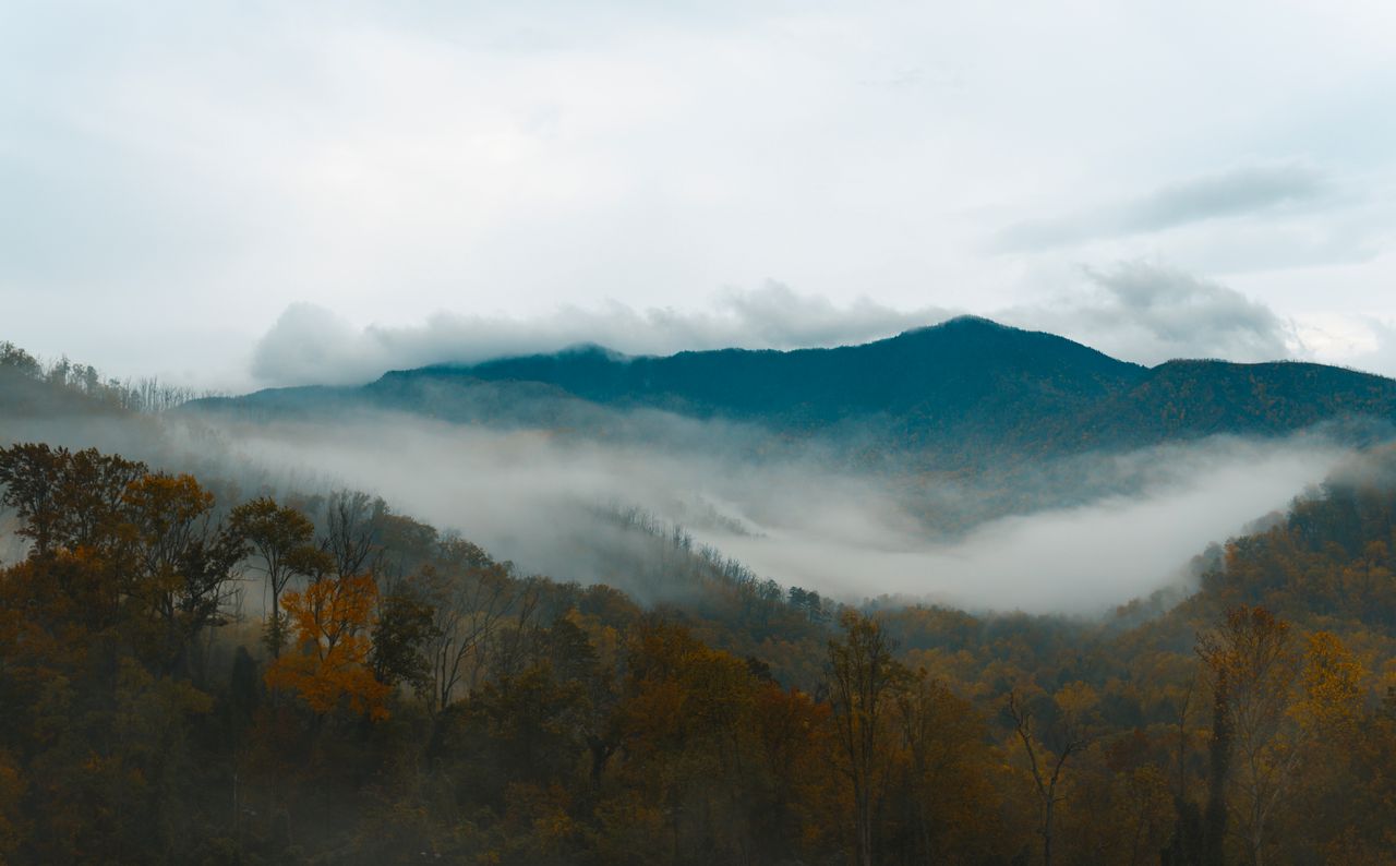
The Great Smoky Mountains hold a distinction no other park in the system can claim: they’re the single most visited national park in America by a wide margin, drawing more annual visitors than Yellowstone, Yosemite, and Grand Canyon combined. That popularity comes from a genuine, distinctive appeal — dense temperate rainforest, waterfalls tucked into nearly every drainage, exposed rock outcrops delivering panoramic ridgeline views after miles of enclosed forest hiking, and a biodiversity so rich the park is sometimes called the Salamander Capital of the World. The trails here don’t chase dramatic single peaks the way Western parks do; instead, the Smokies reward hikers who appreciate variety packed into relatively modest mileage.
This guide covers the best hikes in the Smokies, from easy waterfall loops through the park’s most rewarding ridgeline scrambles — with current 2026 parking tag information, since this is one of the only national parks in the country without a traditional entrance fee.
For gear appropriate to the Smokies’ genuinely humid, rain-prone conditions, our what to wear hiking in summer guide covers layering for a temperate rainforest environment, and our best hiking boots for men and best hiking boots for women guides cover footwear for consistently wet, rocky trail surfaces.
Before You Go — Essential 2026 Planning Information
There is no entrance fee, but a parking tag is required. The Great Smoky Mountains remains one of the only national parks without a traditional entrance fee — but any vehicle parked for longer than 15 minutes anywhere in the park requires a valid parking tag under the “Park it Forward” program. A daily tag costs $5, a weekly tag $15, and an annual tag $40. Interagency passes, including the America the Beautiful pass, are not accepted in lieu of a parking tag and provide no discount toward one.
Buy your tag before you arrive if possible. Daily and weekly tags are available through Recreation.gov and must be printed in advance — park staff will not print them for you, and digital-only display isn’t accepted. Tags are also available at visitor centers and automated kiosks throughout the park. If you’re just driving through on a scenic road like Cades Cove Loop without stopping to hike, no tag is required.
Free entrance days waive the parking tag requirement. On NPS fee-free days throughout the year — including Presidents Day, Juneteenth, and Veterans Day among others — parking tags aren’t required, since the park is technically free on those dates anyway.
Popular trailheads fill fast regardless of the parking tag system. A parking tag doesn’t guarantee you a spot — Alum Cave, Rainbow Falls, and Abrams Falls trailheads specifically are known for filling completely on weekends and during fall color season. Arrive early.
Pets are permitted on only two trails in the entire park — the Gatlinburg Trail and the Oconaluftee River Trail — and nowhere else, including all the trails covered in this guide. Plan accordingly if hiking with a dog.
The park sits in a temperate rainforest, and rain is a genuine year-round possibility. Expect precipitation regardless of season, with afternoon thunderstorms common in summer. Trail surfaces stay consistently damp and rocky in a way that rewards genuinely grippy footwear more than most Western parks demand.
Easy Hikes — Waterfalls and Accessible Trails
Deep Creek Three Waterfalls Loop — Best Easy Waterfall Hike
Distance: 2.5 miles (loop) | Elevation gain: Minimal | Difficulty: Easy
This loop delivers three genuinely distinct waterfalls — Tom Branch Falls, Indian Creek Falls, and Juney Whank Falls — on a wide, mostly level trail that follows Deep Creek closely throughout. Tom Branch Falls sits just a quarter mile in, with benches positioned right across from the creek where you can watch the falls flow directly into Deep Creek.
The route can be hiked as a simple out-and-back or extended into a loop using the Deep Creek Horse Trail, connecting to Juney Whank Falls on the return rather than backtracking the same way. Juney Whank Falls has a genuinely distinctive feature — a bridge that crosses directly through the middle of the falls, a different visual than the typical single-drop waterfall found elsewhere in the park. Deep Creek is also one of the premier tubing destinations in the Smokies, with tube rentals available at multiple outfitters near the trailhead — a fun way to combine the hike with a ride back down the creek to the parking area. Portions of the Deep Creek and Indian Creek trails are among the extremely limited stretches in the entire park where bicycles are permitted.
Grotto Falls — Best Waterfall You Can Walk Behind
Distance: 2.6 miles round trip | Elevation gain: Moderate | Difficulty: Moderate
Grotto Falls delivers a genuinely distinctive experience among the park’s many waterfalls — the trail passes directly behind the 25-foot falls, letting you walk through the spray zone rather than just viewing it from a distance. This is one of the most popular family-friendly hikes in the entire park, and the trailhead parking area fills consistently early — visitors arriving even by mid-morning frequently find the lot full and need to park further down the road.
Rainbow Falls — Best for Photography
Distance: 5 miles round trip | Elevation gain: Roughly 340 feet | Difficulty: Moderate
Rainbow Falls delivers one of the most photogenic waterfalls in the park — water pouring over squared-off blocks of rock in a way that creates genuinely striking compositions, and on sunny afternoons, an actual rainbow effect in the mist that gives the falls their name. Supervise children closely near the base given rocky terrain, slippery surfaces, and real current in the pool below.
Moderate Hikes
Chimney Tops — Best Short, Steep Payoff Hike
Distance: Roughly 3.7 miles round trip to the current viewpoint | Elevation gain: Roughly 1,720 feet, concentrated heavily in the final mile | Difficulty: Moderate to Strenuous
Chimney Tops is a genuine proving ground for Smokies hikers — a steep, rocky trail that climbs Sugarland Mountain’s flank, crossing three stream crossings before the real climbing begins. In just under 2 miles you reach the top of the first “chimney” at roughly 4,800 feet, with dramatic vistas over Sugarlands Valley and Mount LeConte as the reward.
The original summit viewpoint was destroyed in the devastating 2016 wildfires that swept through this area, and the National Park Service later created a new, safer viewpoint below the original pinnacle — the exposed rock spire itself remains closed due to ongoing fire damage instability. Head out early specifically on this trail; it’s genuinely one of the most popular hikes in the park and summit crowds build quickly.
Alum Cave Trail — Best Overall Hike in the Park
Distance: 4.5 miles round trip | Elevation gain: Roughly 1,120 feet | Difficulty: Moderate
Alum Cave is consistently ranked among the top hikes in the entire park, and it earns that reputation through genuine variety packed into a manageable distance. From the Sugarlands Visitor Center near Gatlinburg, the trailhead is roughly 8.5 miles up Newfound Gap Road, with parking directly on the left.
The first mile runs beautifully alongside Alum Cave Creek before reaching Arch Rock at roughly 1.3 to 1.4 miles — a natural stone archway the trail actually passes through. From there, the terrain gets noticeably more demanding — steep sections with genuine stairs, and cable-assisted sections along exposed rock faces where a fixed rope helps hikers across tricky terrain. The bluff near Alum Cave itself stretches over 500 feet, and hiking its full length rewards you with some of the best vantage points in the entire park. The descent is genuinely steep — take real care on the way down, since the terrain that felt manageable ascending becomes considerably more demanding heading downhill. This trail also continues onward toward Mount LeConte’s summit for hikers who want to extend the day significantly.
Practical tip: Start early given this trail’s popularity, and bring real layers — the sun doesn’t reach this section of trail until later in the day, keeping early morning temperatures noticeably cooler than elsewhere in the park.
Andrews Bald — Best High-Elevation Grass Bald
Distance: 3.6 miles round trip | Elevation gain: Roughly 1,200 feet on the return climb | Difficulty: Moderate
Andrews Bald is the highest grass bald in the Smokies, and the best time to visit is June through early July, timed to coincide with the blooming of scattered rhododendrons and flame azaleas across the open meadow. The trail is genuinely accessible for a moderate difficulty rating, making it one of the more approachable high-elevation destinations in the park, and it delivers sweeping panoramic views uncommon on trails that stay within the park’s dense forest canopy.
Strenuous Hikes
Charlies Bunion — Best Ridgeline Views Along the Appalachian Trail
Distance: 8 to 8.1 miles round trip | Elevation gain: Roughly 1,600 feet | Difficulty: Moderate to Strenuous
Charlies Bunion is frequently described as one of the best-kept secrets in the Smokies — genuinely big views without the crowds found on more famous trails, despite following a section of the Appalachian Trail from the highly accessible Newfound Gap trailhead. At around 2.7 miles you pass the Boulevard Trail junction toward Mount LeConte and the Icewater Spring shelter, before cresting a narrow ridge with sweeping views.
The final short spur reaches the exposed rock outcrop that gives the trail its name — a genuinely unusual quartzite rock face, the product of a fire and flood roughly a century ago that stripped away the trees and soil covering the ridge, leaving bare rock exposed. From the outcrop, expect roughly 270-degree views spanning Mount LeConte, Mount Kephart, and Mount Guyot — some of the most dramatic ridgeline scenery available anywhere in the park.
Mount LeConte — Best Multi-Route Summit Objective
Distance: Varies by route, typically 8 to 11 miles round trip depending on trail chosen | Elevation gain: Substantial, typically 2,700 to 3,300 feet | Difficulty: Strenuous
Mount LeConte is the third-tallest peak in the Smokies at 6,593 feet, and it’s genuinely distinctive for offering five separate trail options to the summit — Trillium Gap, Alum Cave, Rainbow Falls, Bullhead, or Boulevard, each with a meaningfully different character and difficulty profile. Alum Cave is the most popular approach and the shortest, passing the arch and cave features covered above before continuing to the summit.
The summit hosts LeConte Lodge, the only lodge inside the park’s boundaries and accessible exclusively by hiking — no road reaches it. For hikers who want to make the summit a genuine overnight rather than a demanding day hike, lodge reservations are notoriously difficult to secure and should be planned well in advance.
Mount Cammerer — Best Strenuous Hike for Solitude
Distance: 13 miles (loop) | Elevation gain: Roughly 3,150 feet, sustained across nearly the entire route | Difficulty: Strenuous
Mount Cammerer delivers a genuinely demanding full-day objective with a reward most other strenuous hikes in the park can’t match: a historic fire tower and stunning 360-degree views with almost no crowds, a genuine rarity in a park that sees over 12 million annual visitors. The trailhead is accessed from Cosby, taking TN-32 south to the Low Gap trailhead parking lot.
This is not a hike for young children or casual day hikers — the elevation gain is sustained across nearly the entire 13-mile loop rather than concentrated in one section, making it one of the more physically demanding full-day objectives in the entire park.
Building Your Smoky Mountains Itinerary
One day: Alum Cave Trail in the morning for the park’s best overall combination of features, followed by a shorter waterfall hike like Grotto Falls or Deep Creek in the afternoon if energy allows.
Two to three days: Day one covers the Gatlinburg side — Alum Cave and Chimney Tops, both accessible from Newfound Gap Road. Day two covers Charlies Bunion or Andrews Bald from the Newfound Gap trailhead for ridgeline and bald scenery. Day three covers the North Carolina side — Deep Creek’s waterfall loop, plus Mount LeConte via a different route if you’re ready for the park’s signature summit.
Four or more days: Add Mount Cammerer for a genuinely demanding, crowd-free full day, and consider whether an overnight at LeConte Lodge is worth the advance planning required to secure a reservation.
Final Thoughts
The Great Smoky Mountains reward hikers who embrace variety over chasing a single dramatic peak — waterfalls tucked into nearly every drainage, dense temperate rainforest that opens unexpectedly onto exposed rock outcrops with panoramic ridgeline views, and a level of biodiversity that rewards slowing down as much as covering distance. Start with Alum Cave to understand why it’s consistently ranked the park’s best overall hike, add Charlies Bunion for genuine solitude on a trail that somehow stays quiet despite following the Appalachian Trail from one of the most accessible trailheads in the park, and if you’re ready for a full-day commitment, Mount Cammerer delivers views that rival anything in the park with almost none of the crowds.
Buy your parking tag before you arrive, start early at the popular trailheads regardless of season, and pack for genuine rain at any time of year given the park’s temperate rainforest climate.
For more national park hiking guides, check our best hikes in Shenandoah National Park and best hikes in Acadia National Park guides for more of the East Coast’s finest hiking destinations.