
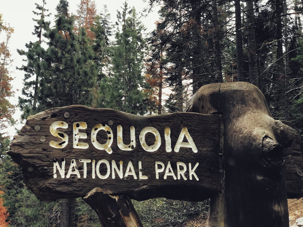
Sequoia National Park is one of those places that earns the word spectacular without exaggeration. Standing at the base of a tree that was already ancient when the Roman Empire fell, looking up at a trunk wider than most living rooms, in a forest so quiet you can hear individual branches move in the wind — it’s a genuinely humbling experience that photographs don’t capture.
The park covers over 400,000 acres of the southern Sierra Nevada, with more than 800 miles of maintained trail ranging from paved half-mile strolls to 20-plus mile wilderness routes that gain 5,000 feet of elevation. The challenge for first-time visitors isn’t finding good hikes — it’s deciding which ones to prioritize across the limited days most people have available.
This guide covers the best hikes in Sequoia National Park organized by difficulty, with everything you need to plan each one — distance, elevation, time, logistics, and the specific details that make each trail worth doing or worth skipping depending on your priorities.
Before You Go: Essential Planning Information
Entry and passes: A vehicle entry pass costs $35 and covers 7 days. The America the Beautiful Annual Pass at $80 covers all 400+ national park sites for 12 months — if you’re visiting more than two or three national parks in a year, the annual pass pays for itself immediately and is worth buying before arrival.
Best time to visit: June through September is peak season — all park roads are open, weather is reliable for hiking, and the trails are fully accessible. The trade-off is crowds, particularly at high-traffic areas like the General Sherman Tree. May and October offer significantly reduced crowds, cooler temperatures, and often better light for photography. Winter brings closures on many roads and icy conditions on trails — check road status before any visit outside the main season.
Getting there: Fresno is the closest airport, approximately 90 minutes from the park entrance. San Francisco and Los Angeles are both roughly four hours away. There’s no public transit directly to the park — a rental car is the practical option for most visitors.
Altitude awareness: Sequoia sits high. The Giant Forest area where most popular trails are located sits around 6,500 feet. Alta Peak, the highest trail on this list, reaches 11,200 feet. Visitors coming from sea level should plan for reduced exertion capacity on the first day, drink more water than usual, and hike at a slower pace than they would at lower elevation. Headache and fatigue at altitude are common and manageable with proper pacing and hydration; chest pain or significant shortness of breath are reasons to descend immediately.
Parking and shuttles: The free park shuttle system runs throughout the Giant Forest area in summer, connecting the Giant Forest Museum, General Sherman Tree trailhead, Moro Rock, and Crescent Meadow. Using the shuttle for the first hike of the day — parking at the Giant Forest Museum and shuttling to General Sherman — frees you from the parking lot scramble at the most popular trailheads and allows you to chain multiple hikes together without returning to a car between them.
What to bring: Water is the most critical item — at elevation in summer, a liter per two hours of hiking is a conservative minimum. Sunscreen, sunglasses, and a wide-brim hat are essential on exposed trails. A rain jacket is worth packing for afternoon thunderstorms that develop rapidly in summer. Trekking poles help significantly on the steeper and longer trails on this list. For backcountry permits, check the Sequoia National Park reservation system well in advance — popular routes book out months ahead.
Easy Hikes — Great for Families, First-Time Visitors, and Anyone
General Sherman Tree — The World’s Largest Tree
1.2 miles | 196 feet elevation | 30 minutes | Easy
Every visit to Sequoia starts here. The General Sherman Tree is the largest tree on earth by volume — 52,500 cubic feet of living wood, 275 feet tall, over 36 feet in diameter at the base, and estimated to be between 2,200 and 2,700 years old. The numbers are impressive; the experience of standing beside it is more so.
The trail from the Wolverton Road trailhead descends to the tree and then climbs back up — making the return leg the only moderately strenuous part of an otherwise easy walk. The park shuttle stops at the accessible trailhead lower on the route, which reduces the total climb for families with young children or visitors with mobility limitations.
The crowd situation is real. General Sherman is the most visited spot in the park, and summer mornings often produce lines of people waiting for clear photographs. Two strategies help: arriving before 8am gives you the best chance of a relatively uncrowded experience, or simply accepting the crowds and using the visit as the start of the Congress Trail instead, which takes you immediately into quieter forest.
Practical tip: Park at the Wolverton lot and descend to the tree. Take the shuttle back up to the parking lot on the return to save the climb on tired legs, particularly if you’re continuing to other hikes.
Big Trees Trail — Best Introduction to the Giant Forest
1.3 miles | 114 feet elevation | 30-45 minutes | Easy
The Big Trees Trail is the most informative easy hike in the park — a flat loop around Round Meadow through the Giant Forest, one of the world’s most significant sequoia groves, with interpretive signs explaining sequoia biology, ecology, and conservation throughout. For visitors who want to understand what they’re looking at rather than just photographing it, this trail delivers more context than anywhere else in the park.
The meadow itself is worth the visit independent of the trees — wildflowers bloom through the meadow in early summer, and the contrast between the open grassy expanse and the cathedral-like sequoia forest surrounding it creates a visual drama that surprises most visitors expecting a more uniformly forested experience.
Start from the Giant Forest Museum, which provides additional context on sequoia natural history before the trail. Arriving before 9am significantly improves the parking situation. In summer, the shuttle from this location runs to all other major trailheads — making the Giant Forest Museum the logical home base for a multi-trail day.
Practical tip: Combine with the Congress Trail by walking from the Big Trees Trail to the General Sherman trailhead via the connecting trail — creating a 4-5 mile loop that covers the best of the Giant Forest without retracing steps.
Congress Trail — Best Way to Escape the General Sherman Crowds
3 miles | 495 feet elevation | 1.5 hours | Easy
The Congress Trail begins at the General Sherman trailhead and immediately provides the most valuable service a trail in Sequoia can offer: it takes you away from the General Sherman crowds within minutes. Two hundred yards past General Sherman, the forest quiets and the trail opens into one of the park’s most impressive sequoia corridors.
The trail loops through two significant sequoia groves — named the House and the Senate — with individual trees named after presidents, generals, and members of Congress. The President Tree, visible from a viewing area on the trail, is among the most photogenic large sequoias in the park. The McKinley Tree nearby is equally impressive in a cluster that provides perspective on the sheer density of large trees in this section of the Giant Forest.
The 495 feet of elevation gain is spread across 3 miles — gentle enough that the trail earns its “easy” designation despite being the longest on this section of the list. The few steeper sections are short and manageable for most fitness levels.
Practical tip: This is the best trail in the park for the combination of giant tree access, solitude relative to General Sherman, and manageable distance. If you only have time for one hike beyond General Sherman, this is it.
Crescent Meadow Loop — Best Wildlife and Wildflower Hike
1.8 miles | 206 feet elevation | 1 hour | Easy
Crescent Meadow sits at the end of Moro Rock Road and provides the park’s best opportunity for wildlife observation on a short hike. Deer, marmots, and occasionally black bears visit the meadow regularly — particularly in early morning before day hikers arrive in numbers.
The loop encircles the meadow through a mixed forest of sequoias and firs, with the meadow itself visible throughout most of the circuit. In June and early July, wildflowers cover the meadow in dense patches of color that contrast with the dark sequoia bark in a way that’s genuinely striking.
The parking lot is small and fills quickly on summer weekends. From Memorial Day weekend through the end of summer, the road into Crescent Meadow is closed to private vehicles on weekends and holidays — the free park shuttle is the only access option. Plan accordingly: take the shuttle from the Giant Forest Museum and skip the parking lottery entirely.
Crescent Meadow connects to several longer trails including the Trail of the Sequoias and Tharp’s Log Trail — allowing extension to a longer half-day hike if the loop feels too short.
Practical tip: The meadow is at its best in the first two hours after sunrise — wildlife is more active, light is better for photography, and the humidity from overnight moisture gives the forest a different quality than midday visits.
Moderate Hikes — More Challenge, More Reward
Moro Rock — Best Sunset View in the Park
0.5 miles | 177 feet elevation | 30 minutes | Moderate
Moro Rock is the park’s most dramatic short hike and one of the best sunset destinations in the Sierra Nevada. The granite dome rises above the Giant Forest and its summit — reached via 350+ carved stone steps — provides a 360-degree panorama of the Great Western Divide, the Kings Canyon wilderness to the north, and the San Joaquin Valley haze to the west.
The elevation and step count make it more aerobically demanding than the distance suggests. At 6,725 feet, the thin air turns what would be an effortless quarter-mile at sea level into a moderately strenuous climb that warrants the moderate designation. Take the steps at a comfortable pace and stop at the several intermediate viewpoints — each offers a meaningful perspective even if the summit is the primary goal.
The sunset experience here is genuinely exceptional. The western-facing exposure catches the alpenglow on the Great Western Divide from the opposite direction — the granite peaks turning pink and orange as direct sun fades is a different visual experience than most Sierra viewpoints.
Practical tip: Arrive at least 45 minutes before sunset to claim a summit position. In summer, the Moro Rock parking lot fills quickly — take the shuttle from the Giant Forest Museum to eliminate the parking uncertainty on peak days.
Tokopah Falls Trail — Best Waterfall Hike
4 miles | 639 feet elevation | 2 hours | Moderate
Sequoia has fewer waterfall hikes than parks with more dramatic snowmelt geography, which makes Tokopah Falls the most important waterfall trail in the park. The 1,200-foot cascade at the end of the trail is most powerful in late May and June when snowmelt is at peak volume — plan accordingly if experiencing the falls at full force is the goal.
The trail follows the Marble Fork of the Kaweah River from Lodgepole Campground through a granite canyon with increasingly dramatic cliff walls as you approach the falls. The riverside scenery is worth the hike independent of the destination — the canyon section about a mile from the falls is genuinely beautiful in a way that’s easy to miss if you’re focused on reaching the waterfall.
The trail is mostly flat with the 639 feet of elevation distributed across 4 miles — a gentle grade that makes it accessible for older hikers and families with children comfortable covering 4 miles total. By late August and September, the waterfall reduces significantly — still worth seeing but substantially less dramatic than the spring visit.
Practical tip: Start early from Lodgepole Campground to secure parking. The trail is popular with families staying in the campground — weekday mornings are significantly quieter than weekend afternoons.
Little Baldy — Best Views for the Distance
3.3 miles | 793 feet elevation | 2 hours | Moderate
Little Baldy is the park’s best-kept moderate secret — a switchback climb to a granite dome summit with views that most visitors don’t discover because the trailhead is on the highway between the Giant Forest and Dorst Campground rather than at a major visitor hub. That relative obscurity makes it one of the quietest quality hikes in a busy park.
The summit view encompasses the Silliman Crest, the Great Western Divide, and the forested valleys between them in a panorama that rivals Moro Rock with significantly fewer people. The exposed granite summit also provides good marmot watching — these large ground squirrels sun themselves on warm rocks throughout the summer and are completely accustomed to human presence.
The 793 feet of elevation gain over 3.3 miles is the steepest gradient on the moderate list — not difficult by Sierra standards but noticeably more sustained than the other options in this category. Take water and take breaks on the switchback sections.
Practical tip: The trailhead is marked by a large sign on the east side of the Generals Highway, 1.5 miles south of Dorst Campground. If you’re staying at Dorst, this is the most accessible quality day hike from the campground.
Big Baldy Ridge — Best Midpoint Hike Between Sequoia and Kings Canyon
6 miles | 1,473 feet elevation | 2-3 hours | Moderate
Big Baldy Ridge sits roughly halfway between the Giant Forest in Sequoia and Grant Grove in Kings Canyon — making it the natural choice for visitors traveling between the two parks who want to add a hike to the drive rather than just viewing the forest from the road.
The summit provides what may be the best dual-park viewpoint in the Sierra — looking south into Sequoia and north into Kings Canyon simultaneously from a 360-degree vantage point that rivals dedicated summit hikes three times as long. Castle Peak, Alta Peak, and the Great Western Divide are all visible on clear days.
The 6-mile round trip with 1,473 feet of elevation makes this the most physically demanding hike in the moderate category — appropriate for reasonably fit hikers accustomed to day hiking but not for beginners or those struggling with altitude. Start with water for the full distance and budget more time than the trail stats suggest if you’re not acclimatized.
Practical tip: The trailhead is on the east side of the Generals Highway. Combining this hike with a visit to Grant Grove in Kings Canyon on the same day makes logical geographic sense and creates a full park experience across both protected areas.
Strenuous Hikes — For Experienced and Fit Hikers
Alta Peak — Best Full-Day Summit Hike
14.9 miles | 4,064 feet elevation | 8-10 hours | Strenuous
Alta Peak is the most rewarding full-day hike in Sequoia for hikers capable of handling the distance and elevation. The trail gains over 4,000 feet from the Lodgepole trailhead to the 11,204-foot summit — a climb that requires genuine cardiovascular fitness and previous experience hiking at elevation.
The summit view is the payoff: on clear days, Mount Whitney — the highest peak in the contiguous United States — is visible to the southeast, alongside hundreds of miles of Sierra Nevada wilderness extending in every direction. The high-country landscape above treeline — granite basins, scattered tarns, marmots, and the occasional thunderstorm building over distant peaks — is a completely different Sequoia from the giant tree forest below.
Acclimatization matters here more than on any other trail on this list. The trailhead starts above 7,000 feet and the summit exceeds 11,000 feet — visitors arriving from low elevation the previous day will struggle significantly. Spending a night at Lodgepole before attempting Alta Peak dramatically improves the experience.
Start no later than 6am to summit and descend before afternoon thunderstorms develop — a non-negotiable safety consideration on exposed peaks above treeline in summer.
Practical tip: Carry at least 3 liters of water and enough food for a full day. The trail passes no reliable water sources in its upper section. Trekking poles are strongly recommended for the knee-saving descent from this elevation gain.
Franklin Lakes — Best Overnight Backpacking Destination
11.2 miles | 3,458 feet elevation | 6-7 hours | Strenuous
Franklin Lakes sits in the Mineral King area of Sequoia — one of the park’s most spectacular and most remote sections, accessed via a narrow winding road that requires significant commitment to reach. The effort filters out casual visitors and rewards those who make it with a dramatically different experience from the crowded Giant Forest trails.
The trail climbs steadily from the Mineral King Ranger Station through subalpine forest and meadow to a series of three alpine lakes nestled beneath the surrounding Sierra peaks. As a day hike, the 11.2-mile round trip is long but manageable for fit hikers starting early. As an overnight backpacking trip, the lakeside camping provides evening light on the peaks that day hikers never experience.
A backcountry permit is required for overnight camping — apply through the Sequoia National Park reservation system well in advance. Summer permits for Mineral King are among the most sought-after in the park.
Practical tip: The road to Mineral King is narrow, winding, and takes significantly longer than the mileage suggests. Budget extra driving time and arrive at the trailhead early to secure a parking spot at this limited-capacity trailhead.
Lakes Loop to Heather, Emerald, and Pear Lake — Best Multi-Lake Trail
12.3 miles | 2,936 feet elevation | 6 hours | Strenuous
The Lakes Loop is the most popular backcountry trail in Sequoia — and despite the “loop” designation, it’s an out-and-back that passes three increasingly impressive alpine lakes before returning to the trailhead at the Wolverton parking area.
Heather Lake at 4 miles is the first objective — an accessible alpine lake for hikers who want the high-country experience without committing to the full distance. Emerald Lake a mile further is where most day hikers turn around, and the campsite popularity here means overnight visitors need permits booked well in advance. Pear Lake, the largest and most dramatic of the three, is 1.5 miles past Emerald — worth the additional distance for the dramatic rocky basin and significantly fewer visitors than the closer lakes.
The elevation gain is distributed across the full distance with sustained climbing in the first half and a more gradual approach to the lakes. The trailhead shares parking with the General Sherman tree access — arrive early or take the shuttle from Giant Forest Museum.
Practical tip: Pack for weather variability. Afternoon thunderstorms are common above treeline in summer, and the exposed sections of trail above Heather Lake provide little shelter. Starting by 7am gives you summit time before weather builds.
Mineral King to Eagle Lake — Best Alpine Lake Day Hike
6.5 miles | 2,214 feet elevation | 4 hours | Strenuous
Eagle Lake packs more alpine scenery per mile than almost any other trail in the park — the 6.5-mile round trip feels more substantial than the distance because the consistent elevation gain keeps legs working throughout. The destination is a classic Sierra alpine lake ringed by granite and populated by the marmots that make Mineral King one of the best wildlife-watching areas in the park.
The optional side trip to Mosquito Lake adds roughly 3 miles and provides access to a second quieter lake for hikers who want more exploration time in the basin. The combination of Eagle and Mosquito Lakes creates a full-day itinerary in the Mineral King area without requiring the overnight commitment that Franklin Lakes demands.
The same remote access road that makes Mineral King feel special applies here — the narrow winding approach takes significantly longer than the distance suggests. Plan the driving time accordingly.
Mount Langley — Best Peak Bagging Experience
23 miles | 4,688 feet elevation | 12+ hours | Strenuous
Mount Langley is the ninth-highest peak in California at 14,026 feet — one of the state’s 14,000-foot peaks and a genuine mountaineering objective despite requiring no technical climbing skills. For hikers who want the 14er experience without the permit competition and crowds of Mount Whitney, Langley is the logical alternative.
The 23-mile route is almost universally done as a two-day backpacking trip with a high camp overnight. The first day covers the approach to a camp in the high alpine basin; the second day completes the summit and the return to the trailhead. Attempting the full route as a single-day hike is within the capability of extremely fit and experienced hikers but requires an extremely early start and careful weather management.
A backcountry permit is required. At this elevation, afternoon thunderstorms are not a threat to take lightly — lightning exposure above treeline at 14,000 feet is a genuine danger. Summit by noon and begin descending before afternoon weather builds.
Practical tip: Acclimatize for at least two nights above 6,000 feet before attempting Langley. The elevation jump from sea level to 14,000 feet is physiologically significant and proper acclimatization makes the difference between an enjoyable summit and a miserable, potentially dangerous one.
Building Your Sequoia Itinerary
One day: General Sherman Tree → Congress Trail → Moro Rock at sunset. This combination covers the park’s essential experiences in a manageable sequence. Use the shuttle between trailheads to avoid parking challenges.
Two days: Day one covers the Giant Forest area — Big Trees Trail, Congress Trail, Tokopah Falls. Day two goes to Mineral King — Eagle Lake with time in the afternoon for the drive back. Two days gives you both the famous trees and the high alpine country that most visitors miss.
Three days or more: Add Little Baldy or Big Baldy Ridge on day three for ridge views, with the Lakes Loop as a half-day or full-day option depending on fitness. Three days allows genuine exploration of the park’s range from easy forest walks to strenuous mountain terrain.
For gear to support any of these hikes, our day hiking essentials checklist covers everything you need to bring. For footwear appropriate to Sierra terrain, our best hiking shoes for men and best hiking shoes for women guides cover trail-appropriate options across different terrain types.