
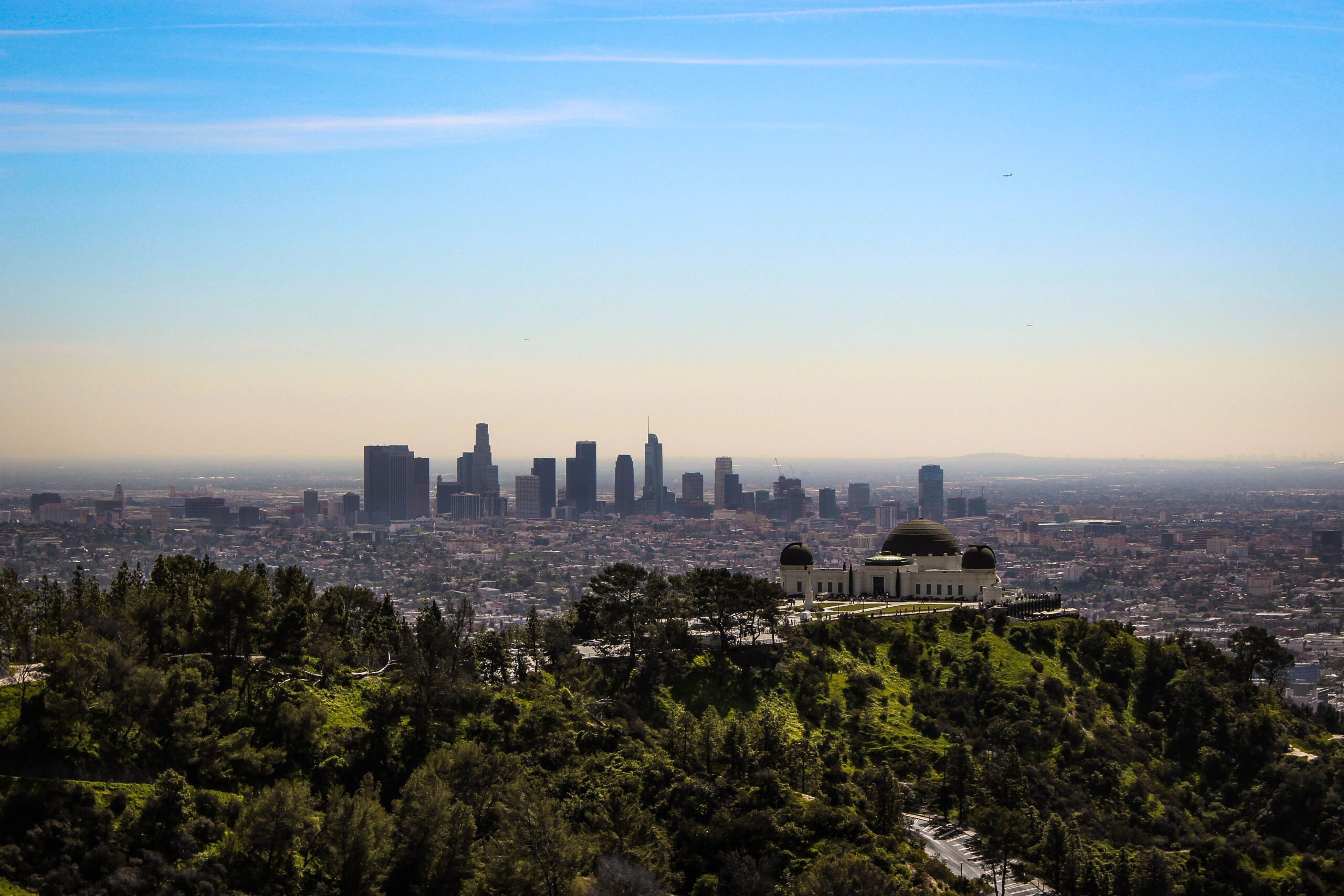
Los Angeles has a reputation as a city you experience from a car — and for most of it, that’s accurate. But within 30 minutes of downtown, the Santa Monica Mountains, Griffith Park, and the hills above Hollywood contain some of the most rewarding short hikes in California, with views of the city, ocean, and surrounding mountains that most visitors never find because they’re looking for parking at Runyon Canyon with everyone else.
The best short hikes near LA share a specific quality: they deliver something genuinely unexpected given how close they are to 10 million people. A shaded fern canyon with nine wooden bridges a half mile from the main Griffith Park road. A coastal ridge with unobstructed ocean and downtown LA views on a 3-mile loop from Pacific Coast Highway. The Hollywood Sign close enough to read from behind the fence, with nobody else around, before 8am. These experiences exist. You just need to know where to go.
This guide covers the best short hikes near Los Angeles — organized by location and difficulty — with everything you need to plan each one including parking, trailhead access, and what makes each trail worth the drive.
For gear recommendations before any of these hikes, our day hiking essentials checklist covers everything worth carrying on a city-adjacent trail day. For footwear appropriate to LA’s varied trail surfaces, check our best hiking shoes for men and best hiking shoes for women guides.
Griffith Park Trails
Ferndale Trail — Best Easy Family Hike in Los Angeles
Distance: 0.5 miles round trip (Ferndale section only) | 2.6 miles round trip (Ferndale to Griffith Observatory loop)
Elevation gain: 600 feet (full loop) | Minimal (Ferndale section only)
Difficulty: Easy (Ferndale) | Moderate (full loop)
Parking: Street parking on Ferndale Drive — free but fills early on weekends
Dogs: Yes on leash
The Ferndale Trail is one of those LA places that stops people in their tracks because it doesn’t look like LA. A shaded creek canyon with nine wooden bridges crossing back and forth over a stream, over 50 species of ferns covering the banks, small waterfalls after rain, and a tree canopy so complete that the main Griffith Park road running parallel becomes completely inaudible within a few hundred feet of entering the trail. It was built by the Civilian Conservation Corps in the 1930s and feels like it belongs in the Pacific Northwest rather than a municipal park within the city limits of Los Angeles.
The pure Ferndale experience — just the creek canyon section — is roughly a quarter mile each way. This is the right version for families with young children, visitors who want something genuinely beautiful without significant exertion, and anyone who wants to understand why Angelenos love Griffith Park so much. The path is wide, well-graded, and appropriate for most fitness levels. Multiple access points with different parking options allow flexibility in how you approach the trailhead.
For hikers who want more than the creek canyon, Ferndale connects to a trail network that climbs to the Griffith Observatory — the famous copper-roofed building from La La Land and dozens of films before it, sitting at 1,134 feet with panoramic views of downtown Los Angeles, the Hollywood Sign, and on clear days, the Pacific Ocean. The full Ferndale to Observatory loop runs 2.6 miles round trip with 600 feet of elevation gain — all of which comes in the steep, exposed section climbing to the observatory from the top of Ferndale. This section is a dirt road with no shade and significant sun exposure; bring water and sunscreen regardless of the morning temperature.
The observatory itself is worth as much time as you’re willing to give it. The lawn outside provides the best non-telephoto view of the Hollywood Sign available from any easily accessible location in LA. When the building is open — check griffithobservatory.org for current hours — the exhibits and rooftop telescope access are excellent and free.
Trailhead directions: Enter Griffith Park at the Ferndale Drive entrance off Los Feliz Boulevard. Street parking is available along Ferndale Drive. Look for the Ferndale Trail sign immediately after entering — the canyon entrance is visible from the road.
Timing: Weekday mornings provide the most peaceful Ferndale experience. Weekend afternoons bring enough hikers to make the creek canyon feel social rather than serene. The trail after rain is noticeably more beautiful — the ferns are at their most vibrant and small waterfalls that are dry in summer come alive.
After the hike, The Trails Café at the trailhead entrance serves coffee and food — closed Tuesdays and Wednesdays but worth planning around on other days.
Hollywood Sign via Innsdale Trail — Best Hike to an LA Icon
Distance: 6 miles round trip
Elevation gain: 750 feet
Difficulty: Moderate
Parking: Free street parking on Canyon Lake Drive near Lake Hollywood Park
Dogs: Yes on leash
The Hollywood Sign is one of the most photographed landmarks in the world — and one of the most confusing to actually hike to. Countless online guides send hikers to viewpoints rather than the sign itself, or describe routes that no longer exist. This route via the Innsdale Trail is the most consistent access to the sign itself — close enough to see each individual letter clearly and read the anti-trespassing signs that protect the fenced perimeter.
Start with street parking on Canyon Lake Drive near Lake Hollywood Park. Before beginning the main hike, take the short detour to the Lake Hollywood Reservoir viewpoint — a direct view of the sign from the front that provides the photograph most people want before the sign becomes too close for a full frame at the end of the route. This viewpoint view is actually harder to get once you’re behind and above the sign.
From the Lake Hollywood Park area, head north along Canyon Lake Drive before cutting into the neighborhood and finding Innsdale Drive. The Innsdale Trail entrance is visible from here — about a half mile into the walk from parking. The Innsdale Trail is mostly flat with multiple angles of the sign as you traverse the hillside, giving you the kind of centered perspective that most viewpoints don’t provide.
At the end of Innsdale, the route connects to Mulholland Highway — a paved pedestrian trail — which you follow briefly before the gates marking Mount Lee Drive. This is where the ascent begins in earnest, a steady climb on wide paved trail that eventually brings you behind and above the sign. The route skirts the north side of the neighborhood before reaching the transmission tower that marks the top — and the back of the sign itself, close enough to touch if the fence weren’t there.
Views from the top include the Griffith Observatory directly below, downtown Los Angeles through the haze, and the San Fernando Valley spreading north. On clear days, the Pacific Ocean is visible. The sign from behind is less photogenic than from the front — shoot through the fence at the letters above you for the close-up that most people don’t expect.
Timing: The sign hike gets significantly more crowded as the day progresses. Starting at or before sunrise gives you the trail essentially alone — locals do this hike regularly in the dark with headlamps specifically to have it to themselves. Arriving at the lot by 7am on weekends still gives you light crowds. By 10am on weekends, expect to share the trail with dozens of other hikers.
Santa Monica Mountains
Temescal Canyon Loop — Best Ocean View Hike Near LA
Distance: 3 miles round trip
Elevation gain: 800 feet
Difficulty: Moderate
Parking: $10 day-use fee at Temescal Gateway Park lot, or free street parking nearby
Dogs: Allowed in the lower section; not permitted in Topanga State Park section
Temescal Canyon is the best short hike on the west side of Los Angeles for the combination of canyon character, ridgeline views, and ocean panorama that it delivers in three miles. Located about a mile off Pacific Coast Highway at the corner of Sunset Boulevard and Temescal Canyon Road in Pacific Palisades, it’s accessible from both the Westside and the Valley without significant traffic navigation.
The recommended approach is counterclockwise — head right from the trailhead past the historic retreat center and cabins, taking the dirt road that connects to the Temescal Canyon Road trail. This direction means you’re climbing through the shaded canyon on the ascent and descending with ocean views the entire way down — significantly better than the alternative which reverses this sequence.
The lower canyon section is heavily shaded with picnic benches alongside the trail — popular with families and a welcome relief from the sun on warm days. The trail passes in and out of shade throughout the canyon climb, making it more manageable in summer than fully exposed alternatives. Note that dogs are welcome in the lower section but not permitted once the trail crosses into Topanga State Park — check the signage at the boundary.
The first ridge section delivers the view that makes this trail worth the $10 parking: the Pacific Ocean visible to the southwest, downtown Los Angeles to the east, and the Santa Monica Mountains extending north. A seasonal waterfall at the footbridge around the mile-and-a-half mark runs in spring after winter rains — by late summer it’s dry, but the footbridge and surrounding vegetation remain attractive.
The final push to the ridgeline is the steepest section of the hike — a sustained climb with full sun exposure. The reward at the top is one of the best three-mile views in California: unobstructed ocean and downtown simultaneously, with nothing blocking either direction. Most hikers stop here for as long as the sun and their water supply allow.
The descent on the Temescal Ridge Trail provides continuous ocean views the entire way down — the main argument for the counterclockwise direction. You’re not hiking toward the view; you’re hiking with it in front of you for a full mile of descent.
Timing: This is described as one of the most popular workout hikes on the west side of LA — weekends bring hundreds of hikers. Weekday mornings are significantly quieter. The trail is hot and exposed on the ridge section in summer — start before 8am in July and August.
Tips for Hiking Near Los Angeles
Water is more important than it seems. LA’s Mediterranean climate means the trails are dry and warm for much of the year, and the sun exposure on ridge sections accelerates dehydration faster than the mild temperatures suggest. Carry at least 1.5 liters for any of these hikes, more in summer. Our best hiking backpacks with a water bladder guide covers hands-free hydration options worth considering for longer LA trail days.
Parking fills early on weekends. Every popular LA trail has a parking problem. Arriving before 8am on weekends guarantees a spot at every trailhead on this list. Arriving at 10am on a sunny Saturday means driving in circles for 30-45 minutes. Street parking around most Griffith Park trailheads is free — the Temescal Gateway Park lot charges $10 but saves time.
Start early in summer. Most of these trails have significant sun exposure sections. A 7am start in July means 2-3 hours of hiking in moderate temperatures before the heat builds. A 10am start means hiking in 85-90°F direct sun — still manageable but significantly less enjoyable.
Rattlesnakes are present. Particularly on the Hollywood Sign trail and Temescal Canyon during warmer months. Stay on the trail, watch where you step particularly around rocks and brush, and give any snake you encounter time and space to move. For complete rattlesnake safety information, our what to do if bitten by a rattlesnake while hiking guide covers prevention and response.
Sunscreen and a hat are non-negotiable. The ridge sections on these trails — particularly the Hollywood Sign climb and Temescal Ridge — have zero shade for sustained periods. Apply SPF 50 before leaving the car and bring a wide-brim hat. For more on appropriate summer hiking clothing, our what to wear hiking in summer guide covers sun protection specifically.
Download offline maps before you go. Cell service in parts of Griffith Park and Temescal Canyon is intermittent. Download the AllTrails map for your specific hike before leaving — the Ferndale to Observatory loop on AllTrails is listed as the West Observatory Trail Loop, and the Hollywood Sign route described here is the Innsdale to Hollywood Sign via Mount Lee Trail.
Best Times to Visit
Spring (March through May) is the best season for all three of these hikes — wildflowers on the Temescal Ridge, the Ferndale Creek running with more volume, and comfortable temperatures throughout the day. The Hollywood Sign hike is pleasant any morning before 10am.
Summer (June through September) requires early starts on the exposed sections. The Ferndale Canyon is comfortable in summer due to shade throughout. The Observatory climb and Temescal Ridge are best before 9am.
Fall (October through November) offers clear skies that produce the best downtown LA and ocean views on all three hikes. Temperatures are moderate and consistent. Crowds reduce from summer peaks.
Winter (December through February) is the least-visited season and often the most beautiful after rain — the Ferndale ferns are at peak green, small waterfalls appear throughout Griffith Park, and the cleared air produces views that summer haze obscures. Check trail conditions after significant rain as some sections become muddy.
Final Thoughts
The best short hikes near Los Angeles share a quality that’s easy to miss when you’re stuck in traffic wondering why anyone would live here: they deliver the kind of perspective on the city and its surroundings that you can’t get from a car, a rooftop bar, or a viewpoint you drove to. Standing behind the Hollywood Sign at sunrise with nobody around, walking through a fern canyon that feels like the Pacific Northwest a quarter mile from a parking lot, watching the ocean and downtown simultaneously from a ridge you climbed on your own two feet — these experiences exist in Los Angeles and they’re accessible to anyone willing to start early and walk uphill for an hour.
For more California trail guides, check our best hikes in Santa Clarita Valley, best easy hiking trails in Orange County California, and Point Lobos State Natural Reserve hiking guide for more of California’s finest outdoor destinations within reach of major cities.