
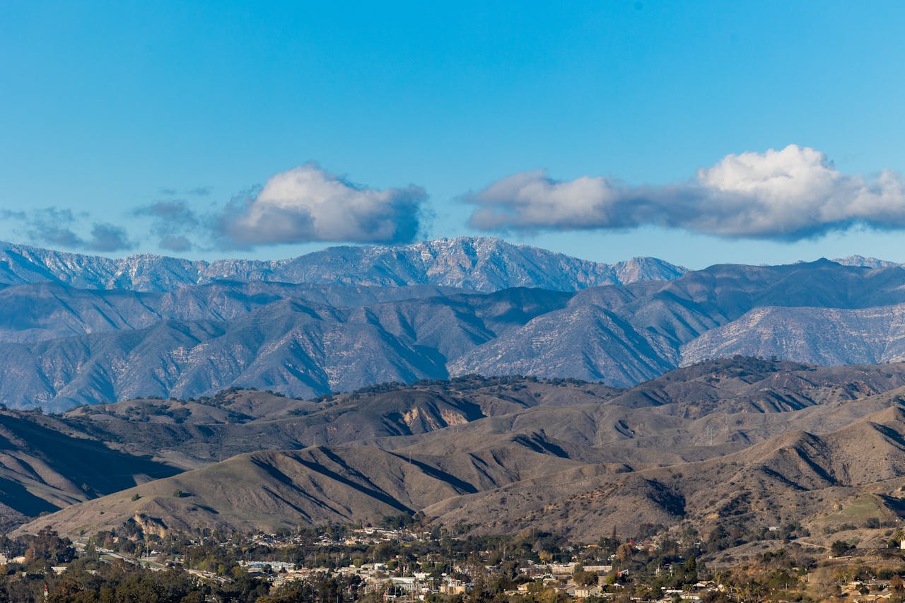
Most Angelenos drive through Santa Clarita Valley on the 5 freeway without a second thought — it’s the stretch between LA and the grapevine, the place you pass through on the way somewhere else. What most people in that car don’t know is that the mountains and canyons surrounding the valley contain some of the most rewarding hiking within an hour of Los Angeles, including seasonal waterfalls, caves, dramatic rock formations, creek crossings, and spring wildflower displays that genuinely surprise first-time visitors.
The Santa Clarita Valley sits about 30 miles north of downtown LA, surrounded on all sides by the Santa Susana Mountains to the south, the San Gabriel Mountains to the east, and the Sierra Pelona and Santa Clara Divide to the north. After winter and spring rains, the canyons come alive with running water, blooming wildflowers, and lush vegetation that transforms the landscape completely from its dry summer character.
This guide covers the best hikes in Santa Clarita Valley — from easy family trails to more challenging canyon scrambles — with everything you need to plan your visit including the best season, safety considerations, and what makes each trail worth doing.
For general hiking gear recommendations, our day hiking essentials checklist covers everything worth bringing on any of these trails. For footwear appropriate to Southern California terrain, check our best hiking shoes for men and best hiking shoes for women guides.
When to Hike in Santa Clarita Valley
The single most important planning decision for Santa Clarita hiking is timing. This valley operates on a clear seasonal rhythm that determines what you’ll find on the trail.
Spring (March through May) is the best season by a significant margin. Winter rains fill the creeks, activate the seasonal waterfalls, and trigger wildflower blooms that cover the hillsides in yellow, purple, and orange. The temperatures are comfortable — typically 65-75°F at trail level — and the landscape is as green and lush as it gets in Southern California. If you have any flexibility in when to visit, spring is the answer.
Summer (June through September) is the most challenging season. Temperatures regularly exceed 95°F in the valley and on exposed south-facing trails. Creeks dry up, waterfalls disappear, and the vegetation turns brown and brittle. Most experienced local hikers avoid midday summer hiking entirely, starting before 7am and finishing before the heat peaks. If you hike in summer, bring significantly more water than you think you’ll need — dehydration at these temperatures is a real risk.
Fall (October through November) offers comfortable temperatures and quieter trails than spring, though most seasonal water features will be dry unless preceded by early rains. A pleasant time to hike the ridge and canyon trails that don’t depend on water for their appeal.
Winter (December through February) is underrated — cooler temperatures make hiking comfortable throughout the day, early rains bring the first hints of green, and the trails are at their quietest. After significant rain, some of the waterfall trails become active before spring proper.
Essential Safety Information
Snakes: Rattlesnakes are present throughout Santa Clarita’s hiking areas, particularly on rocky trails and near creek edges in spring and summer. Stay on marked trails, watch where you step especially when crossing rocks or stepping over logs, and give any snake you encounter ample space. The vast majority of rattlesnake bites in California happen when people attempt to handle or approach them — a snake on the trail will move away if given time and space. Read this article to learn what to do when you are bitten by a rattlesnake.
Water: Carry significantly more water than you expect to need. A minimum of 2 liters for any hike under 5 miles, 3+ liters for longer or more exposed routes. In summer, consider 1 liter per hour of planned hiking. Natural water sources in Santa Clarita’s canyons are not reliable for drinking without treatment — seasonal creeks may look clear but carry bacteria and parasites. Our best personal water filter for hiking guide covers compact filtration options worth carrying on longer trails.
Trail conditions: Check recent trail reports before visiting. Spring rains that create the beautiful waterfall conditions can also make creek crossings significantly more challenging and some trails temporarily impassable. AllTrails reviews and the Santa Clarita city hiking page provide the most current conditions.
Leave No Trace: Santa Clarita’s hiking areas are maintained by a combination of city, county, and state resources with limited ranger presence. The quality of the experience depends on hikers packing out everything they bring in and staying on marked trails. The cave and waterfall areas are particularly vulnerable to damage from off-trail exploration.
Best Hikes in Santa Clarita Valley
Whitney Canyon Trail — Best Overall Hike in Santa Clarita
3.2 miles | Moderate | Free parking
Whitney Canyon Trail is the most popular hiking route in Santa Clarita — a 3.7-mile trail that features coastal sage scrub, oak woodland, and year-round springs. It’s the best introduction to what makes Santa Clarita hiking worth the drive from Los Angeles — a genuine canyon environment with varied terrain, reliable vegetation, and rewarding views from the upper sections.
From the top of Whitney Canyon, a panoramic view of Santa Clarita enchants hikers. Whitney canyon is easy to reach and accessible, providing visitors a wonderful sampling of California’s biodiversity. The trail climbs through the canyon floor before ascending to ridge views that put the surrounding valley and mountain geography in clear perspective.
The Whitney Canyon Waterfall hike is moderate, about 3.5 miles, and parking is free. Reaching the waterfall is not for the faint of heart — you climb uphill, descend back down, reach a small waterfall, and then go through it to finally arrive at Whitney Waterfall. It’s a bit sketchy, definitely thrilling, and absolutely worth it but only if you’re prepared. Hiking shoes are a must. This trail is not recommended for kids or beginner hikers due to steep and slippery sections.
The waterfall version of the Whitney Canyon route is a spring-specific experience — plan for late February through April for the best water flow. The base canyon trail is worthwhile year-round for the oak woodland and ridge views.
Best for: First-time Santa Clarita hikers who want a genuine canyon experience with optional waterfall access in spring.
Placerita Canyon Waterfall Trail — Best Family-Friendly Waterfall Hike
2.5 to 5 miles round trip | Easy to Moderate | Free
Placerita Canyon Natural Area is the most complete outdoor experience in the Santa Clarita Valley — a county park with a nature center, live animal presentations, accessible nature walks, and a trail network that leads deeper into the canyon to a seasonal waterfall. The combination of educational infrastructure and genuine natural beauty makes it the best family destination in the area.
Placerita Canyon Natural Area features trails that lead to a seasonal waterfall, offering a refreshing sight especially after rainfall. The area’s oak woodlands also provide a peaceful setting for your walk. The shorter version of the waterfall trail covers 2.5 miles round trip — appropriate for families with young children. The longer Walker Ranch extension adds additional canyon miles for hikers who want more distance.
The nature center at the trailhead is worth spending time in before hitting the trail — the exhibits on local ecology, geology, and history provide context that deepens the experience of the canyon walk. Live animal presentations with native species run on weekends and are a genuine attraction for children.
The canyon has historical significance alongside its natural beauty — it’s the site of California’s first documented gold discovery in 1842, predating the famous 1848 Gold Rush. Historical markers throughout the canyon add a layer of interest that purely natural trails don’t provide.
Best for: Families with children, first-time hikers, and anyone who wants educational content alongside a pleasant canyon walk with spring waterfall access.
Elsmere Canyon — Best Creek Canyon Hike
3 miles | Easy to Moderate | Free
Elsmere Canyon Loop is a 3-mile trail leading through canyons and along a creek, often completed in about 1 hour and 28 minutes. For spring hikers specifically, Elsmere Canyon delivers the creek-side hiking experience that defines the best of Santa Clarita’s seasonal landscape — the trail follows the canyon creek through oak woodland and coastal sage scrub, crossing the water multiple times as the canyon narrows and widens.
After significant winter rain, Elsmere Creek runs with enough volume to make the crossings genuinely entertaining — not dangerous in most conditions, but wet-footed in trail runners rather than the dry crossing of summer visits. The canyon walls close in on both sides in the middle section, creating an enclosed, shaded environment that feels dramatically different from the exposed ridge trails elsewhere in the area.
Wildlife is active in this canyon — birds are particularly abundant given the year-round water and dense oak canopy. Early morning visits in spring produce the best bird activity, and the combination of creekside habitat and adjacent scrubland creates a diversity of species that concentrated birders specifically seek out.
Best for: Spring creek hiking, wildlife watching, and families who want a manageable loop with genuine canyon character.
Haskell Canyon — Best Views Above the Valley
3-4 miles | Moderate
Haskell Canyon is pretty cool. Following a short trail, hikers can get way above the Santa Clarita Valley. The views into the mountain ranges beyond give the feeling that you are far away from the suburbs. One section follows a narrow box canyon — the hills close in around you, shielding you into a secluded natural setting. Located just off Copper Hill Drive, Haskell Canyon is easy to reach for a nice afternoon hike.
The box canyon section is the trail’s signature feature — a narrow slot where the canyon walls rise steeply on both sides and the trail occupies essentially the full canyon floor width. In spring, this section can have running water that adds to the atmosphere. The narrow walls and filtered light create a completely different environment from the open ridge and scrubland trails that characterize most Santa Clarita hiking.
The views from the upper canyon section extend across the full Santa Clarita Valley to the San Gabriel Mountains on the eastern horizon and the Santa Susanas to the south — a perspective that genuinely reframes the geography of this corner of Los Angeles County for hikers accustomed to the valley floor view.
Best for: Hikers who want a combination of dramatic narrow canyon topography and panoramic valley views in a compact, accessible route.
Towsley Canyon — Best for Rock Formations and Geological Interest
2 to 6 miles | Easy to Moderate | Free
Towsley Canyon in Ed Davis County Park offers the most geologically interesting hiking in the Santa Clarita area — the canyon exposes dramatic rock formations including tilted sedimentary layers, tar seeps, and eroded sandstone walls that tell a clear story of the area’s geological history. For hikers interested in more than just scenery, Towsley Canyon delivers a genuinely educational outdoor experience.
The canyon contains active tar seeps — natural oil deposits that have seeped to the surface for thousands of years and were used by the Chumash and Tataviam people who inhabited this area historically. The seeps are visible from the trail and have their own interpretive context worth reading before visiting.
Two trail options provide flexibility: a shorter 2-mile loop stays in the lower canyon for an easy family-appropriate walk, while the full Wiley Canyon extension adds distance and elevation for hikers who want more challenge. The ridge sections of the longer route provide views of the Santa Susana Mountains and the Santa Clarita Valley that justify the additional climbing.
Best for: Geologically curious hikers, families who want interpretive content alongside hiking, and anyone who wants varied terrain in a single trail system.
Vasquez Rocks Natural Area — Most Dramatic Landscape
4 miles | Moderate | Small parking fee
Vasquez Rocks sits at the eastern edge of the Santa Clarita area — technically in Agua Dulce but accessible as part of a Santa Clarita hiking day — and provides the most visually dramatic landscape of any trail on this list. The tilted sandstone slabs rising at 45-degree angles from the desert floor have appeared in dozens of films and television productions and are immediately recognizable even to visitors who’ve never been.
The rock formations are the primary attraction — hikers scramble across and around the tilted slabs while the trail winds through the base of the formations and up to ridge views overlooking the Antelope Valley. The Pacific Crest Trail passes through this area, providing the option for longer extensions toward the San Gabriel Mountains for hikers who want more distance.
Spring brings wildflower blooms across the scrubland surrounding the rocks — purple sage, yellow brittlebush, and orange California poppies cover the hillsides in a color display that contrasts dramatically with the pale sandstone formations. The combination of geological drama and spring wildflowers makes March and April the peak time for this location.
Best for: Hikers who want the most visually distinctive landscape in the Santa Clarita area, photographers seeking dramatic rock formations, and anyone who wants to scramble on exposed sandstone.
Bouquet Canyon Falls — Best Year-Round Waterfall
Short walk from parking | Easy | Free
Bouquet Canyon Falls is fed by release from the Bouquet Canyon Reservoir just upstream, making it a small waterfall that runs all year. Water is rare in these parts, and a waterfall even less so. After a winding drive up Bouquet Canyon Road, the falls are located off a small parking lot about 1 mile south of Bouquet Reservoir — easy to miss, but if you’ve reached the reservoir, you’ve gone too far. A short walk takes you to the falls, complete with shallow pools, rocks, and oak trees.
The year-round flow fed by the reservoir makes Bouquet Canyon Falls unique among Santa Clarita waterfall destinations — while Whitney Canyon and Placerita Canyon depend on seasonal rain for their falls, Bouquet runs consistently regardless of precipitation. This makes it the reliable waterfall option for summer visitors who want the experience outside of spring.
The falls themselves are modest in height but the pool at the base and the surrounding oak canopy create a genuinely pleasant rest stop. The winding drive up Bouquet Canyon Road through oak woodland is itself a scenic experience that extends the value of the trip beyond the falls.
Best for: Summer visitors who want waterfall access when seasonal alternatives are dry, and families who want a short, easy walk to a water feature with reliable year-round flow.
Rice Canyon Trail — Best Hidden Gem
4 miles round trip | Moderate
Rice Canyon is one of Santa Clarita’s least-visited quality trails — a canyon hike that follows a creek through oak woodland and chaparral with enough isolation from development to feel genuinely remote despite being minutes from residential streets. The trail crosses the creek multiple times in spring when water is running, creating the same creek-hopping experience as Elsmere Canyon in a location that most visitors to the area never discover.
The canyon walls are visible throughout the lower sections of the hike, with rock formations and erosion features that become more dramatic as the trail climbs toward the canyon head. Wildlife including coyotes, mule deer, and a variety of raptors uses this canyon regularly — early morning visits produce the most animal activity.
The trail connects to a broader network of open space that extends the hike significantly for visitors who want more distance. The base 4-mile round trip is appropriate for moderate hikers; the extended options provide full-day potential for stronger hikers who want to explore the broader canyon system.
Best for: Hikers who want solitude, creek access, and genuine canyon character without the crowds of the more well-known Santa Clarita trails.
Lookout Trail and Rowher Loop — Best Strenuous Hike
9+ miles | Strenuous | 2,400+ feet elevation
With an ascent of 2,408 feet, Lookout Trail and Rowher Loop has the most elevation gain of all trails in the Santa Clarita area. For hikers who’ve covered the moderate trails and want a genuine physical challenge with panoramic views that justify the effort, this is the destination.
The route climbs into the hills above the Santa Clarita Valley to ridgeline views that encompass the entire local geography — the valley floor below, the San Gabriel Mountains to the east, the Santa Susanas to the south, and on clear days the distant outline of the Sierra Pelona to the north. The elevation gain puts this firmly in the strenuous category and requires proper preparation including adequate water, sun protection, and appropriate footwear for the exposed ridge sections.
Start no later than 7am in any season to avoid the worst heat on the exposed climbing sections. Carry at minimum 3 liters of water — the route has no reliable water sources and the exposed ridge sections generate significant fluid loss even in mild temperatures. For more on managing water on demanding hikes, our best personal water filter for hiking guide covers compact filtration options worth carrying as backup.
Best for: Fit and experienced hikers who want the most demanding route in the Santa Clarita area with the most panoramic views as reward.
William S. Hart County Park — Best Easy Walk with History
1.9 miles | Easy | Free
Hart Trail Loop at William S. Hart County Park is an easy 1.9-mile path that offers a pleasant walk through parkland with views of the surrounding area. The park surrounding the historic Hart Mansion — former home of silent film cowboy star William S. Hart — provides a pleasant easy walk through maintained grounds with views of the Santa Clarita Valley and access to the mansion museum.
A herd of American bison lives in an enclosure within the park — an unexpected and genuinely remarkable wildlife encounter that surprises every first-time visitor. The bison are visible from the trail throughout the walk, providing a wildlife experience that no other hiking destination in the Los Angeles area offers.
The short distance and easy terrain make Hart Park the right choice for hikers with limited mobility, families with very young children, or anyone who wants a pleasant outdoor walk with historical and wildlife content rather than a demanding trail experience. The adjacent nature center and mansion museum extend the visit beyond the trail itself for those interested in local history.
Best for: Families with young children, easy walkers, and anyone who wants historical and wildlife content alongside a pleasant outdoor walk.
Building Your Santa Clarita Hiking Day
Spring half-day: Placerita Canyon Waterfall Trail in the morning, Whitney Canyon in the afternoon. Both trails are accessible from the central valley and the combination covers the spring waterfall experience at two different scales and characters.
Spring full day: Start early at Whitney Canyon Waterfall, continue to Elsmere Canyon for the creek experience, and finish at Vasquez Rocks in late afternoon for the dramatic rock formation light. This combination covers the full range of Santa Clarita landscape types in a single day.
Summer morning: Any of the canyon trails starting before 7am — Elsmere or Rice Canyon for shade. Bouquet Canyon Falls for a reliable water feature when seasonal alternatives are dry. Be back at the car before 10am.
Fall or winter: Towsley Canyon or Haskell Canyon for geology and views without dependence on seasonal water. Vasquez Rocks for dramatic rock formations in clear autumn light. William S. Hart Park for an easy walk with bison viewing when shorter days limit hiking time.
Getting There
Santa Clarita Valley is accessible from Los Angeles via the I-5 North (approximately 30-40 minutes from downtown depending on traffic) or via the 14 freeway for trails in the eastern part of the valley near Agua Dulce and Vasquez Rocks. Most trailheads have free parking — Vasquez Rocks has a small day-use fee.
For hikers combining Santa Clarita with other Los Angeles area hiking, check our best hiking areas near Los Angeles guide for more options across the broader region.
Final Thoughts
Santa Clarita Valley’s hiking is one of the Los Angeles area’s genuine outdoor secrets — close enough for a morning trip from the city, diverse enough to reward multiple visits across different seasons, and quiet enough that even popular trails feel uncrowded compared to the heavily trafficked options closer to LA.
Spring is the time to be here. The waterfalls, the wildflowers, the running creeks, and the comfortable temperatures create a hiking environment that’s difficult to find this close to one of the world’s largest cities. Go early, bring plenty of water, watch your step on rocky sections, and leave nothing behind — the quality of what you find depends entirely on the choices of the hikers who came before you.