
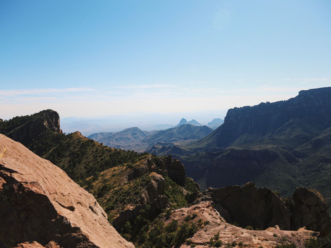
Big Bend sits in one of the most remote corners of the Lower 48 — deep in West Texas along more than 100 miles of the Rio Grande, which forms the actual border between the U.S. and Mexico here. That remoteness is part of the appeal: over 450,000 visitors come here annually, but the park is so genuinely enormous that even peak-season crowds thin out fast once you’re a mile past a trailhead. Hikingbackpackpro.com’s other desert-park coverage has focused on Death Valley, a very different Mojave ecosystem — Big Bend is Chihuahuan Desert, with the Chisos Mountains rising dramatically out of the desert floor and creating a genuinely distinct high-elevation forest environment within the same park boundary as cactus and creosote flats.
This guide covers the best hikes in Big Bend, from short canyon walks along the Rio Grande through the park’s signature full-day Chisos summit — with current 2026 access and permit information.
For gear appropriate to Big Bend’s genuine desert-to-mountain elevation range, our what to wear hiking in summer guide covers layering for the temperature swing between the desert floor and the Chisos high country.
Before You Go — Essential 2026 Planning Information
The park is open 24 hours a day, but entrance stations and visitor centers keep separate, limited hours — during spring break specifically, the entrance station opens at 10am, so plan around that if you’re arriving before dawn. Purchasing a National Park Pass in advance lets you come and go freely once checked in, without needing to stop at the gate each time.
Big Bend is genuinely enormous, and the park has its own gas stations inside its boundaries — a real rarity among national parks, and worth using, since driving out for fuel and back in again eats real time given how spread out the park’s points of interest are.
Cell phone reception is spotty throughout most of the park. Panther Junction Visitor Center is a reliable spot for Wi-Fi if you need it, and the Fossil Discovery Exhibit also has decent cell connection.
Popular trailhead parking fills extremely early. The Chisos Basin lot for Lost Mine Trail and the South Rim/Emory Peak trails was completely full by 7:30am during one visit, and multiple hikers report being turned away entirely at 10am on busy weekends — arrive before 8am if you want a realistic shot at these trailheads.
The Southeast and Northeast Rim trails, south of Emory Peak, close annually from February 1 through July 15 for Peregrine Falcon nesting. This affects part of the South Rim loop specifically — check current trail status before planning a spring visit around this route.
A backcountry permit is required for all river trips, including canoeing or kayaking sections of the Rio Grande through Santa Elena Canyon.
Grapevine Springs Road (to Balanced Rock) and several backcountry campsite roads are unpaved and genuinely rough — standard cars can manage Grapevine Springs, but high-clearance or 4-wheel drive is strongly recommended, and some primitive roadside campsites (Paint Gap, for example) require real ground clearance for the final stretch.
The Boquillas Crossing port of entry lets visitors cross into the Mexican village of Boquillas del Carmen when open — a genuinely unique border-crossing experience within the park itself, including a passport stamp. Check current operating status before planning around it, since it’s subject to closure.
Easy Hikes
Balanced Rock — Best Photogenic Short Hike
Distance: 2.2 miles round trip | Elevation gain: Minimal, with a steeper final push | Difficulty: Easy to Moderate
Reaching this trailhead is genuinely the hardest part of the hike — a 6.3-mile drive on Grapevine Springs Road, a gravel route that’s suitable for standard cars but genuinely benefits from 4-wheel drive. Once you’re hiking, most of the trail is wide, flat, and sandy, walking through what feels like a genuine rock garden before climbing uphill toward the formation itself.
The final stretch is the most technically demanding and the most fun — the trail climbs some rock cliffs, and you may need real scrambling to get over boulders on the way up. Balanced Rock itself is the clear highlight and a popular photo spot, with lines forming for the classic under-the-rock shot during busy periods; looking past it delivers genuinely great desert landscape views as a bonus. Save this hike for morning or evening specifically, since there’s no shade anywhere along the route.
Fossil Discovery Exhibit — Best Stop for Dinosaur History
Distance: Short interpretive trail, wheelchair accessible | Elevation gain: Minimal | Difficulty: Easy
Located 8 miles north of Panther Junction, this isn’t a traditional hike but a genuinely worthwhile stop for anyone interested in the park’s deep geological history — over 90 dinosaur species have been discovered within Big Bend’s boundaries, documented here through 130 million years of geological time via plants, fish, and giant crocodile fossils, plus a life-size dinosaur replica at the picnic area. A short trail leads to views of nearby geologic points of interest, and this area sees meaningfully less crowding than the park’s most popular hiking destinations.
Santa Elena Canyon Trail — Best Up-Close Rio Grande Experience
Distance: 1.7 miles round trip | Elevation gain: ~600 feet | Difficulty: Easy to Moderate
Santa Elena Canyon is genuinely one of the highlights of any Big Bend trip, and it’s the image most people associate with the park before ever visiting. After crossing a small bridge and a brief initial climb, the trail runs largely along the edge of the Rio Grande itself, with the canyon’s stone walls forming a natural border between the U.S. and Mexico. The tallest cliffs here reach roughly 1,500 feet — genuinely difficult to capture the true scale in photos.
Parking at the main trailhead is limited, with overflow parking available at the Santa Elena Overlook nearby. Most hikers complete the trail in under an hour, and you can cool off directly in the river at the end — worth knowing if you’re visiting during the hotter months, when temperatures can exceed 100°F even in the canyon’s partial shade. The recommended visiting window is September through May specifically, given how genuinely hot this exposed trail gets in summer.
Window View Trail — Best Easy Overlook Alternative
Distance: Short, paved | Elevation gain: Minimal | Difficulty: Easy
For visitors who don’t want to commit to the full Window Trail’s mileage but still want to see the formation, this short, largely paved trail delivers genuine views of the Window — the V-shaped notch in the Chisos rim that frames the desert beyond — without the elevation loss and return climb the full trail requires.
Moderate Hikes
Lost Mine Trail — Best Overall Hike in the Park
Distance: 4.8 miles round trip | Elevation gain: Roughly 1,100 feet | Difficulty: Moderate
If you could only do one hike at Big Bend, this would genuinely be it. Located in the Chisos Basin near the lodge, Lost Mine Trail delivers sustained views of the surrounding mountains and desert throughout a gradual, moderate climb, with the average hiker completing it in about three hours. The reward-to-effort ratio here is genuinely excellent — even hiking just the first mile in delivers stunning views if you’re short on time.
The trailhead parking lot fills extremely early — 7:30am arrivals have found it already full. This trail offers minimal shade, so plan for early morning or late evening specifically, and bring real water and snacks regardless of how short the distance looks on paper. Big Bend hosts over 450 recorded bird species, with 56 living in the park year-round, and this trail is a genuinely strong spot for birdwatching alongside the mountain views.
The Window Trail — Best for Wildlife Encounters
Distance: ~5.6 miles round trip | Elevation gain: Roughly 900 feet (net loss on the way in, climb on the return) | Difficulty: Moderate
Starting from the Chisos Basin and descending through Oak Creek drainage toward the Window formation itself, this trail delivers genuine wildlife encounters — black bear sightings, including mothers with cubs, are common enough here that carrying bear spray accessible (not buried in your pack) is worth doing. Multiple hikers rank this among their favorite trails in the entire park specifically for the combination of forest scenery and wildlife activity uncommon elsewhere in the desert sections of Big Bend.
The trail descends on the way out, meaning the return climb is where the real elevation gain happens — pace your water and energy accordingly rather than assuming an easy hike out simply because the trail in felt gentle. A word of caution repeated by experienced Big Bend hikers: avoid wearing perfume or strongly scented lotion on this trail specifically, since bears are genuinely attracted to a wide range of scents beyond food.
Dorgan-Sublett Trail — Best for Ranching History
Distance: Short, near Santa Elena Canyon | Elevation gain: Minimal | Difficulty: Easy to Moderate
This short trail near Santa Elena Canyon leads to the remains of a historic farmhouse nicknamed Grand Canyon Farms, operated in the early 1900s. When Big Bend’s land was first leased for development, the operators actually intended to build a Mexico-Texas resort here to attract cross-border visitors — a genuinely interesting bit of regional history most visitors never learn about, given how much less foot traffic this trail sees compared to the nearby canyon hike.
Strenuous Hikes
South Rim Trail Loop (with Emory Peak) — Best Full-Day Hike in the Park
Distance: 12.3-12.6 miles for the South Rim loop alone; 15.6 miles combined with the Emory Peak detour | Elevation gain: ~2,800 feet for the loop, up to 3,640 feet combined with Emory | Difficulty: Strenuous
The South Rim Trail is widely regarded as the best full-day hike in the entire park, and experienced repeat hikers specifically recommend starting before sunrise from the Chisos Basin Visitor Center to beat both the heat and the crowding — one hiker reported being turned away at a full parking lot at 10am on a Saturday, then successfully starting before 8am on a Sunday instead. Most hikers combine the Laguna Meadows Trail on the way out with the Pinnacles Trail on the return, or the reverse, creating a genuine loop through the Chisos high country.
At the saddle beneath Emory Peak, you can choose to add the 3-mile Emory Peak detour — the highest point in Big Bend and the Chisos Mountains, adding roughly 800 feet of elevation and about 90 minutes to the day. The final push to the summit includes a genuinely exposed 25-foot rock scramble; roughly a third of hikers who reach that point choose not to complete the final scramble given the exposure. For those who do, the reward is 360-degree views widely described as the best in the entire park, with the Chihuahuan Desert and full Chisos Mountain range visible on a clear day.
Practical tip: Bring hiking poles for the steeper sections, start as early as you possibly can, and remember the Southeast and Northeast Rim closure from February through mid-July if your visit falls in that window — check current trail status before committing to this specific route during those months.
Building Your Big Bend Itinerary
One day: Lost Mine Trail at sunrise, Balanced Rock late morning (arriving before the heat builds), and Santa Elena Canyon in the late afternoon when the canyon walls start catching better light.
Two to three days: Day one covers the Chisos Basin cluster — Lost Mine Trail early, then the Window Trail or a shorter Window View walk. Day two tackles the South Rim Trail with the Emory Peak detour as a dedicated full-day objective, started before dawn. Day three covers Santa Elena Canyon, the Fossil Discovery Exhibit, and Dorgan-Sublett Trail for a lower-effort, history-focused finish.
Four or more days: Add a primitive backcountry campsite stay (Paint Gap or similar, with a permit) for genuine dark-sky stargazing, and check current Boquillas Crossing status if visiting Mexico via the park’s port of entry interests you.
Conclusion
Big Bend rewards visitors who embrace both halves of its genuinely dual character — desert canyon hiking along the Rio Grande, and a completely different high-elevation forest environment in the Chisos Mountains, all within the same remote park boundary. Start with Lost Mine Trail to understand why it’s consistently ranked the park’s best overall hike, add Santa Elena Canyon for the classic Big Bend image, and if you’re ready for a genuine full-day commitment, the South Rim Trail with the Emory Peak scramble delivers the single best view available anywhere in the park.
Arrive at popular trailheads before 8am regardless of season, carry real water on every hike given how quickly this desert heat builds even in the Chisos high country, and check the current Southeast and Northeast Rim closure status if your visit falls between February and mid-July.
For more desert national park hiking guides, check our best hikes in Death Valley National Park guide for a different but equally dramatic desert hiking experience.