
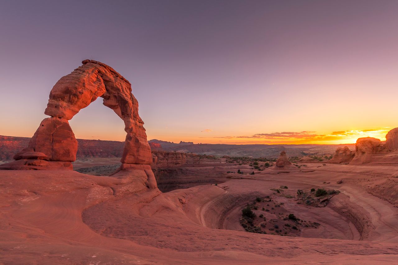
Arches packs an extraordinary concentration of dramatic scenery into a genuinely small footprint — just 119 square miles, one of the smallest national parks in the system, yet home to over 2,000 documented arches, more than anywhere else on Earth. That density is exactly what makes Arches such an efficient park to hike: most of the iconic formations sit within a mile or two of a trailhead, and a single well-planned day can realistically take in half a dozen of the park’s most famous arches without demanding serious backcountry mileage.
This guide covers the best hikes in Arches, from short roadside strolls through the park’s signature strenuous climb — with current 2026 access information, since the park’s entry system genuinely changed this year in a way that affects how you should plan your visit.
For gear appropriate to Arches’ exposed, shadeless desert terrain, our what to wear hiking in summer guide covers sun protection layering, and our best hiking sandals for women and best hiking boots for men guides cover footwear suited to sandstone, slickrock, and sandy wash terrain.
Before You Go — Essential 2026 Planning Information
Timed entry reservations have been eliminated for 2026. After running a reservation system from 2022 through 2025, the National Park Service announced on February 18, 2026 that Arches will not require timed entry this year — no advance booking, no $2 processing fee, no midnight scramble on Recreation.gov. You simply need a valid entrance pass and can arrive at any hour, since the park is open 24 hours a day, year-round.
Standard entrance fees still apply. A 7-day vehicle pass costs $30, purchasable at the entrance station or in advance on Recreation.gov. The America the Beautiful Annual Pass covers entry for 12 months.
Removing timed entry doesn’t remove the crowding problem — it shifts it to parking. Before 2022, Arches regularly closed its entrance entirely once the park reached capacity, with visitors turned away and told to return later. Without a reservation system managing arrival flow in 2026, parking lots at Delicate Arch, the Windows, and Devils Garden are expected to fill quickly during peak hours, and rangers can temporarily close access roads to those areas for 3 to 5 hours once lots are full. Arrive before 8am or after 4pm between May and October to avoid this.
Devils Garden Campground and Fiery Furnace permits still require advance booking through Recreation.gov, independent of the timed-entry change. Devils Garden is the only campground inside the park, with 51 sites, and reservations are required March 1 through October 31.
Pets are not permitted on any trail in Arches, a blanket park-wide rule.
There is no shade and very little natural water anywhere on these trails. Carry considerably more water than you think you’ll need, especially on Delicate Arch and the longer Devils Garden routes — this is genuine high-desert terrain with real heat risk in summer.
Easy Hikes
Park Avenue Trail — Best First Stop in the Park
Distance: 2 miles round trip (or 1 mile one-way with a shuttle arrangement) | Elevation gain: Roughly 300 feet | Difficulty: Easy
Park Avenue is typically the first hike you’ll encounter entering the park, just 2.2 miles from the Visitor Center, and it delivers a genuinely striking canyon experience for minimal effort. From the parking lot, stairs descend into the canyon, where towering rock walls rise on both sides as the trail runs flat toward Courthouse Towers.
If you’re hiking with a group and have two vehicles, park one at Park Avenue and one at Courthouse Towers to hike the trail one-way rather than doubling back — cutting the walking distance in half. Solo hikers or those without a shuttle arrangement simply retrace their steps back to the original parking lot. This is also one of the better spots in the park to potentially spot bighorn sheep, though sightings aren’t guaranteed. Even visitors short on time can walk out to the Park Avenue viewpoint alone for a striking overlook without committing to the full canyon descent.
The Windows Loop (with Turret Arch) — Best Easy Introduction With Multiple Arches
Distance: 1.2 miles round trip | Elevation gain: Roughly 154-187 feet | Difficulty: Easy
The Windows Loop is one of the most popular hikes in the park specifically because it delivers a genuine multi-arch payoff for very little walking. From the parking lot, the trail leads first to the North Window — the largest arch in this specific loop at a 90-foot span and 48-foot height. Rounding a corner from there brings you to the South Window, and continuing on leads to Turret Arch, a genuinely distinctive formation composed of a main arch alongside a smaller secondary arch beside it, unique enough in shape that many visitors name it a personal favorite for photography.
Much of this trail runs on stairs with only slight elevation change overall, making it broadly accessible. In winter, expect snow and ice on these stone steps — microspikes are worth carrying if conditions look questionable, though most of the relatively flat sections don’t require them. Double Arch sits close by and is easily combined into the same outing.
Sand Dune Arch and Broken Arch — Best Shaded Slot Canyon Detour
Distance: 2 miles round trip (combined) | Elevation gain: Roughly 226 feet | Difficulty: Easy
Both of these arches share a single trailhead and parking lot, making them an efficient combined stop. Veer right first to reach Sand Dune Arch, walking into a genuine slot canyon with a sandy floor — a popular spot specifically because the narrow canyon walls provide real shade during the heat of midday, a rare commodity anywhere else in this park.
Retrace your steps back to the canyon entrance, then follow the trail through more open terrain to Broken Arch. Despite the name, Broken Arch isn’t actually broken — it’s genuinely one of the more underrated arches in the park, and the trail here does something distinctive: it passes directly through the arch itself rather than just alongside it, and the far side offers some of the better photographic angles available on this hike.
Moderate to Strenuous Hikes
Devils Garden Trail (to Landscape Arch) — Best Easy Turnaround Point on a Longer Trail
Distance: 1.6 miles round trip to Landscape Arch alone | Elevation gain: Minimal | Difficulty: Easy
Landscape Arch lays claim to being the longest arch in North America at 306 feet, and the walk to see it is relatively flat and genuinely well-suited to families with younger kids. On the way, a short side path near the beginning leads to Pine Tree Arch and Tunnel Arch, both worth the brief detour before continuing to the main attraction.
Landscape Arch is thin enough that slabs of rock occasionally fall from it — the most recent significant event in 1995 — and rangers no longer allow hikers to walk underneath it for exactly that reason, though you can still get relatively close. Watching the visible debris field below the arch is a genuinely effective, tangible reminder of the same erosive forces that created every other arch in this park, and that will eventually destroy them too. This is consistently one of the busiest trails in the park, so timing your visit to avoid midday traffic and parking congestion matters more here than on most other hikes on this list.
Devils Garden Trail (to Double O Arch) — Best Moderate Extension
Distance: 4.5 miles round trip | Elevation gain: Moderate, with some technical footing | Difficulty: Moderate
For hikers who want more than the flat walk to Landscape Arch, continuing on to Double O Arch is genuinely worth the extra effort. Along the way, a stop at Partition Arch is a natural addition, and Navajo Arch sits close by as well for hikers with extra time, though it requires a short additional detour to reach.
Part of this route includes walking along a narrow sandstone ridge — a genuinely memorable, slightly exposed section that adds real character to the hike beyond just arch-spotting. Double O Arch itself, featuring two stacked arch openings, is widely considered one of the most visually striking formations in the entire park, and the area around it makes a genuinely pleasant rest stop.
Devils Garden Primitive Trail — Best for Solitude and a Full-Day Commitment
Distance: 7.2 miles round trip | Elevation gain: Substantial, genuinely strenuous terrain | Difficulty: Strenuous
The full Devils Garden Primitive Loop extends well beyond the Double O Arch turnaround, and it’s the trail experienced repeat visitors specifically recommend for hikers seeking genuine solitude and a more demanding day away from the park’s busiest trail corridors. This route sees meaningfully less foot traffic than the shorter Landscape Arch and Double O options, precisely because most visitors turn around before committing to the full primitive loop’s mileage and technical terrain.
Delicate Arch Trail — Best and Most Iconic Hike in the Park
Distance: 3 miles round trip | Elevation gain: Roughly 610 feet | Difficulty: Moderate to Strenuous
Delicate Arch is the single most recognizable arch in the park — the formation on the Utah license plate, and arguably one of the most photographed natural arches anywhere in the world. The trail starts at the Wolf Ranch trailhead and covers a genuine mix of desert terrain, including a notably strenuous slickrock slope ascent partway up that catches some first-time hikers off guard given the trail’s otherwise moderate reputation.
There is no shade anywhere on this route — carry real water regardless of season. As you approach the arch along a stretch of sandstone, the formation comes into view suddenly as you round a final corner, and it’s worth taking real time to photograph it from multiple angles once there. Stay genuinely aware of your footing near the arch itself; there are several steep, unmarked drop-offs in the immediate area that have caused real injuries to inattentive visitors.
Delicate Arch is especially striking at sunrise or sunset, when low-angle light hits the sandstone directly — sunset draws considerably larger crowds given the dramatic lighting, so hikers specifically looking to avoid people in their photos, or simply wanting an easier time finding trailhead parking, should consider a sunrise attempt instead.
Alternative for non-hikers: A separate driving route leads to Delicate Arch viewpoints rather than the trailhead — you’ll end up roughly a mile from the arch itself rather than standing beneath it, but it’s a genuine option for visitors unable to complete the full hike who still want to see this signature formation.
Roadside Attractions Worth a Quick Stop
Balanced Rock requires only a 0.3-mile walk right off the main park road — a large sandstone boulder resting precariously atop a more easily eroded mudstone base, genuinely worth circling on foot to appreciate the improbable balance from multiple angles.
Double Arch sits just off a parking lot near the Windows Loop, with a half-mile round trip trail leading to two arch spans joined at one end. Double Arch South is the largest single arch in the entire park at 112 feet in height, and standing directly beneath the joined spans is a genuinely impressive experience most visitors don’t expect from what looks like a minor roadside stop on a map.
Skyline Arch, just down the road from the Devils Garden trailhead, requires only a 0.4-mile round trip walk. The arch sits elevated against the open sky, creating a genuinely striking silhouette effect that makes it one of the more photogenic quick stops in the park relative to the minimal walking required.
Building Your Arches Itinerary
One day: Park Avenue and the Windows Loop in the morning, Sand Dune and Broken Arch around midday when the slot canyon shade genuinely helps, and Delicate Arch at sunset to close the day with the park’s signature formation.
Two to three days: Day one covers the easy cluster near the entrance — Park Avenue, Balanced Rock, the Windows Loop, and Double Arch. Day two tackles Devils Garden, choosing between the Landscape Arch turnaround, the Double O Arch extension, or the full Primitive Trail depending on time and ambition. Day three is built around Delicate Arch at sunrise for the best light and lightest crowds, plus Sand Dune and Broken Arch afterward.
Four or more days: Add the Devils Garden Primitive Trail as a dedicated full-day objective for genuine solitude, and consider a day trip to nearby Canyonlands National Park, roughly 30 minutes away, for a genuinely different, wilder hiking experience in the same region.
Final Thoughts
Arches rewards efficient planning more than almost any other national park on this list — its small footprint and trailhead-adjacent formations mean a well-sequenced day can genuinely deliver six or more of the park’s best-known arches without demanding serious mileage. Start with Park Avenue and the Windows Loop to understand the park’s scale, add Devils Garden once you’re ready for genuine multi-arch hiking with some real trail commitment, and don’t skip Delicate Arch regardless of how crowded it gets — it earns its reputation as the single most iconic formation in the park.
Arrive early or late to beat both the heat and the parking congestion that’s genuinely intensified now that timed entry no longer manages arrival flow, and carry real water on every hike in this guide — there is no shade and no reliable water source anywhere in this park.
For more national park hiking guides, check our best hikes in Bryce Canyon National Park and best hikes in Zion National Park guides for more of southern Utah’s finest hiking destinations.