
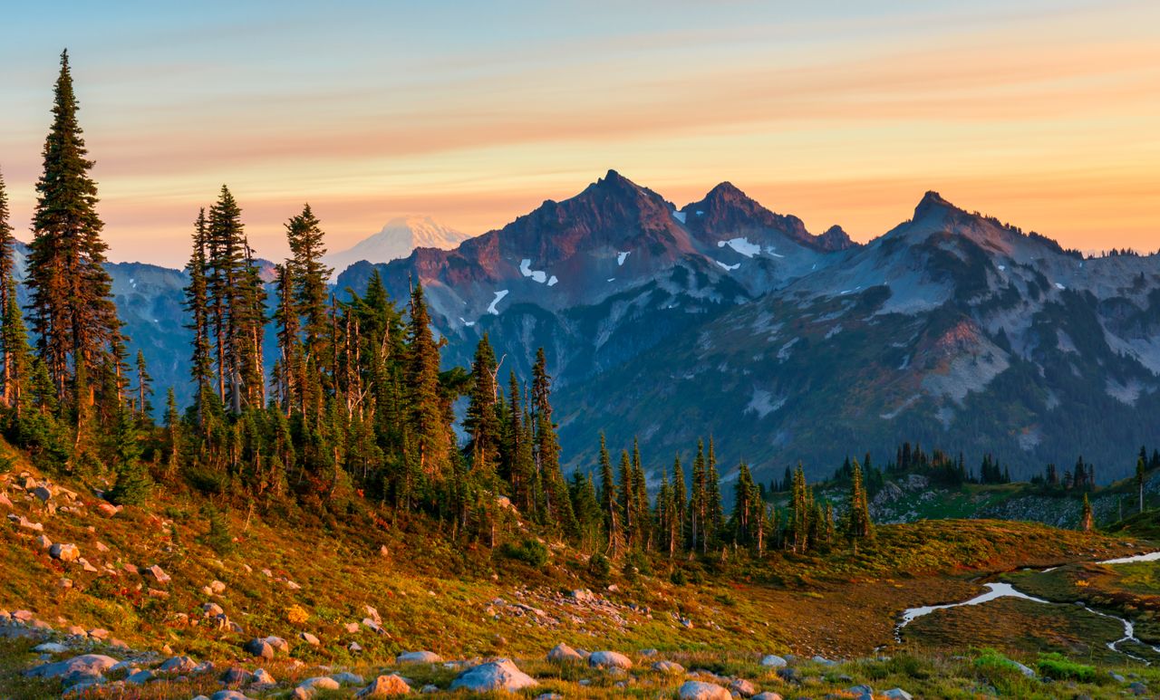
North Cascades earns its nickname as the American Alps honestly — jagged, glaciated peaks, alpine lakes so blue they look computer-generated, and terrain genuinely rugged enough that black bear encounters are a real, regular part of hiking here rather than a remote possibility. Despite that dramatic scenery, this remains one of the least-visited major national parks in the Lower 48, which means the crowding pressure that defines a trip to nearby Mount Rainier or Olympic (both covered elsewhere on hikingbackpackpro.com) largely doesn’t apply here — except at a small handful of trailheads that have become genuinely popular exceptions to that rule.
This guide covers the best hikes in North Cascades, from a genuinely popular loop with real crowd management strategy through the park’s signature alpine arm hike — with current 2026 permit and access information, since this park’s fee structure and backcountry rules work differently than most national parks.
For gear appropriate to North Cascades’ genuinely variable alpine weather — hot and cold within the same hike, per multiple experienced visitors — our what to wear hiking in summer guide covers layering, and our best hiking poles guide covers options for the steep, loose descents this terrain regularly demands.
Before You Go — Essential 2026 Planning Information
There is no entrance fee to North Cascades National Park itself, a genuine rarity among major national parks. Day-hiking on NPS trails requires no permit at all. However, several popular trailheads sit on adjacent U.S. Forest Service land rather than inside the park boundary — Maple Pass among them — and those specifically require a separate Forest Service day-use fee or parking pass, currently $5 per vehicle per day or $30 annually, payable via a Recreation Pass or the Recreation.gov Scan & Pay system. Download the Recreation.gov app before your trip so you can pay on-site even without cell service.
Backcountry permits are required year-round for any overnight stay, available at the Wilderness Information Center in Marblemount during its main operating season, or via posted self-issue instructions when the center is closed. Limited advance reservations are available for some specific backcountry campsites through Recreation.gov. Marblemount is genuinely your last practical stop to sort out permits, gas, food, or road-condition questions before continuing deeper into the park — don’t count on resolving any of this once you’re further east.
Popular trailhead permit lines form early, and this is a genuinely real phenomenon rather than an exaggeration. Wilderness Information Center lines of 30-40 people deep by 7am are common in peak summer, and Washington State hikers are broadly known for showing up prepared to camp out overnight for a coveted permit — this is a genuinely outdoorsy user base, and popular backcountry zones book out fast.
Check road status in this specific order before committing to any route: State Route 20 (the North Cascades Highway) status first, since the corridor can be partially closed by section rather than fully open or closed; then NPS road conditions specifically. This matters most during shoulder season, after storms, during wildfire season, or whenever SR-20 shows an unusual partial opening.
Parking at popular trailheads is genuinely limited and fills fast. Some Forest Service trailheads east of Diablo Lake have as few as 20 designated spots — arrive early or have a genuine backup plan rather than building your entire day around one specific lot.
Cascade River Road and similar access roads can be narrow, steep, and treacherous when passing oncoming traffic, particularly in a larger vehicle. Drive cautiously and be prepared to pull off for oncoming cars on the narrowest stretches.
Moderate Hikes
Maple Pass Loop — Best Popular Loop With Real Payoff
Distance: ~6-7.2 miles (loop) | Elevation gain: Roughly 2,000 feet | Difficulty: Moderate to Strenuous
Maple Pass is genuinely one of the most popular trails on the east side of the North Cascades, and for good reason — sweeping 360-degree views from a high ridge, a genuine alpine bowl centered on Lake Ann below, and a real payoff-to-distance ratio that keeps this trailhead’s parking lot full even on weekdays. Technically located on Forest Service land just outside the park boundary (with the trail’s far end running along the actual park border), this is exactly the trailhead where the separate day-use fee covered above applies.
Hike this loop counterclockwise, not clockwise. Multiple experienced hikers specifically flag this: going counterclockwise keeps elevation gain steady and manageable throughout, while clockwise front-loads a genuinely steep climb early in the hike. A short half-mile detour partway through drops down to Lake Ann itself — genuinely worth the side trip, with clear blue water, a small island, and small fish visible from shore, though also correspondingly mosquito-heavy near the water’s edge given the standing water nearby. From the ridge above, the same lake looks dramatically different — a bird’s-eye view with noticeably fewer bugs, and better light for photos.
Practical tip: Bring real bug spray specifically for this trail — multiple hikers report other visitors coming off the trail describing themselves as covered in bites, and the mosquito pressure near Lake Ann’s shoreline is genuinely significant in summer.
Strenuous Hikes
Cascade Pass to Sahale Arm — Best Alpine Hike in the Park
Distance: Roughly 11-12 miles round trip to the Sahale Arm area | Elevation gain: Roughly 4,000 feet | Difficulty: Strenuous
This is genuinely one of the signature hikes in the entire park — often described by repeat visitors as delivering “American Alps” scenery without needing to leave the country. Starting from the Cascade Pass trailhead (reached via the sometimes narrow, occasionally treacherous Cascade River Road covered above), the trail climbs roughly 4,000 vertical feet over more than 5.5 miles to reach Cascade Pass itself, with the terrain growing genuinely steep toward the end.
Black bear encounters are a real, active possibility on this specific trail, not a remote hypothetical. Multiple hikers report encountering black bears directly on this route — including a mother, cub, and adult male in a single outing, all actively feeding on berries along the trail. Carry bear spray accessible rather than buried in your pack, and know how to use it before you’re on trail.
At Cascade Pass, numerous designated campsites and rock shelters dot the area, and from here the trail continues climbing toward Sahale Arm, delivering increasingly dramatic alpine views along the way — genuinely variable weather is common here even within a single hike, with hikers reporting needing both gloves and sunglasses across different sections of the same day, so bring real layers including a windbreaker regardless of the forecast at the trailhead. From the arm, you can look down on Doubtful Lake and additional high-altitude lakes in the distance, and the trail continues up toward a genuine rock glacier and snowfield near the base of Sahale Peak itself for hikers with the energy and daylight to push further.
A genuine safety note on the descent: the trail down from Cascade Pass and Sahale Arm includes steep, loose sections where hiking poles make a real difference — bring them, and consider that crampons or an ice axe may be warranted for anyone continuing to the actual peak across the snowfield near the top.
Diablo Lake Trail (Partial, to Ross Dam) — Best Accessible Lake and Dam Views
Distance: Variable, several miles depending on how far you continue | Elevation gain: Minimal along the lakeside sections | Difficulty: Moderate
The full Diablo Lake Trail is sometimes closed in sections — check current status before planning around it specifically. Even when the main trail is affected, the route down to Ross Dam remains a genuinely rewarding alternative, following a road down to a boat ramp before crossing the dam itself to the far side. The steep hills falling directly into strikingly blue water make this a memorable stop even as a shorter add-on rather than a dedicated full-day hike.
Beyond the dam, a suspension bridge crosses toward the far end of the Diablo Lake Trail, with beautiful river views along the way — a worthwhile stop if you’re not planning to hike the trail’s full distance, since the walk back out (largely uphill and along a service road built for the hydroelectric plant workers) is a genuinely long return trip that’s worth factoring into your time and energy budget before committing to how far you go in.
Building Your North Cascades Itinerary
One day: Maple Pass Loop, hiked counterclockwise and started early to beat both the parking lot and the day’s heat — a genuinely complete sampling of the park’s alpine scenery in a single manageable hike.
Two to three days: Day one covers Cascade Pass to Sahale Arm as a dedicated full-day objective, with bear spray and real layers packed given the terrain’s genuine variability. Day two covers Maple Pass Loop. Day three covers the Ross Dam and Diablo Lake area for a lower-effort, high-payoff finish, or a Stehekin excursion if you have the time and budget for the Lake Chelan boat access.
Four or more days: Add a genuine backcountry overnight if you can secure a permit — arrive at the Wilderness Information Center in Marblemount early, ideally before opening, given how quickly popular zones book out during peak summer.
Conclusion
North Cascades rewards hikers willing to navigate its slightly more complicated logistics — a separate Forest Service fee at certain trailheads, year-round backcountry permits, and road status that genuinely changes section by section — in exchange for alpine scenery and a level of solitude that’s increasingly hard to find at more famous Pacific Northwest parks. Start with Maple Pass Loop for an accessible, genuinely rewarding introduction, and once you’re ready for the park’s signature full-day commitment, Cascade Pass to Sahale Arm delivers the dramatic, glaciated “American Alps” experience this park is genuinely known for among the hikers who’ve discovered it.
Check SR-20 and NPS road status in that order before finalizing any route, carry bear spray on the Cascade Pass corridor specifically, and get to Marblemount early if a backcountry permit is part of your plan — Washington hikers take this park seriously, and permit lines reflect it.
For more Pacific Northwest hiking guides, check our best hikes in Olympic National Park and Mount Rainier National Park: Best Day Hikes guides.