
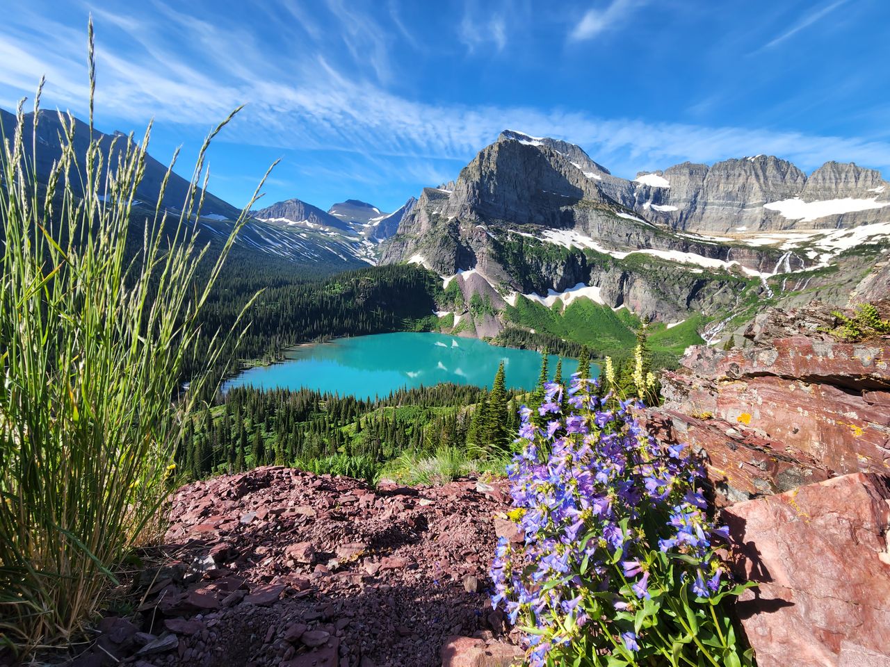
Glacier National Park delivers something few places in the Lower 48 can: the chance to hike to an actual glacier, watch icebergs float in a lake in the middle of summer, and share a valley with more grizzly bears per square mile than almost anywhere else in the country. With over 700 miles of trail winding through alpine meadows, past thundering waterfalls, and up to passes that sit directly on the Continental Divide, Glacier rewards hikers who come prepared for genuinely demanding terrain and genuinely serious wildlife encounters.
This guide covers the ten best hikes in Glacier National Park, organized from easy boardwalk strolls to full-day alpine treks — with 2026 access changes, shuttle logistics, and the practical details that make the difference between a smooth trip and a frustrating one.
For gear to prepare for any of these hikes, our day hiking essentials checklist covers the basics, and our best hiking boots for men and best hiking boots for women guides cover footwear for Glacier’s mix of boardwalk, rocky switchbacks, and exposed ridgeline.
Before You Go — Essential 2026 Planning Information
Vehicle reservations are gone for 2026. For the first time in five years, Glacier has eliminated the timed-entry vehicle reservation system park-wide — no reservation needed for Going-to-the-Sun Road, Many Glacier, Two Medicine, or the North Fork. You still need a valid park entrance pass, purchased at the gate or in advance. Instead of timed entry, rangers manage congestion with temporary closures when a specific valley or parking lot reaches capacity — arriving before 6am or after 4pm remains the best strategy for avoiding those closures during peak summer.
Logan Pass now has a 3-hour parking limit, effective beginning July 1, 2026. The lot at Logan Pass has historically filled before dawn and stayed full all day; the time limit is designed to increase turnover. Three hours is generally enough for the Hidden Lake Overlook hike plus time at the visitor center, but any hike requiring more time — the Highline Trail, Piegan Pass, or an extended Hidden Lake hike down to the water — will need the shuttle instead of parking at Logan Pass directly.
A new ticketed shuttle system replaces the old first-come, first-served shuttles. Tickets cost $1 per person, required for ages 2 and up, with a maximum of 10 per day per booking, and are non-transferable. A portion release on a rolling 60-day window starting May 2 at 8am Mountain time; the majority release at 7pm Mountain time the night before your visit date, starting June 30. Book through Recreation.gov or by phone. If you’re planning any hike along the Going-to-the-Sun Road corridor beyond a quick Logan Pass stop, securing a shuttle ticket should be one of your first planning steps.
Going-to-the-Sun Road opens seasonally, typically mid-June through early July depending on snowpack, and closes for the season around mid-October. Check current road status before finalizing any itinerary built around Logan Pass access.
Bear spray is not optional in this park. Grizzly density here is among the highest in the Lower 48, and multiple hikes on this list pass directly through prime grizzly habitat. Carry it, know how to use it before you’re on trail, and keep it accessible rather than buried in your pack.
Easy Hikes — Boardwalk, Family-Friendly, No Serious Elevation
Trail of the Cedars — Best Easy Hike in the Park
Distance: 0.6-1 mile round trip | Elevation gain: Minimal | Difficulty: Easy | Time: 30-60 minutes
By far the easiest and most accessible hike in the park — a boardwalk and paved loop through old-growth cedar forest, fully wheelchair and stroller accessible, that follows Avalanche Creek past mossy ground cover, ferns, and the dramatic overlook into Avalanche Gorge where the creek carves through the rock below. Multiple experienced Glacier hikers describe this as a genuinely peaceful, serene walk that serves as the best introduction to the park’s forested ecosystem.
The trailhead sits directly off Going-to-the-Sun Road, and the trail connects directly to the start of the Avalanche Lake hike below — a natural pairing if you want to extend the walk. Expect this trail to be busy regardless of when you visit; its accessibility makes it one of the most-visited short trails in the park.
Note for 2026: Trail of the Cedars and Avalanche Lake access has seen construction-related closures in recent seasons — verify current trail status before your visit.
St. Mary and Virginia Falls — Best Easy Waterfall Hike
Distance: 1.7-3.2 miles round trip depending on how far you extend | Elevation gain: Minimal | Difficulty: Easy | Time: 1.5-2.5 hours
A genuinely popular hike specifically because it’s easy while delivering real payoff — the shorter version reaches St. Mary Falls, a distinctive three-tiered cascade with a footbridge where people swim in warm weather, while extending to Virginia Falls adds a walk through fern-heavy forest to a taller, equally rewarding waterfall. The trail begins in open, previously burned forest, which creates good wildlife visibility and expansive views of the surrounding peaks.
This trailhead sits along the shuttle route on the east side of the park, making it an easy add to a Logan Pass day without needing to drive and park separately.
Sun Point Nature Trail — Best Flat Walk With Big Views
Distance: 1.7 miles round trip | Elevation gain: Minimal | Difficulty: Easy | Time: 1 hour
An almost entirely flat trail along Going-to-the-Sun Road — the same road featured in Forrest Gump and The Shining — with sweeping views across St. Mary Lake and access to three waterfalls (Virginia, Baring, and St. Mary Falls) from the same general trail network. Multiple hikers recommend starting early specifically because this spot gets genuinely crowded by midday given how accessible and scenic it is.
Moderate Hikes
Hidden Lake Overlook — Best Alpine Views for Moderate Effort
Distance: 2.6 miles round trip to the overlook, 5.2-5.5 miles if extended down to the lake | Elevation gain: ~460-1,200 feet | Difficulty: Easy to Moderate | Time: 2-4 hours
Starting at Logan Pass — the highest point reachable by vehicle on Going-to-the-Sun Road — this trail delivers exceptional return for the effort required. Much of the route runs on boardwalk through wide-open alpine meadows with consistently high odds of spotting mountain goats, plus views of Mount Reynolds and Mount Clements framing the landscape throughout. Wildflowers here are genuinely spectacular in July and August.
Most visitors turn around at the overlook itself; extending down to the lake roughly doubles the distance and adds real elevation loss (and the corresponding climb back). Given the new Logan Pass parking rules, plan this hike specifically around the 3-hour limit if you’re driving yourself, or take the shuttle if you want more flexibility. Check in at a visitor center before starting — bear sightings here are common enough that they periodically close the trail.
Avalanche Lake — Most Visited Trail in the Park
Distance: 4.5-5.5 miles round trip | Elevation gain: ~730 feet | Difficulty: Easy to Moderate | Time: 2-4 hours
According to AllTrails data cited by multiple experienced Glacier hikers, Avalanche Lake was the single busiest trail in America in 2024 — a reflection of both its genuine beauty and its convenient location near the West Glacier entrance, where most park visitors are already staying. The trail begins at Trail of the Cedars and follows Avalanche Creek up a steady, manageable incline, passing dramatic views into Avalanche Gorge before reaching the lake itself — a glacial basin ringed by towering cliffs and fed by multiple cascading waterfalls.
The lake has a genuine beach area where visitors swim, picnic, and relax, making this one of the best family-friendly options on this list for a full lake destination rather than just a viewpoint. Guided day tours are available for hikers who want deeper ecological context and prefer not to deal with parking logistics — some tour operators offer pickup and drop-off directly from your accommodation.
Grinnell Glacier — Best Hike to an Actual Glacier
Distance: 7.6-11 miles round trip depending on route | Elevation gain: ~1,600 feet | Difficulty: Moderate to Strenuous | Time: 4-8 hours
This is the hike most consistently ranked as a top pick across every source covering Glacier’s trails, and for good reason — it’s one of the only places in the Lower 48 where you can hike to a genuine, visible glacier while it still exists. Starting from the Many Glacier area, the first two miles are flat, passing two alpine lakes before the real climbing begins; a scenic boat shuttle across Swift Current Lake and Lake Josephine lets you skip that flat section entirely and start the climb where the trail gets interesting.
The trail delivers consistent views of a chain of blue alpine lakes as you climb, passes beneath overhanging waterfalls, and — for hikers with good timing — offers real odds of spotting bighorn sheep grazing in meadows below the glacier itself. The final quarter mile is the steepest section, rewarded with sweeping views of both Grinnell Glacier and Salamander Glacier alongside the upper lake’s striking sea-green color.
Practical tip: The Many Glacier parking lot fills quickly in peak season — arrive early or take the boat shuttle option to reduce pressure on parking.
Ptarmigan Tunnel — Best Hike With a Historic Feature
Distance: 10.7-11 miles round trip | Elevation gain: ~2,300 feet | Difficulty: Moderate to Strenuous | Time: 6-8 hours
Starting behind the cabins near Swift Current Motor Inn in Many Glacier, this trail climbs steadily to Ptarmigan Falls (a good early snack stop) before the Ptarmigan Wall — a dramatic, thin ridge of rock towering roughly 1,700 feet above the trail — comes into view. The final approach involves two long, sustained switchbacks that multiple hikers describe as genuinely tough, deceptively so given how far away the wall initially appears.
The reward is the tunnel itself — a 240 to 250-foot passage blasted through solid rock by the Civilian Conservation Corps in the 1930s, connecting the Many Glacier Valley to the rarely-seen Belly River Valley on the other side. Walking through it is consistently described as feeling like stepping into an entirely different world, with the Belly River Valley and Elizabeth Lake opening up on the far side — terrain that most visitors never see unless they’re backcountry camping.
Iceberg Lake — Best Chance to See Actual Icebergs in Summer
Distance: 9.6-10 miles round trip | Elevation gain: ~1,275-1,459 feet | Difficulty: Moderate | Time: 4-6 hours
Exactly what the name promises — a genuine glacial lake with actual chunks of ice floating in it well into summer, surrounded by towering mountain peaks in one of the most photogenic settings in the park. The trailhead sits near Swift Current Motor Inn in Many Glacier, following the same initial route as the Ptarmigan Tunnel hike before splitting off toward the lake.
This is also one of the most reliable grizzly-viewing trails in Glacier — multiple experienced hikers report seeing bears here on nearly every visit, sometimes multiple bears in a single trip. The area sees enough hiking traffic that safety-in-numbers helps, but bear spray and awareness remain essential regardless. For the genuinely brave, swimming in the lake is an option — expect the coldest water of your life.
Strenuous Hikes — Full-Day Commitments
Highline Trail — The Most Famous Hike in the Park
Distance: 7.4-14.9 miles depending on route | Elevation gain: ~1,950 feet | Difficulty: Moderate to Strenuous | Time: 6-8 hours
Starting at Logan Pass, the Highline Trail follows a dramatic ridgeline directly above Going-to-the-Sun Road, delivering sweeping views into the valley below for essentially the entire route. The trail’s opening section includes genuine exposure — steep drop-offs to the road far below — but the path is wide enough for safe passing, and a hand cable is available for extra security through the narrowest sections.
Most hikers do this as an out-and-back to Granite Park Chalet (roughly 14.9 miles round trip) and turn around there. A popular alternative extends past the chalet and descends to a point called the Loop, where a shuttle returns you to Logan Pass — this route runs closer to 11.8 miles and has the advantage of being a steady decline for most of the second half rather than requiring backtracking. For hikers who want the single best add-on on this entire list, a 0.9-mile detour to Grinnell Glacier Overlook delivers dramatic views of both Grinnell and Salamander Glaciers and is widely considered the most rewarding — and most physically demanding — optional section of the whole hike.
Practical tip: Given the new Logan Pass 3-hour parking limit, this hike essentially requires the shuttle system in 2026 unless you’re starting and finishing well within that window — plan your shuttle ticket booking accordingly.
Cracker Lake — Most Photogenic Lake in the Park
Distance: 12.6-13.2 miles round trip | Elevation gain: ~1,400-2,000 feet | Difficulty: Strenuous | Time: 6-8 hours
Cracker Lake’s turquoise-blue color — created by glacial silt suspended in the water, illuminated by direct sun — makes this one of the most photographed and most striking lakes in the entire park, sitting beneath the 10,000-foot Mount Siyeh. An abandoned copper mine at one end adds genuine historical interest; local legend holds that the prospectors who staked the claim named the lake after the cheese and crackers they were eating when they arrived.
The trail itself is a mixed bag according to multiple hikers — much of it runs through dense forest without significant views until the final approach, and the route is shared with horseback riding tours, meaning muddy sections and horse droppings are a genuine and consistent feature of this hike. There’s also a documented history of elevated bear activity in this specific area — the trail was closed for eight weeks in a recent season due to a notoriously aggressive bear. Carry bear spray and stay alert regardless of how the trail’s popularity might suggest otherwise.
Piegan Pass — Best Underrated Alpine Hike
Distance: 9 miles round trip (out-and-back from Siyeh Bend) | Elevation gain: Significant, dramatic alpine exposure near the pass | Difficulty: Strenuous | Time: Full day
Multiple experienced Glacier hikers specifically flag this trail as underrated relative to how spectacular it actually is — most visitors gravitate toward Highline or Grinnell Glacier and skip this one entirely, which means genuinely more solitude on a trail that delivers dramatic, rugged alpine views once you clear treeline. Most hikers approach from Siyeh Bend, a roadside pullout on Going-to-the-Sun Road, hiking up to the pass and back rather than attempting the full through-hike to Many Glacier, which requires coordinated transportation on both ends.
Early season hikers should expect significant snowpack in the higher sections — traversing snowfields well into June is common in typical snow years, so check current conditions before attempting this route early in the season.
Building Your Glacier Itinerary
One day: Trail of the Cedars in the morning, Hidden Lake Overlook from Logan Pass mid-day (working within the 3-hour parking limit or via shuttle), and St. Mary Falls in the afternoon on the way out.
Two to three days: Day one covers the West Glacier and Logan Pass side — Trail of the Cedars, Avalanche Lake, Hidden Lake Overlook. Day two moves to Many Glacier — Grinnell Glacier or Iceberg Lake, both requiring an early start for parking. Day three adds either the Highline Trail with a shuttle ticket booked in advance, or Ptarmigan Tunnel for the historic feature and quieter trail.
Four or more days: Add Cracker Lake or Piegan Pass for a genuinely demanding, less crowded full-day route, and consider a boat tour on one of the park’s lakes as a lower-effort day between hiking days to let your legs recover.
Final Thoughts
Glacier rewards hikers who plan around its specific 2026 access changes — no vehicle reservation needed, but the new Logan Pass parking limit and ticketed shuttle system mean the trails starting there require more advance thought than in previous years. Start with Trail of the Cedars and Hidden Lake Overlook to understand the park’s scale without serious commitment. Add Grinnell Glacier once you’re ready for a genuine full-day alpine hike, and if you can secure shuttle tickets and handle the exposure, the Highline Trail delivers views that few trails anywhere in the country can match.
Carry bear spray on every hike on this list without exception — this is genuinely some of the highest grizzly density habitat in the Lower 48, and the wildlife is as much a part of the Glacier experience as the scenery itself.
For more national park hiking guides, check our best hikes in Rocky Mountain National Park and best hikes in Yosemite National Park guides.