
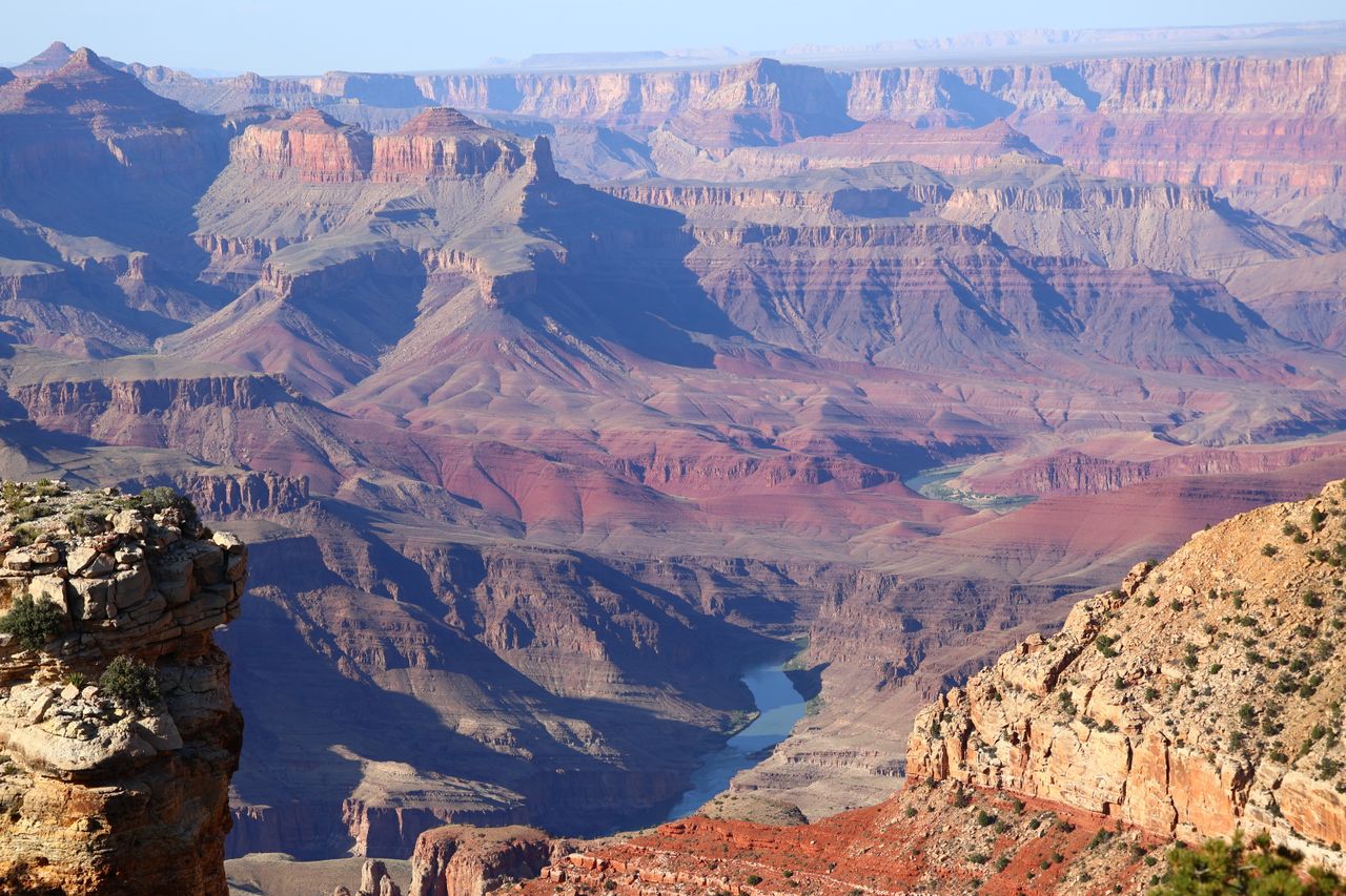
The Grand Canyon is one of those places that photographs genuinely fail to prepare you for. Standing on the rim for the first time and looking out at a mile of vertical rock spanning 277 miles of canyon is a physical experience that no image communicates — the scale is simply too large for a camera to capture in a way that registers as real. You have to be there.
Hiking into it is something else entirely. The moment you descend below the rim, the canyon stops being a viewpoint and starts being an environment. The temperature changes. The sound of the rim disappears. The rock walls close around you. A mile of geological history is suddenly visible at eye level rather than from above. It’s one of the most distinctive trail experiences in America.
This guide covers the best hikes on the Grand Canyon’s South Rim — organized from easy rim-level walks to serious inner canyon day hikes — with everything you need to plan each one including 2026 trail conditions, shuttle logistics, water availability, and the critical safety information that keeps the canyon’s search and rescue team less busy.
For gear recommendations before any Grand Canyon hike, our day hiking essentials checklist covers everything worth carrying. For footwear appropriate to the varied terrain, our best hiking boots for men and best hiking boots for women guides cover the ankle support and traction that canyon hiking demands.
Before You Go — Essential Grand Canyon Planning Information
Entry fees: Grand Canyon National Park charges a vehicle entry fee. The America the Beautiful Annual Pass at $80 covers entry to all 400+ national park sites for 12 months — if you’re visiting multiple parks in a year, it pays for itself immediately.
The most important thing to understand about Grand Canyon hiking: Every canyon trail is an inverse mountain. You hike down first and up last — when you’re tired, dehydrated, and the temperature has climbed significantly. The uphill return from any inner canyon destination requires approximately twice as long as the descent and significantly more effort. Plan your turnaround time based on this reality, not on how you feel going down.
Heat is the primary danger. Summer temperatures in the shade routinely pass 100°F. Avoid hiking between 10am and 4pm, the hottest times of day. From July to September, monsoons can build large, violent lightning storms. Heat-related illness is the leading cause of emergency evacuations at the Grand Canyon — taking it seriously is not optional. HikingGuy
The free shuttle system: Most South Rim trailheads are served by the park’s free shuttle bus network, which runs multiple color-coded routes throughout the day. There is no parking at the South Kaibab trailhead. The most practical approach for most visitors is parking at the Grand Canyon Visitor Center and using the shuttle system from there to reach any trailhead. Check the current shuttle schedule at the park website — hours and availability vary by season. HikingGuy
Water strategy: During hot weather, take at least 4 liters of water. The South Kaibab Trail has no water sources along its length except at the trailhead. The Bright Angel Trail has water stations at the 1.5-mile and 3-mile rest houses — but check current availability on the park website before relying on them, as pipeline breaks can take them offline without notice. HikingGuy
2026 trail closures: The Bright Angel Trail is closed in 2026. Verify current trail status at nps.gov/grca before planning any inner canyon route — conditions change frequently due to maintenance and weather events. Washington Trails Association
Easy Hikes — For Casual Visitors and Families
Rim Trail — Best Easy Hike at the Grand Canyon
Distance: Up to 13 miles one-way | Recommended section: 2.7-3 miles one-way
Elevation gain: Minimal | Mostly flat
Difficulty: Easy
Shuttle: Free park shuttle between all major points
Dogs: Leashed dogs permitted on the Rim Trail
The Rim Trail delivers nonstop South Rim views without the steep descent most Grand Canyon hikes demand. Pick your distance: 2.7, 5, or 8.5 miles, with stroller-accessible sections throughout, so you’re not committed to the full 13. Voyager Info
The most rewarding section for first-time visitors is the 2.7 to 3-mile stretch between the Grand Canyon Visitor Center and the Bright Angel Trailhead — a paved, mostly flat walk directly along the canyon’s edge that passes through the most concentrated viewpoints and visitor facilities on the South Rim. This stretch is the most popular part of the Rim Trail, connecting Mather Point and the Visitor Center with the Bright Angel Trailhead. It’s an easy, paved 3-mile walk with shuttle access at both ends, nonstop canyon views, and plenty of spots to stop along the way. Voyager Info
The Trail of Time is embedded within this section — an interpretive trail that uses markers spaced one meter apart to represent one million years of geological time, encouraging visitors to physically walk the timeline of the canyon’s formation. Each meter of walking represents a million years of the Earth’s history visible in the rock layers below you. It’s the most effective geological education available anywhere on the rim.
The Rim Trail also extends in both directions beyond this central section — west toward Hermit’s Rest along Hermit Road and east toward the South Kaibab trailhead along Desert View Drive. The stretch of the Rim Trail from the Visitor Center to the South Kaibab Trail is one of the quieter ways to see the canyon, connecting some of the best viewpoints, including Mather Point and Pipe Creek Vista. The free shuttle runs the full length, making one-way hiking with shuttle return the most practical approach for longer sections. Voyager Info
One critical safety note: People have died leaving the trail for photos. Stay on it. 100% of the time it’s because they’ve left the trail to take pictures or explore. The canyon’s rim has no guardrails in most places — the edge is real, not a viewpoint designed for visitor safety. Voyager Info
Best for: Every visitor to the Grand Canyon — the Rim Trail is the one hike that should not be skipped regardless of fitness level, age, or time available. Even 20 minutes on the rim edge between Mather Point and the Visitor Center delivers a genuinely extraordinary experience.
Rim Trail — Trail of Time Section
Distance: 1.3 miles one-way
Elevation gain: Minimal
Difficulty: Easy
Parking: Grand Canyon Visitor Center
The Trail of Time is worth singling out as a standalone experience within the broader Rim Trail system because it provides educational context that significantly deepens every other canyon experience. Walking the timeline from the youngest surface rocks to the oldest basement rocks at the bottom of the canyon — the Vishnu Schist, 1.7 billion years old — makes the canyon’s geology comprehensible in a way that viewpoint signs alone cannot achieve.
The interpretive markers, rock samples embedded in the pathway, and bronze models along the route were designed in collaboration with geology educators and represent the best public science communication at any national park site. For families with curious children, the Trail of Time provides a structured activity that keeps younger visitors engaged and transforms a walk into an exploration.
Moderate Hikes — Into the Canyon
South Kaibab Trail to Ooh Aah Point — Best Inner Canyon Hike for Casual Visitors
Distance: 1.8 miles round trip
Elevation gain/loss: 790 feet
Time: 1-2 hours
Difficulty: Moderate
Shuttle: Required — no parking at trailhead | Take the Kaibab/Orange shuttle from the Visitor Center
Hikers seeking panoramic views unparalleled on any other trail at Grand Canyon will want to consider a hike down the South Kaibab Trail. It is the only trail at Grand Canyon National Park that so dramatically holds true to a ridgeline descent. But this exhilarating sense of exposure to the vastness of the canyon comes at a cost: there is little shade and no water for the length of this trail. HikingGuy
The South Kaibab Trail is undoubtedly more beautiful than the Bright Angel Trail, as Ooh Aah Point truly lives up to its name. The views on the Bright Angel Trail feel much more sheltered, while the views from South Kaibab are far more expansive — not to mention prettier in the early morning light — which is why Ooh Aah Point and Cedar Ridge are such great places to catch the sunrise. Vetriscience
Ooh Aah Point at 1.8 miles round trip is the ideal destination for visitors who want the genuine inner-canyon experience — the feeling of being inside the Grand Canyon surrounded by those walls of layered Kaibab limestone, Toroweap Formation, Coconino sandstone, and Hermit shale — without committing to the more demanding distances of Cedar Ridge or Skeleton Point.
The first section of the South Kaibab Trail is the steepest and most strenuous. For one mile, a series of steep switchbacks descend below the level of the rim. The views are great all along the South Kaibab Trail but Ooh Aah Point gives you your first panoramic view of the Grand Canyon, sitting at 6,660 feet, which is 600 feet under the rim. Stretching out in front of you is the South Kaibab Trail, the Tonto Plateau, and the colorful layers of sedimentary rock that makes the Grand Canyon so beautiful. Green Mountain Club
The descent to Ooh Aah Point takes most hikers 30-45 minutes. The return climb takes 45-75 minutes and is noticeably harder than the descent — the elevation gain is manageable but the canyon sun exposure on the return in summer makes timing critical. Start before 8am in summer to complete the round trip before the midday heat makes the climb genuinely difficult.
Critical logistics: No private vehicles are allowed at the trailhead. Access is by foot, bicycle, or shuttle bus only. Park at the Grand Canyon Visitor Center and take the Kaibab/Orange shuttle. Every morning, three hiker express buses leave from the Bright Angel Lodge and then from the Backcountry Information Center — times vary by season, check the current schedule at the park website. HikingGuy
Water: There is no water on the South Kaibab Trail. Water at the South Kaibab Trailhead is currently OFF due to a localized pipeline break. During hot weather, take at least 4 liters of water. Carry everything you need from the rim. There is no mid-trail resupply opportunity. HikingGuy
Best for: First-time canyon hikers who want the most impressive views available on the shortest inner-canyon route — the best single investment of two hours and modest physical effort at the Grand Canyon.
South Kaibab Trail to Cedar Ridge — Best Half-Day Inner Canyon Hike
Distance: 3 miles round trip
Elevation gain/loss: 1,120 feet
Time: 2-4 hours
Difficulty: Moderate to Strenuous
Shuttle: Required
Cedar Ridge extends the Ooh Aah Point hike by another 0.6 miles each way and another 330 feet of descent — enough additional distance and elevation to transform a casual viewpoint visit into a genuine half-day inner canyon experience. The ridge provides a broader, flatter rest area than Ooh Aah Point with multiple positions for sitting, eating, and taking photographs with the canyon’s inner walls surrounding you on three sides.
From Ooh Aah Point, you pass to Cedar Ridge, where you’re now at 5,200 feet, which is 1,000 feet under the rim and 2 miles from the trailhead. The trail continues along the ridgeline between the descent sections, making Cedar Ridge feel like a destination rather than just a waypoint on the way to something further. Green Mountain Club
The same heat and water warnings that apply to Ooh Aah Point apply with greater force at Cedar Ridge — the additional distance and elevation means more time in the sun and more physical effort on the return climb. For summer hiking, start before 7am and be back at the rim before 10am. For spring and fall hiking, the timing window is more forgiving but the return climb still demands water reserves that casual hikers consistently underestimate.
Best for: Hikers with moderate fitness who want a more complete inner canyon experience than the short Ooh Aah Point hike provides, and who are prepared with adequate water, food, and appropriate footwear for 1,120 feet of return climbing.
Bright Angel Trail — Best Inner Canyon Trail for Water Availability
Important 2026 note: The Bright Angel Trail is closed in 2026. Verify current status at nps.gov/grca before planning. The following information applies for when the trail reopens. Washington Trails Association
Distance: 3 miles round trip to 1.5-mile Resthouse | 6 miles round trip to 3-mile Resthouse
Elevation gain/loss: 1,120 feet to 1.5-mile | 2,120 feet to 3-mile Resthouse
Difficulty: Moderate (to 1.5-mile) | Strenuous (to 3-mile)
Parking: Lot D near Bright Angel Lodge, or shuttle from Visitor Center
Bright Angel Trail is the most popular trail on the South Rim of the Grand Canyon, and for good reason. Along with its convenient starting point, this trail is well-maintained and is considered by many to be a great introduction to inner-canyon hikes. Nail the Trail
Bright Angel Trail is tucked deep within a side canyon along a massive fault, which keeps the trail in this side canyon for the first few miles. The majority of the trail’s elevation change takes place in the upper four miles via a series of switchbacks that seem endless. Views are framed by massive cliffs, with more plant and animal life thanks to a higher degree of shade and natural water sources. If you’re interested in geology or wildlife, this is a trail with complementary features. Hikingupwiththepup
The two dynamite-blasted tunnels in the first half mile are the first memorable landmarks — short dark passages through the canyon wall that open onto increasingly expansive views as the trail descends. About 10 minutes down from the trailhead, you’ll pass through the first dynamite-blasted tunnel. From there, high on the wall on your left, you can spot ancient pictographs. Further along the trail, you may be able to spot fossilized trackways on the rocks and boulders nearby. Nail the Trail
The 1.5-mile Resthouse is the most practical turnaround point for casual visitors — a flat rest area with shade structures, emergency phones, and a seasonal water station that provides the only reliable mid-trail water on the route. The Mile-and-a-Half Resthouse is 3 miles round trip, 2-4 hours, with 1,120 feet of elevation change. Hikingupwiththepup
The practical advantage of Bright Angel over South Kaibab for casual hikers is shade — the side canyon location provides significantly more shade in the upper sections than the exposed ridgeline of South Kaibab. In summer, this difference is meaningful for comfort and safety. The trade-off is less dramatic panoramic views — the enclosed canyon walls create a more intimate but less expansive visual experience than South Kaibab’s open ridgeline.
Best for: When the trail reopens — hikers who prioritize shade and water availability over panoramic views, and first-time canyon hikers who want the most forgiving inner-canyon descent available.
Strenuous Hikes — For Experienced and Fit Hikers
South Kaibab to Skeleton Point — Best Full-Day Inner Canyon Hike
Distance: 6 miles round trip
Elevation gain/loss: 2,040 feet
Time: 4-6 hours
Difficulty: Strenuous
Skeleton Point sits at 5,200 feet elevation — the first point from which the Colorado River becomes visible as a silver ribbon 3,000 feet below, winding through the inner gorge. Reaching it requires descending past both Ooh Aah Point and Cedar Ridge and continuing deeper into the canyon along the ridgeline that defines the South Kaibab’s character.
This is a serious commitment. Six miles with 2,040 feet of elevation change over exposed, shadeless terrain demands fitness, preparation, and early timing. The National Park Service consistently identifies this route as too ambitious for casual hikers in summer conditions — not because it’s technically difficult but because the combination of distance, sun exposure, and return elevation gain creates conditions where inexperienced hikers run out of water and energy simultaneously.
For fit, experienced hikers with adequate water — the NPS recommendation of 4 liters minimum is the right starting point, more in summer — Skeleton Point delivers one of the most rewarding viewpoints accessible as a day hike at the Grand Canyon. The river visible below provides the final piece of perspective that transforms the abstract understanding of the canyon’s depth into something visceral.
Start no later than 6am in any season to complete this route before afternoon heat peaks. In summer, starting before dawn with a headlamp is the standard approach among experienced canyon hikers.
South Kaibab Trail to the Tipoff — Most Ambitious Day Hike
Distance: 8.8 miles round trip
Elevation gain/loss: 3,060 feet
Time: 6-9 hours
Difficulty: Strenuous
Only for experienced, well-conditioned hikers
The Tipoff sits at the edge of the Tonto Plateau where the trail descends steeply into the inner gorge toward the Colorado River. At 4,000 feet elevation and 4.4 miles from the trailhead, it represents the limit of what the NPS considers reasonable as a day hike destination on the South Kaibab — and that guidance is based on decades of search and rescue experience with hikers who misjudged the return.
This route is appropriate for hikers who regularly cover demanding day hikes with significant elevation change and who understand the specific demands of canyon hiking. If you can hike 9 miles with 3,000+ feet of elevation gain on a standard mountain trail, you’re physically capable of the Tipoff. The difference at the Grand Canyon is the heat, the exposed terrain with no shade, and the complete absence of water along the South Kaibab until you return to the rim.
A 4am start in summer is not unusual for hikers targeting the Tipoff — getting the descent done before sunrise and the climb back to the rim completed before noon is the standard approach for avoiding the worst heat conditions.
Understanding Grand Canyon Hiking Safety
The inverse mountain principle is not a metaphor. It is the single most important concept for Grand Canyon hiking. Hiking into the canyon is physically easy. Hiking out is when the actual effort happens — tired legs, depleted water and food, and an ascending trail in the hottest part of the day. The return hike back up and out of the canyon is far more difficult and requires much more effort. Plan for at least twice as much time back up as it took to go down. Hikingupwiththepup
Water math matters. A 2-liter water bottle that seems adequate for a short canyon hike becomes inadequate on the return climb in warm conditions. The NPS recommendation of 4 liters minimum in hot weather is based on rescue data. Follow it. Carry more if you’re uncertain. For a complete guide to trail hydration systems, our best hiking backpacks with a water bladder guide covers hands-free hydration options that make consistent drinking easier on canyon trails.
Eat on trail. Electrolyte depletion — not just dehydration — causes many canyon rescue situations. Drinking large quantities of water without food and salt creates the conditions for hyponatremia, a dangerous sodium imbalance. Eat salty snacks every 60-90 minutes on inner canyon hikes and carry electrolyte supplements for full-day routes.
Turn around before you feel like it. The canyon’s descent is deceptive in its ease. The excitement of going deeper, the improving views at each switchback, and the physical comfort of downhill movement all push toward continuing further than planned. The standard NPS guidance — turn around at a predetermined point rather than when you feel tired — exists because hikers who feel fine going down consistently struggle badly coming up.
Footwear matters more here than on most trails. The canyon’s trail surfaces — loose rock, steep switchbacks, gritty sand, and exposed rock ledges — are demanding on footwear. Trail runners work adequately for most day hikes on the maintained South Kaibab and Bright Angel trails. For longer routes and less maintained terrain, ankle support from a proper hiking boot reduces the twisted ankle risk that ends canyon days prematurely. Check our best trail gaiters for hiking guide for protection against the grit that inevitably works into shoes on canyon terrain.
Planning Your Grand Canyon Visit
Best seasons: Spring (March through May) and fall (September through November) are the ideal seasons for inner canyon hiking — comfortable temperatures at rim level, manageable heat in the canyon, and the wildflower blooms that cover the Tonto Plateau in spring. Summer is the most visited season but the most dangerous for inner canyon hiking. Winter offers the most dramatic light and least crowded trails but requires awareness of ice on the upper trail sections.
Accommodation: Grand Canyon Village on the South Rim has lodges ranging from the historic El Tovar to the more accessible Bright Angel and Kachina lodges. Book as early as possible — months in advance for peak season dates. Campgrounds at Mather Campground on the South Rim accept reservations through Recreation.gov. For backcountry camping below the rim, a permit is required — apply through the backcountry permit system, which is competitive for popular spring and fall dates.
Getting there: The South Rim is approximately 4 hours from Phoenix, 4.5 hours from Las Vegas, and 8 hours from Los Angeles. Flagstaff, 90 minutes from the South Rim, is the most practical overnight base for visitors flying into northern Arizona.
Final Thoughts
The Grand Canyon is one of those places where the preparation matters as much as the destination. Hikers who arrive at the South Rim knowing the difference between the Rim Trail and the inner canyon hikes, who understand the inverse mountain principle, who carry adequate water and food, and who plan turnaround times conservatively have a completely different experience from those who arrive uninformed and improvise.
Start with the Rim Trail to understand the scale. Add the South Kaibab to Ooh Aah Point if you want to experience the canyon from inside it. Extend to Cedar Ridge if you want more. And if you’re here in a season when the Bright Angel is open, add it to your itinerary for the shade and water stations that make it the most forgiving inner canyon route available.
The canyon will still be there on your next visit — and knowing it well enough to plan that next visit is one of the best outcomes a first trip can produce.
For complete gear preparation for any Grand Canyon hike, our best ultralight hiking first aid kits guide covers the medical supplies worth carrying, and our best personal water filter for hiking guide covers filtration options for hikers who want backup water treatment alongside their carried supply.