
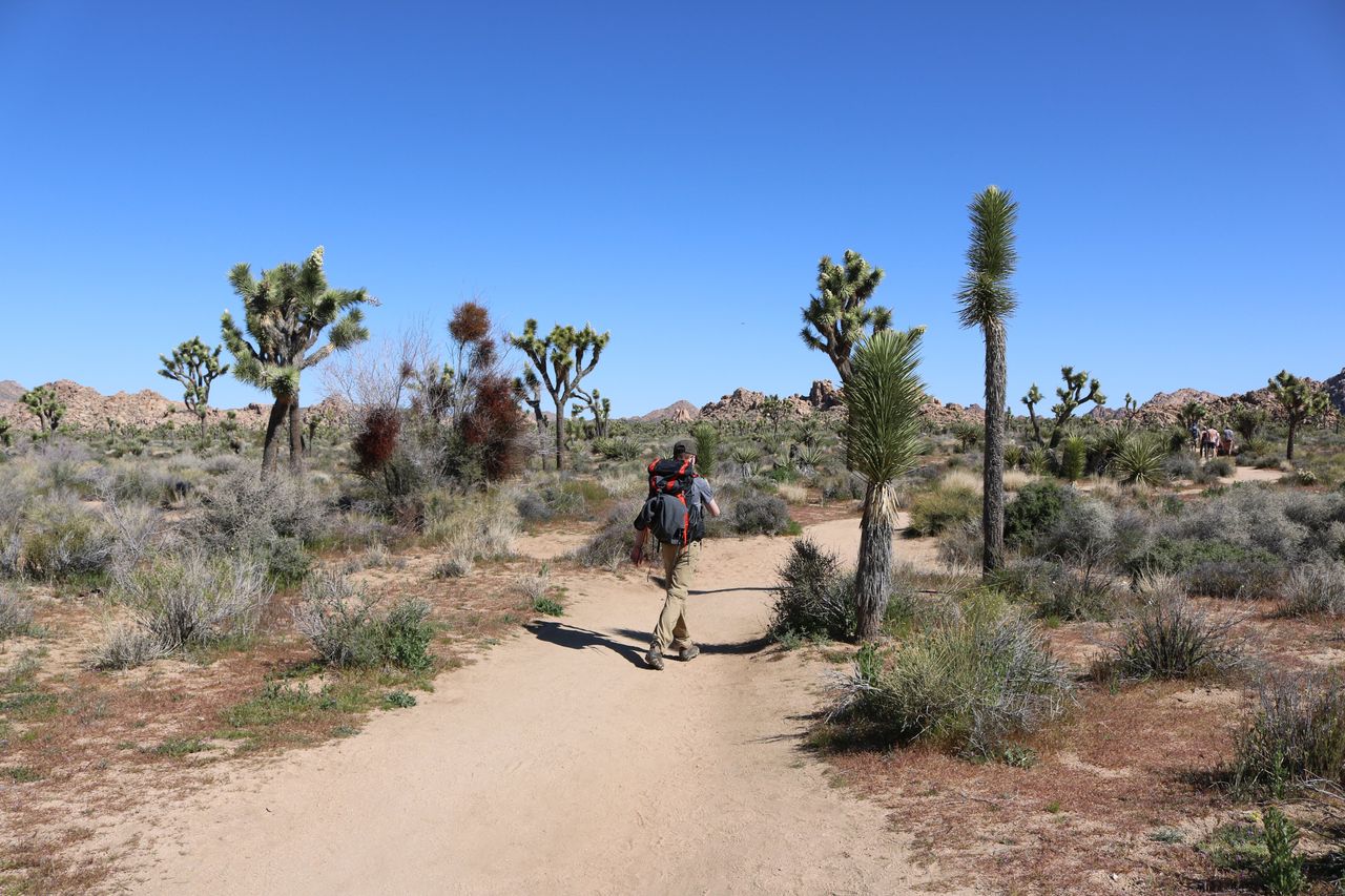
There’s something genuinely otherworldly about Joshua Tree — the rocky desert landscape, the alien-looking Joshua trees themselves that give the park its namesake, and boulder formations that seem to invite scrambling the moment you spot them. Whether you’re planning a full multi-day itinerary or just have one day to sample the park’s highlights, hikingbackpackpro.com has covered this park extensively, and Joshua Tree genuinely delivers trails suited to every skill level, several packed with real history alongside the scenery.
This guide covers the best hikes in Joshua Tree, from easy family-friendly loops through the park’s most rewarding scrambles and mine-hunting adventures — with current 2026 entrance and planning information.
For gear suited to Joshua Tree’s genuinely rugged rock terrain, our best hiking boots for men and best hiking boots for women guides cover footwear with the grip this terrain rewards.
Before You Go — Essential 2026 Planning Information
Entrance fees. A 7-day vehicle pass costs $30, motorcyclists pay $25, and individuals entering on foot or bicycle pay $15 per person (children under 16 free). Purchase your pass in advance on Recreation.gov to skip the entrance line — lines at the gates can stretch for a considerable wait during the October-through-May peak season.
Free entrance days in 2026 are restricted to US citizens and residents only, a genuine change from prior years — non-residents will pay the standard fee and any applicable nonresident surcharge on these dates, though passes like the America the Beautiful Pass remain valid for access on any day regardless of residency.
There is no public water anywhere inside the park’s 800,000 acres. Pack at least one gallon of water per person per day, and top off at the West Entrance visitor center before heading in, since that’s your final reliable water source.
Historic structures and artifacts are protected — leave everything exactly as you find it. Several hikes on this list pass genuine early-1900s mining structures, rusted vehicles, and petroglyphs; removing anything or adding graffiti is both illegal and erases history for the next visitor.
The park is open 24 hours a day, year-round, and stargazing under International Dark Sky conditions is a genuine reason to plan at least one evening into your visit regardless of which trails you hike during the day.
Easy Hikes
Hidden Valley Trail — Best Introduction to the Park
Distance: 1 mile (loop) | Elevation gain: ~118 feet | Difficulty: Easy
Hidden Valley is genuinely the trail most repeat visitors recommend as a first stop, whether you’re just driving through the park or starting a longer visit. The loop winds through the giant boulders Joshua Tree is famous for, with interesting desert plant life along the way and wildflowers in spring. This trail is popular equally with hikers and rock climbers — the formations here suit both beginner and advanced climbing — and it’s one of the better spots in the park to see bighorn sheep. For a bit more challenge, a large rock mound in the back corner of the loop rewards climbers with gorgeous views across the entire valley. Most hikers complete the loop in under 30 minutes, making this the easiest “yes, do this one” recommendation in the entire park.
Barker Dam Trail — Best for History and (Occasional) Water
Distance: Roughly 1.3 miles (loop) | Elevation gain: ~59-158 feet depending on route | Difficulty: Easy
If you want to see actual water in the dry desert of Joshua Tree, this is the trail — though it depends entirely on timing, since the dam area only fills after significant rainfall, most commonly in spring. The mostly flat, easy-to-follow trail passes enormous boulders, genuine Native American petroglyphs (viewable from a respectful distance), and iconic Joshua trees along the way to the dam itself. Even during dry stretches with no water visible, this area remains genuinely beautiful and worth exploring — and when there’s no water, you can actually climb down into the dam basin for a closer look. This is also one of the most family-friendly hikes on this list, with only minimal optional rock scrambling.
Wall Street Mill — Best Hike for Abandoned History
Distance: Roughly 1.8 miles round trip (visiting both structure areas) | Elevation gain: ~75-158 feet | Difficulty: Easy
Located close to Barker Dam, this trail leads to a genuinely well-preserved historic gold ore crushing mill from the late 1800s, featuring actual two-stamp mill machinery still standing on site. Beyond the mill itself, you’ll find three abandoned vehicles scattered along the route — genuinely popular photography subjects — plus informational signage covering local mining history and a notable Worth Bagley stone marker referencing a historical land and water dispute shootout in the area. The trail is mostly flat, sandy, and easy, but budget real extra time here if you’re into photography; what’s officially a 35-minute hike frequently stretches to well over an hour once you start exploring the structures.
Cholla Cactus Garden — Best Ultra-Short Stop
Distance: ~0.2 miles | Elevation gain: ~9 feet | Difficulty: Easy
This is genuinely the shortest and flattest trail in this entire guide, taking most visitors about 5 minutes to walk. The cholla cacti here are strikingly beautiful, especially at sunset when they seem to glow — but keep real distance from them. Cholla cacti are nicknamed “jumping cactus” because their small, barbed segments detach and cling to anything that brushes past, and the thorns are genuinely painful to remove. This is a stop worth building into any itinerary purely for the photography, without needing to treat it as a real hike.
Moderate Hikes
Split Rock Trail — Most Underrated Trail in the Park
Distance: ~2.4 miles | Elevation gain: ~275 feet | Difficulty: Moderate
Multiple experienced Joshua Tree hikers specifically call this trail underrated, and it’s easy to see why once you actually walk it — surprisingly beautiful, weaving through interesting rock formations with just enough elevation gain and occasional stairs to make it genuinely exciting for hikers who enjoy scrambling. Rather than hiking toward Split Rock as a destination, this trail starts right at the formation itself and continues through large boulders and picturesque valleys from there. Real rock scrambling opportunities and countless boulders and rocky outcroppings make this the kind of trail where you could genuinely spend hours without noticing the time pass.
Arch Rock and Heart Rock Trail — Best for Distinctive Rock Formations
Distance: ~1.7 miles | Elevation gain: Moderate | Difficulty: Moderate
This trail delivers some of the park’s most distinctive individual formations — Arch Rock itself, the aptly named Dragon’s Spine, and the more elusive Heart Rock, now considerably easier to find thanks to added trail signage pointing hikers in the right direction. Beyond the arch, there’s a genuinely fun area to explore with additional rock scrambling opportunities and even a short tunnel that takes you around to the back side of the arch — bring a tracker or offline map if you plan to explore off the marked path, since it’s genuinely easy to lose your bearing among the rock formations back there. This trail is especially beautiful at sunset, though also correspondingly popular at that hour.
Hall of Horrors — Best for Rock Climbers and Tunnel Explorers
Distance: ~0.6 miles (loop) | Elevation gain: ~26 feet | Difficulty: Moderate
Despite the modest distance and elevation figures, this trail earns its “moderate” rating through what’s actually inside the boulder maze — a genuinely popular area with rock climbers, and home to unique tunnel systems and hallways woven between the massive boulders for hikers willing to explore beyond the basic loop. If you or anyone in your group isn’t feeling like a thrill-seeker on a given day, a flat trail option circles the entire area, letting you enjoy the scenery from ground level without committing to the tunnel exploration.
49 Palms Oasis — Best Desert Oasis Hike
Distance: ~3 miles round trip | Elevation gain: Moderate | Difficulty: Moderate
Joshua Tree has five distinct oasis hikes, and 49 Palms is one of the most rewarding — roughly 3 miles round trip, taking most hikers 2 to 3 hours. The reward at the end is a genuine palm oasis in the middle of stark desert terrain, a striking visual contrast that makes the moderate climb worthwhile. Watch for local wildlife along the way, including chuckwallas and rattlesnakes — a basic snake bite kit is worth carrying on this trail specifically given how often they’re spotted here.
Strenuous Hikes
Ryan Mountain Trail — Best Panoramic Summit View
Distance: ~3 miles round trip | Elevation gain: Substantial, reaching 5,457 feet at the summit | Difficulty: Strenuous
Ryan Mountain is one of the most popular hikes in the entire park, and the trail itself is genuinely straightforward and easy to follow despite being steep — a real workout rather than a technical challenge. The payoff is one of the best scenic overlooks anywhere in Joshua Tree, with views stretching far into the distance; on a genuinely clear day, you can see all the way to the massive peaks of San Gorgonio and San Jacinto. This is also widely regarded as one of the best sunset spots in the park, provided you’re comfortable hiking the descent back down in the dark with a headlamp.
Willow Hole Trail — Best Trail Into the Wonderland of Rocks
Distance: Moderate to long, several miles round trip | Elevation gain: Moderate | Difficulty: Moderate to Strenuous
This trail takes hikers into the genuine heart of Joshua Tree — an area known as the Wonderland of Rocks — beginning with a meander through classic Joshua tree desertscape before weaving between massive boulders and striking rock formations. The trail eventually ends at a seasonal water source protected by a thicket of willow trees, and if conditions align, you might spot bighorn sheep drinking there. This is a genuinely rewarding trail specifically for hikers who want to experience the park’s most dramatic boulder-field terrain rather than its more accessible roadside stops.
Desert Queen Mine to Eagle Cliff Boulder House — Best Full Adventure Hike
Distance: Several miles, unmaintained past the mine | Elevation gain: Moderate | Difficulty: Strenuous (route-finding required)
This is genuinely one of the most rewarding hikes in the entire park — real mining history, impressive rock formations, and the genuinely elusive Boulder House waiting at the end. There are no technical sections on this trail, keeping it moderate in pure physical difficulty, but it’s an unmaintained route past the Desert Queen Mine itself, meaning real route-finding skills are necessary rather than optional. As with every historic site in this guide, never remove anything from the structures or add graffiti — these sites remain in genuinely pristine condition specifically because visitors have respected that boundary.
Unofficial and Off-the-Beaten-Path Trails
Samuelson’s Rocks — Best Unofficial Historical Curiosity
Distance: Variable, unofficial route | Elevation gain: Variable | Difficulty: Strenuous (no markers, route-finding required)
This is a genuinely unofficial trail inside the park — no markers, no signage, and correspondingly few visitors even know it exists. For hikers willing to navigate without trail markers, the reward is a set of giant boulders where John Samuelson chiseled his own unique declarations on life sometime in the early 1900s, a genuinely singular piece of desert folk history unlike anything else covered in this guide. This one is specifically for hikers comfortable with real off-trail navigation rather than a casual add-on to a standard park visit.
Building Your Joshua Tree Itinerary
One day: 49 Palms Oasis in the morning for a genuine desert oasis experience, Hidden Valley Trail as a quick midday stop, and Barker Dam in the afternoon — a sampling of the park’s oasis, boulder, and history-focused hiking styles in a single day.
Two to three days: Day one covers the easy cluster — Hidden Valley, Barker Dam, Wall Street Mill, and Cholla Cactus Garden. Day two tackles Ryan Mountain for sunset and Split Rock or Arch Rock/Heart Rock during the day. Day three covers Willow Hole or the Desert Queen Mine to Eagle Cliff Boulder House for a genuine full-adventure day.
Four or more days: Add Samuelson’s Rocks for hikers comfortable with off-trail navigation, and build in a full evening for stargazing given the park’s International Dark Sky designation — something worth experiencing regardless of how you spend your daytime hours.
Conclusion
Joshua Tree rewards hikers who mix easy, accessible trails with the park’s genuine boulder-scrambling and mine-hunting adventures — you don’t need to tackle difficult terrain to see beautiful landscapes here, but the trails that do demand more effort deliver real payoff in history and scenery. Start with Hidden Valley and Barker Dam to understand the park’s character, add Ryan Mountain for the best panoramic view in the entire park, and if you’re drawn to genuine desert history, Wall Street Mill and the Desert Queen Mine to Eagle Cliff Boulder House deliver real mining-era artifacts most visitors never see.
Carry real water on every hike in this guide regardless of distance, respect every historic structure and artifact you encounter, and check current trail conditions before attempting any of the unofficial or route-finding-dependent hikes covered here.
For more Southern California hiking guides, check our Joshua Tree National Park: 3-Day Backpacking Itinerary guide for extended trip planning, and our best hikes in Santa Clarita Valley guide for more Southern California destinations.