
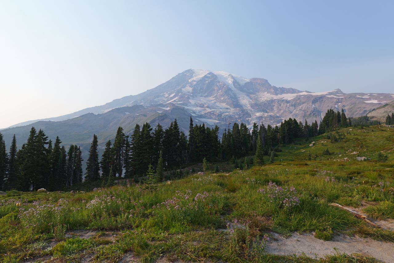
Mount Rainier isn’t just a mountain — it’s a genuine weather system of its own, and that’s part of what makes hiking here so distinctive. The peak generates its own microclimates, and it’s genuinely possible to start a hike at Paradise in a t-shirt under clear skies and find yourself in cold wind and low cloud cover a thousand feet higher within the same afternoon. That volatility is the trade-off for what the park delivers when conditions cooperate: some of the most dramatic close-up glacier views available on foot anywhere in the Lower 48, wildflower meadows that rival anything in the National Park System, and alpine lakes that reflect the mountain back at you with startling clarity.
This guide covers the best day hikes in Mount Rainier National Park, organized by the park’s two main hiking hubs — Paradise and Sunrise — plus standout trails elsewhere in the park, with current 2026 access information since Rainier’s entry system has genuinely changed from recent years.
For gear appropriate to Rainier’s fast-changing alpine weather, our what to wear hiking in summer guide covers the layering system this park’s microclimates genuinely demand, and our best hiking poles guide covers options for the loose volcanic scree and lingering snowfields several trails on this list cross even in mid-summer.
Before You Go — Essential 2026 Planning Information
No timed entry reservation is required anywhere in the park for 2026. The pilot timed-entry system used at Paradise and Sunrise in 2024 and 2025 has been discontinued; the park is managing peak-season congestion through parking management instead. This could return in a future season, so confirm current status on the NPS website before a trip, but for 2026 specifically, you simply drive in and pay the standard entrance fee.
Entrance fees. A 7-day vehicle pass costs $30, valid May through September. The park will not charge the international visitor surcharge in 2026, unlike several other high-traffic parks. Entrance stations and campgrounds are entirely cashless — pay by card, or pre-purchase a paper pass at a local business like the Ashford General Store if you’re paying with cash.
Free entrance days in 2026 include February 16, May 25, June 14, July 3–5, August 25, September 17, October 27, and November 11.
Parking still fills fast at Paradise and Sunrise despite the reservation system going away. Arrive before 10am or after 2:30pm to avoid the worst congestion at the Nisqually and White River entrances, particularly on July and August weekends.
Sunrise Road access is genuinely seasonal and weather-dependent. The road to the 6,400-foot Sunrise area typically opens around July 1 and closes by mid-October, with nightly closures beginning in late September as snow accumulates. Trails in this area — including several of the park’s best — simply aren’t accessible outside this window.
Pets are prohibited on all park trails, in the backcountry, and on roads restricted to bicycles. This is a strict, blanket park-wide rule rather than a trail-by-trail restriction — leave dogs at home or in appropriate off-site care for any hiking day in this park.
Mount Rainier creates genuinely unpredictable microclimates. A clear, warm start at a trailhead doesn’t guarantee conditions higher on the mountain — pack real layers regardless of how the morning looks, and expect temperatures 10 to 20 degrees cooler and windier once you gain elevation into cloud or ridge exposure.
Paradise Region — Waterfalls, Wildflowers, and the Skyline Trail
Skyline Trail — Best Overall Hike in the Park
Distance: Up to 5.5 miles round trip (flexible turnaround points) | Elevation gain: Up to 1,700 feet | Difficulty: Moderate to Strenuous
The Skyline Trail is consistently named the single best hike in the entire park, and in some assessments, one of the best hikes in the state of Washington. Starting directly from the Paradise parking area, the trail climbs through the park’s most famous wildflower meadows before reaching progressively more dramatic close-up views of Mount Rainier’s south face, glaciers, and the surrounding Tatoosh Range.
The full loop extends toward Panorama Point and, for the ambitious, all the way to Camp Muir at the edge of the climbing route — but the trail’s real strength is its flexibility. There’s no need to go all the way to appreciate the views; turning around at Glacier Vista or Panorama Point still delivers a genuinely spectacular hike at a fraction of the full distance and elevation gain. Wildflower meadows peak from late July through early August, and snow lingers on the upper sections of the loop into July most years.
Practical tip: Arrive before 8am to find parking at Paradise on summer weekends — this remains true even without the timed-entry system, since Paradise’s popularity alone fills the lot by mid-morning in peak season.
Comet Falls — Best Waterfall Hike in the Park
Distance: Roughly 3.8 miles round trip | Elevation gain: Roughly 1,200 feet | Difficulty: Moderate
Comet Falls is widely regarded as the single most impressive waterfall in the entire park, and the hike to reach it follows a creek upward through forest to a genuinely dramatic viewpoint. A second, smaller waterfall appears along the route as a pleasant surprise for hikers who weren’t expecting more than the named destination.
This trail delivers real payoff for moderate effort, making it a strong choice for visitors who want a genuine trail experience without the crowds or distance of the Skyline Trail.
Bench and Snow Lake — Best for a Quieter Paradise-Area Experience
Distance: Roughly 2.5 miles round trip | Elevation gain: Roughly 700 feet | Difficulty: Easy to Moderate
For visitors who want the Paradise area’s alpine lake and mountain-reflection scenery without the crowds that concentrate on the Skyline Trail, Bench and Snow Lake delivers a relatively less-trafficked route to two genuine alpine lakes, with a picture-perfect reflection of Rainier visible from Snow Lake under calm conditions.
Nisqually Vista Loop — Best Easy Alternative to Skyline
Distance: Roughly 1.2 miles (loop) | Elevation gain: Minimal | Difficulty: Easy
This paved, accessible loop offers similarly stunning views to the famous Skyline Trail while being considerably easier on the knees and meaningfully less crowded. Expect wildflowers covering the trail edges throughout summer, and a strong likelihood of spotting marmots along the route — genuinely abundant here in a way that consistently surprises first-time visitors.
Sunrise Region — Alpine Vistas and Glacier Views
Burroughs Mountain — Best All-Day Hike and Closest Glacier Views on Foot
Distance: 9.4 miles round trip (full loop) | Elevation gain: Roughly 2,400 feet | Difficulty: Moderate to Strenuous
Burroughs Mountain is genuinely the closest you can get to Mount Rainier’s face on a day hike accessible by road, and it’s consistently recommended as the strongest alternative when the Skyline Trail at Paradise is too crowded. The trail starts at the Sunrise parking area and climbs across alpine tundra to a series of three plateau summits, each one bringing you progressively closer to the Emmons Glacier face.
Most hikers turn around at Second Burroughs, sitting at roughly 7,400 feet — a completely reasonable stopping point that still delivers dramatic glacier views. Third Burroughs adds another 800 feet of gain and genuinely exposed scrambling, fully exposed to weather coming directly off the mountain; only attempt it in clear, stable conditions. The landscape here transforms into something genuinely otherworldly — barren alpine tundra and rock that several hikers describe as moonscape-like, with the possibility of witnessing avalanches on Rainier’s flanks from a safe distance. The trail is typically snow-free by mid-July, and the Sunrise Road must be open to access this trailhead at all, generally from late June through early July depending on snowpack.
Mount Fremont Lookout — Best for Wildlife and a Historic Fire Lookout
Distance: Roughly 5.7 miles round trip | Elevation gain: Roughly 900 feet | Difficulty: Moderate
Also starting from the Sunrise area, this trail delivers unique alpine flora alongside genuinely strong odds of spotting mountain goats along the route — a wildlife encounter that distinguishes this hike from most others in the park. The trail leads to a historic fire lookout with sweeping views, and it’s frequently grouped alongside the Skyline Trail and Tolmie Peak as one of the park’s three essential “must-hike” trails.
Naches Peak Loop — Best Easy Hike for Maximum Views-to-Effort Ratio
Distance: 3.3 miles (loop) | Elevation gain: Minimal to moderate | Difficulty: Easy
Naches Peak Loop is repeatedly described as the best bang for your buck hike in the entire park — and by some accounts, in the entire state. Starting at Tipsoo Lake near Chinook Pass, the trail crosses lush subalpine meadows and gains a gentle hill, delivering sweeping views of the surrounding alpine valleys and, at the trail’s midpoint, a direct view of Mount Rainier itself.
Hike this loop clockwise rather than counterclockwise specifically — going clockwise means Mount Rainier is directly in front of you at the trail’s most scenic midpoint, rather than behind you as the counterclockwise direction would have it. Visit during wildflower season (late July through early August) for the trail at its absolute best, and go early morning or late afternoon if possible, since most of the route is fully exposed to sun.
Summerland Trail — Best for Genuine Backcountry Character on a Day Hike
Distance: Roughly 8.4 miles round trip | Elevation gain: Roughly 2,000 feet | Difficulty: Strenuous
Summerland delivers a genuinely more remote, backcountry-feeling experience than the more heavily visited Sunrise-area trails, climbing through forest and subalpine meadow to a high alpine basin with sweeping views toward Mount Rainier’s eastern side. This is a serious day-hike commitment, appropriate for hikers who want real mileage and elevation gain alongside the payoff.
Best Hike Outside Paradise and Sunrise
Tolmie Peak Fire Lookout — Best Alpine Lake Views From a Historic Lookout
Distance: 5.6 miles round trip | Elevation gain: Roughly 1,000 feet | Difficulty: Moderate
Tolmie Peak is one of the park’s three essential “must-hike” trails, and it starts from the considerably quieter Mowich Lake Campground on the park’s less-visited northwest side. From the trailhead, the route passes Mowich Lake directly, then follows a fork — take the left turn down a series of switchbacks toward Tolmie Peak rather than continuing on the Wonderland Trail, watching for the trail sign marking the junction.
The trail reaches Eunice Lake at the base of the peak, with the historic fire lookout visible on the ridge above. From there, switchbacks climb toward the lookout, delivering the first clear views of Mount Rainier through the trees partway up. At the lookout itself, a genuinely excellent lunch spot opens up along the ridge, with sweeping views down over Eunice Lake below — one of the more striking alpine lake views available anywhere in the park, especially given how much quieter this trailhead runs compared to Paradise or Sunrise. The grade throughout is gradual and moderate, making this one of the more approachable “big three” hikes in the park despite its genuine payoff.
Practical tip: Because this trailhead sits outside the main Paradise and Sunrise corridors, it sees meaningfully less traffic — a strong choice specifically for hikers who want Rainier’s classic scenery without the parking pressure at the park’s two most famous hubs.
Grove of the Patriarchs — Best Easy Family Hike
Distance: Roughly 1 mile (loop) | Elevation gain: Minimal | Difficulty: Easy
This short, flat trail winds through a genuine old-growth forest of Douglas-fir and red cedar, crossing a suspension bridge to a small island in the middle of the Ohanapecosh River before looping back on a boardwalk. It’s consistently recommended as one of the best and easiest hikes for families in the entire park — children in particular tend to love the suspension bridge crossing and the river views.
Best Time to Visit and Wildflower Timing
Mid-July through mid-September delivers the widest trail access across the park, the most reliable weather, and the wildflower peak at Paradise. Late July through early August specifically is the prime wildflower window — the single best stretch for the meadow displays that make the Skyline Trail and Naches Peak Loop so celebrated. For wildflowers specifically, check Berkeley Park near Sunrise or the High Lakes Trail near Paradise, and don’t hesitate to ask rangers at a visitor center where blooms have been reported recently, since timing shifts meaningfully year to year based on snowmelt.
Outside the July-through-September window, Sunrise Road closes entirely and most high-elevation trails remain under snow. Paradise stays accessible year-round but functions primarily as a snowshoeing and skiing destination from November through April rather than a hiking destination.
Building Your Mount Rainier Itinerary
One day: Skyline Trail in the morning (turning around at Glacier Vista or Panorama Point rather than the full distance), then Naches Peak Loop or Nisqually Vista Loop in the afternoon if time and legs allow.
Two to three days: Day one covers the Paradise area — Skyline Trail plus Comet Falls or Bench and Snow Lake. Day two covers Sunrise — Burroughs Mountain or Mount Fremont Lookout, plus Naches Peak Loop on the way in or out via Chinook Pass. Day three covers Tolmie Peak on the quieter northwest side of the park, or Grove of the Patriarchs and Summerland if you’re based near the southeast entrance.
Four or more days: Add a rest day built around shorter, easier trails — Nisqually Vista Loop, Grove of the Patriarchs — and consider whether the 93-mile Wonderland Trail circling the entire mountain is a longer-term backpacking objective worth scouting sections of on a future trip.
Final Thoughts
Mount Rainier rewards hikers who plan around its two main hubs — Paradise for wildflower meadows and the mountain’s south face, Sunrise for the closest glacier views accessible on foot — while building in real weather flexibility given how quickly conditions change here regardless of the morning forecast. Start with the Skyline Trail to understand why Paradise draws the crowds it does, add Burroughs Mountain once you’re ready for the park’s most dramatic glacier views, and if you want Rainier’s classic scenery without the parking pressure at the two main corridors, Tolmie Peak on the quieter northwest side delivers a genuinely comparable payoff.
Check current road status for Sunrise before planning around it, pack real layers regardless of how clear the trailhead looks, and remember that pets aren’t permitted on any trail in this park — plan accordingly if you’re traveling with a dog.
For more national park hiking guides, check our best hikes in Glacier National Park and best hikes in Olympic National Park guides for more of the Pacific Northwest’s finest hiking destinations.